Property Record
4220 Blacks Chapel Rd, Sanford, NC 27332
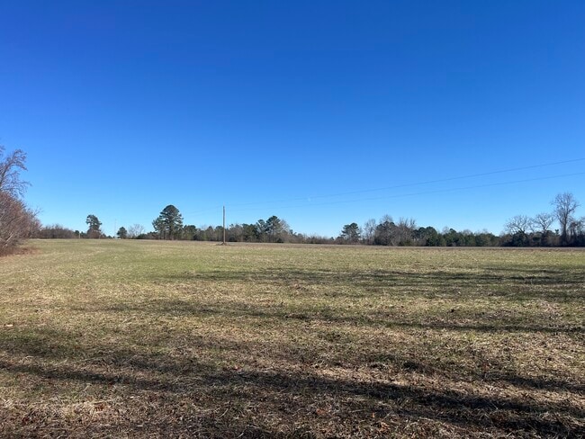


This Property Is For Sale
NEARBY LISTINGS FOR SALE OR LEASE
-
-
View all Sanford listings for sale on LoopNet.com
Property Detail
4220 Blacks Chapel Rd
9547-47-6610-00
4220 BLACKS CHAPEL RD
Timberlandforesttreesagricultural
Lee
AE
North Carolina
3710954600L
192.40 AC
2025
North Carolina Southeast Area
2025
Other Market Areas
030504
Sanford, NC
DEMOGRAPHICS near 4220 Blacks Chapel Rd
1 Mile
3 Mile
5 Mile
2024 Total Population
1,379
5,257
13,308
2029 Population
1,345
5,413
14,234
Pop Growth 2024-2029
(2.47%)
+ 2.97%
+ 6.96%
Average Age
46
43
41
2024 Total Households
554
2,039
5,082
HH Growth 2024-2029
(2.53%)
+ 2.80%
+ 6.91%
Median Household Inc
$102,083
$72,811
$66,907
Avg Household Size
2.50
2.60
2.60
2024 Avg HH Vehicles
3.00
2.00
2.00
Median Home Value
$185,150
$166,537
$160,336
Median Year Built
2003
1999
1995
Nearby Places
Map Layers
Map Styles
 Street
 Aerial
- Restaurants
- Banks
- Shops
- Fitness
- Groceries
PUBLIC TRANSPORTATION
AIRPORT
Fayetteville Regional/Grannis Field
DRIVE
WALK
Distance
Fayetteville Regional/Grannis Field
54 min
34.1 mi
Nearby Properties
Address
Land Use
TOTAL SIZE
Lot Size
Zoning
Address
Land Use
TOTAL SIZE
Lot Size
Zoning
2,080 SF
113.74 AC
HEAVY INDU
Address
Land Use
TOTAL SIZE
Lot Size
Zoning
91.82 AC
HEAVY INDU
Address
Land Use
TOTAL SIZE
Lot Size
Zoning
5,626 SF
9.20 AC
RESIDENTIA
Address
Land Use
TOTAL SIZE
Lot Size
Zoning
367.84 AC
RESIDENTIA
Address
Land Use
TOTAL SIZE
Lot Size
Zoning
936 SF
340.07 AC
RA
Address
Land Use
TOTAL SIZE
Lot Size
Zoning
479.38 AC
Address
Land Use
TOTAL SIZE
Lot Size
Zoning
1,598 SF
307.71 AC
RA
Address
Land Use
TOTAL SIZE
Lot Size
Zoning
399.91 AC
RESIDENTIA
Address
Land Use
TOTAL SIZE
Lot Size
Zoning
1,918 SF
281.25 AC
RESIDENTIA
Address
Land Use
TOTAL SIZE
Lot Size
Zoning
3,560 SF
60.53 AC
RESIDENTIA
Address
Land Use
TOTAL SIZE
Lot Size
Zoning
1,844 SF
192.52 AC
RESIDENTIA
Address
Land Use
TOTAL SIZE
Lot Size
Zoning
12,300 SF
RESIDENTIA
Address
Land Use
TOTAL SIZE
Lot Size
Zoning
13,600 SF
5.32 AC
LIGHT INDU
Address
Land Use
TOTAL SIZE
Lot Size
Zoning
9,748 SF
9.34 AC
RESIDENTIA
Address
Land Use
TOTAL SIZE
Lot Size
Zoning
3,881 SF
38.41 AC
RESIDENTIA
Address
Land Use
TOTAL SIZE
Lot Size
Zoning
918 SF
168.53 AC
RESIDENTIA
Address
Land Use
TOTAL SIZE
Lot Size
Zoning
1,632 SF
16.70 AC
RESIDENTIA
Address
Land Use
TOTAL SIZE
Lot Size
Zoning
1,848 SF
169.95 AC
RESIDENTIA
Address
Land Use
TOTAL SIZE
Lot Size
Zoning
3,789 SF
114.10 AC
RESIDENTIA
Address
Land Use
TOTAL SIZE
Lot Size
Zoning
9,935 SF
4.27 AC
RESIDENTIA
Address
Land Use
TOTAL SIZE
Lot Size
Zoning
84.14 AC
RA20R
Address
Land Use
TOTAL SIZE
Lot Size
Zoning
1,440 SF
97.44 AC
RESIDENTIA
Address
Land Use
TOTAL SIZE
Lot Size
Zoning
1,680 SF
74.21 AC
RESIDENTIA
Address
Land Use
TOTAL SIZE
Lot Size
Zoning
7,504 SF
0.91 AC
RA20R
Address
Land Use
TOTAL SIZE
Lot Size
Zoning
6,002 SF
2.32 AC
RESIDENTIA
Address
Land Use
TOTAL SIZE
Lot Size
Zoning
884 SF
75.94 AC
RESIDENTIA
Address
Land Use
TOTAL SIZE
Lot Size
Zoning
1,848 SF
97.19 AC
RESIDENTIA
Address
Land Use
TOTAL SIZE
Lot Size
Zoning
14.64 AC
RESIDENTIA
Address
Land Use
TOTAL SIZE
Lot Size
Zoning
4,200 SF
1.28 AC
OFFICE & I
The World's #1 Commercial Real Estate Marketplace
Connect with us
© 2025 CoStar Group
The information above has been obtained from sources believed reliable. While we do not doubt its accuracy we have not verified it and make no guarantee, warranty or representation about it. It is your responsibility to independently confirm its accuracy and completeness. Any projections, opinions, assumptions, or estimates used are for example only and do not represent the current or future performance of the property. The value of this transaction to you depends on tax and other factors which should be evaluated by your tax, financial, and legal advisors. You and your advisors should conduct a careful, independent investigation of the property to determine to your satisfaction the suitability of the property for your needs.