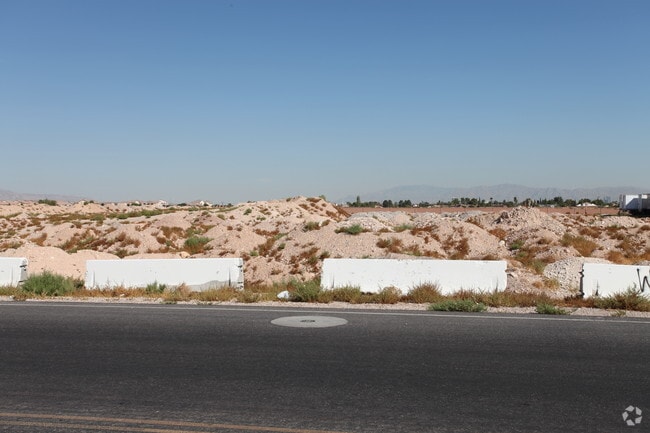
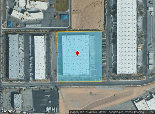
Property Record
4220 W Windmill Ln, Las Vegas, NV 89139
NEARBY LISTINGS FOR SALE OR LEASE
Property Detail
4220 W Windmill Ln
Las Vegas-Henderson-Paradise, NV
Parcel Map File 123 Page 61
177-07-801-021
PARCEL MAP FILE 123 PAGE 61 PT LOT 1
Shipyard
Clark
X
Nevada
32003C2562F
1
2024
7.85 AC
2025
SW Las Vegas
002985
Las Vegas
172,934 SF
DEMOGRAPHICS near 4220 W Windmill Ln
1 Mile
3 Mile
5 Mile
2024 Total Population
7,840
95,555
340,690
2029 Population
8,415
103,624
368,587
Pop Growth 2024-2029
+ 7.33%
+ 8.44%
+ 8.19%
Average Age
38
39
39
2024 Total Households
2,537
35,240
131,376
HH Growth 2024-2029
+ 7.29%
+ 8.29%
+ 8.10%
Median Household Inc
$99,153
$83,158
$73,533
Avg Household Size
3.00
2.70
2.50
2024 Avg HH Vehicles
2.00
2.00
2.00
Median Home Value
$438,084
$416,203
$395,041
Median Year Built
2005
2003
2001
Nearby Places
Map Layers
Map Styles
 Street
 Aerial
- Restaurants
- Banks
- Shops
- Fitness
- Groceries
PUBLIC TRANSPORTATION
AIRPORT
Harry Reid International
DRIVE
WALK
Distance
Harry Reid International
12 min
6.3 mi
Boulder City Municipal
DRIVE
WALK
Distance
Boulder City Municipal
35 min
23.9 mi
Freight Ports
Port of Long Beach
DRIVE
WALK
Distance
Port of Long Beach
308 min
275.4 mi
Nearby Properties
Address
Land Use
TOTAL SIZE
Lot Size
Zoning
Address
Land Use
TOTAL SIZE
Lot Size
Zoning
2,340,130 SF
56.10 AC
H1
Address
Land Use
TOTAL SIZE
Lot Size
Zoning
764,918 SF
94.41 AC
H1
Address
Land Use
TOTAL SIZE
Lot Size
Zoning
321,990 SF
76.15 AC
PF
Address
Land Use
TOTAL SIZE
Lot Size
Zoning
391,021 SF
40.14 AC
Address
Land Use
TOTAL SIZE
Lot Size
Zoning
35.25 AC
MD
Address
Land Use
TOTAL SIZE
Lot Size
Zoning
257,910 SF
31.47 AC
Address
Land Use
TOTAL SIZE
Lot Size
Zoning
459,983 SF
12.65 AC
M1
Address
Land Use
TOTAL SIZE
Lot Size
Zoning
66.26 AC
RE
Address
Land Use
TOTAL SIZE
Lot Size
Zoning
317,500 SF
19.26 AC
Address
Land Use
TOTAL SIZE
Lot Size
Zoning
353,690 SF
17.23 AC
Address
Land Use
TOTAL SIZE
Lot Size
Zoning
262,750 SF
17.95 AC
Address
Land Use
TOTAL SIZE
Lot Size
Zoning
930,204 SF
53.28 AC
MD
Address
Land Use
TOTAL SIZE
Lot Size
Zoning
222,625 SF
16.99 AC
Address
Land Use
TOTAL SIZE
Lot Size
Zoning
374,101 SF
31.11 AC
Address
Land Use
TOTAL SIZE
Lot Size
Zoning
239,500 SF
13.18 AC
Address
Land Use
TOTAL SIZE
Lot Size
Zoning
10,869 SF
14.77 AC
Address
Land Use
TOTAL SIZE
Lot Size
Zoning
4,405 SF
19.79 AC
Address
Land Use
TOTAL SIZE
Lot Size
Zoning
4,444 SF
18.11 AC
Address
Land Use
TOTAL SIZE
Lot Size
Zoning
117.50 AC
Address
Land Use
TOTAL SIZE
Lot Size
Zoning
9.34 AC
Address
Land Use
TOTAL SIZE
Lot Size
Zoning
4,830 SF
15.84 AC
Address
Land Use
TOTAL SIZE
Lot Size
Zoning
4,199 SF
12.11 AC
RE
Address
Land Use
TOTAL SIZE
Lot Size
Zoning
6,782 SF
17.45 AC
R3
Address
Land Use
TOTAL SIZE
Lot Size
Zoning
478,844 SF
35.21 AC
MD
Address
Land Use
TOTAL SIZE
Lot Size
Zoning
370,870 SF
28.56 AC
MD
Address
Land Use
TOTAL SIZE
Lot Size
Zoning
342,768 SF
28.30 AC
H1
Address
Land Use
TOTAL SIZE
Lot Size
Zoning
329,135 SF
18.94 AC
Address
Land Use
TOTAL SIZE
Lot Size
Zoning
3,148 SF
18.80 AC
R3
Address
Land Use
TOTAL SIZE
Lot Size
Zoning
526,284 SF
30.18 AC
The World's #1 Commercial Real Estate Marketplace
Connect with us
© 2025 CoStar Group
The information above has been obtained from sources believed reliable. While we do not doubt its accuracy we have not verified it and make no guarantee, warranty or representation about it. It is your responsibility to independently confirm its accuracy and completeness. Any projections, opinions, assumptions, or estimates used are for example only and do not represent the current or future performance of the property. The value of this transaction to you depends on tax and other factors which should be evaluated by your tax, financial, and legal advisors. You and your advisors should conduct a careful, independent investigation of the property to determine to your satisfaction the suitability of the property for your needs.