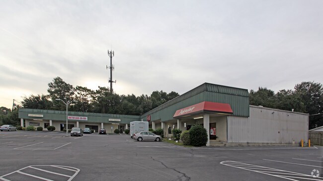
Property Record
4221 Highway 90, Milton, FL 32571

NEARBY LISTINGS FOR SALE OR LEASE
Property Detail
4221 Highway 90
Pensacola-Ferry Pass-Brent, FL
Santa Rosa
15-1N-29-0000-01811-0000
Florida
Storebuilding
1.73 AC
X
Avalon Beach/Milton
12113C0410H
Pensacola
19,586 SF
DEMOGRAPHICS near 4221 Highway 90
1 Mile
3 Mile
5 Mile
2024 Total Population
5,912
27,903
53,562
2029 Population
6,758
32,000
61,340
Pop Growth 2024-2029
+ 14.31%
+ 14.68%
+ 14.52%
Average Age
38
39
39
2024 Total Households
2,217
10,222
19,707
HH Growth 2024-2029
+ 14.57%
+ 14.96%
+ 14.81%
Median Household Inc
$68,561
$71,642
$82,522
Avg Household Size
2.60
2.70
2.70
2024 Avg HH Vehicles
2.00
2.00
2.00
Median Home Value
$184,033
$240,866
$254,675
Median Year Built
1989
1995
1997
Nearby Places
Map Layers
Map Styles
 Street
 Aerial
- Restaurants
- Banks
- Shops
- Fitness
- Groceries
PUBLIC TRANSPORTATION
AIRPORT
Pensacola International
DRIVE
WALK
Distance
Pensacola International
24 min
13.4 mi
Freight Ports
Port of Mobile
DRIVE
WALK
Distance
Port of Mobile
75 min
62.2 mi
SALE & LEASE HISTORY
LISTING DATE
SALE/LEASE

Feb 18, 2019
For Lease
Apr 06, 2017
For Lease
Nearby Properties
Address
Land Use
TOTAL SIZE
Lot Size
Zoning
Address
Land Use
TOTAL SIZE
Lot Size
Zoning
374,114 SF
27.61 AC
R2
Address
Land Use
TOTAL SIZE
Lot Size
Zoning
130,379 SF
18.18 AC
HCD
Address
Land Use
TOTAL SIZE
Lot Size
Zoning
79,708 SF
9.62 AC
HCD
Address
Land Use
TOTAL SIZE
Lot Size
Zoning
232,988 SF
24.57 AC
HCD
Address
Land Use
TOTAL SIZE
Lot Size
Zoning
154,042 SF
10.36 AC
HCD
Address
Land Use
TOTAL SIZE
Lot Size
Zoning
130,603 SF
14.30 AC
R2
Address
Land Use
TOTAL SIZE
Lot Size
Zoning
47.05 AC
AG-RR
Address
Land Use
TOTAL SIZE
Lot Size
Zoning
151,084 SF
19.01 AC
HCD
Address
Land Use
TOTAL SIZE
Lot Size
Zoning
199,775 SF
8.83 AC
HCD
Address
Land Use
TOTAL SIZE
Lot Size
Zoning
113,899 SF
3.05 AC
HCD
Address
Land Use
TOTAL SIZE
Lot Size
Zoning
81,123 SF
8.78 AC
HCD
Address
Land Use
TOTAL SIZE
Lot Size
Zoning
60,129 SF
0.11 AC
HCD
Address
Land Use
TOTAL SIZE
Lot Size
Zoning
23.33 AC
AG-RR
Address
Land Use
TOTAL SIZE
Lot Size
Zoning
13.70 AC
HCD
Address
Land Use
TOTAL SIZE
Lot Size
Zoning
76,674 SF
2.80 AC
HCD
Address
Land Use
TOTAL SIZE
Lot Size
Zoning
93,476 SF
7.43 AC
HCD
Address
Land Use
TOTAL SIZE
Lot Size
Zoning
43,613 SF
3.44 AC
HCD
Address
Land Use
TOTAL SIZE
Lot Size
Zoning
389.54 AC
AG-RR
Address
Land Use
TOTAL SIZE
Lot Size
Zoning
9.61 AC
R1
Address
Land Use
TOTAL SIZE
Lot Size
Zoning
112,196 SF
343.01 AC
HCD
Address
Land Use
TOTAL SIZE
Lot Size
Zoning
50,616 SF
2.56 AC
R3
Address
Land Use
TOTAL SIZE
Lot Size
Zoning
30,564 SF
11.12 AC
HCD
Address
Land Use
TOTAL SIZE
Lot Size
Zoning
23,668 SF
2.30 AC
HCD
Address
Land Use
TOTAL SIZE
Lot Size
Zoning
49,275 SF
2.49 AC
HCD
Address
Land Use
TOTAL SIZE
Lot Size
Zoning
22.16 AC
HCD
Address
Land Use
TOTAL SIZE
Lot Size
Zoning
13,560 SF
5.93 AC
HCD
Address
Land Use
TOTAL SIZE
Lot Size
Zoning
45,485 SF
6.49 AC
HCD
Address
Land Use
TOTAL SIZE
Lot Size
Zoning
48,285 SF
3.52 AC
HCD
Address
Land Use
TOTAL SIZE
Lot Size
Zoning
62,174 SF
4 AC
HCD
The World's #1 Commercial Real Estate Marketplace
Connect with us
© 2025 CoStar Group
The information above has been obtained from sources believed reliable. While we do not doubt its accuracy we have not verified it and make no guarantee, warranty or representation about it. It is your responsibility to independently confirm its accuracy and completeness. Any projections, opinions, assumptions, or estimates used are for example only and do not represent the current or future performance of the property. The value of this transaction to you depends on tax and other factors which should be evaluated by your tax, financial, and legal advisors. You and your advisors should conduct a careful, independent investigation of the property to determine to your satisfaction the suitability of the property for your needs.