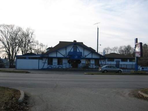
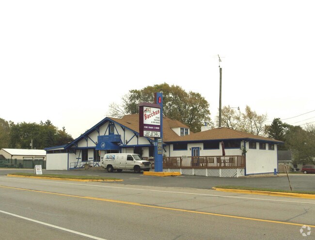
Property Record
42228 N 5Th Ave, Antioch, IL 60002

NEARBY LISTINGS FOR SALE OR LEASE
Property Detail
42228 N 5Th Ave
Chicago-Naperville-Elgin, IL-IN-WI
Calif.Ice & Coal Co S Lk.Marie Sub.
01-12-416-048
CALIF.ICE & COAL CO S LK.MARIE SUB. LOT 165
Residentialacreage
Lake
X
Illinois
55059C0257E
165
2023
0.17 AC
2024
Central Northwest
860809
Chicago
DEMOGRAPHICS near 42228 N 5Th Ave
1 Mile
3 Mile
5 Mile
2024 Total Population
3,634
22,976
47,065
2029 Population
3,646
22,947
47,113
Pop Growth 2024-2029
+ 0.33%
(0.13%)
+ 0.10%
Average Age
42
42
42
2024 Total Households
1,409
9,195
18,751
HH Growth 2024-2029
+ 0.35%
(0.15%)
+ 0.05%
Median Household Inc
$94,346
$87,031
$88,045
Avg Household Size
2.60
2.50
2.50
2024 Avg HH Vehicles
2.00
2.00
2.00
Median Home Value
$259,116
$247,291
$254,451
Median Year Built
1974
1975
1979
Nearby Places
Map Layers
Map Styles
 Street
 Aerial
- Restaurants
- Banks
- Shops
- Fitness
- Groceries
PUBLIC TRANSPORTATION
COMMUTER RAIL
Antioch Station (North Central Service - Northeast Illinois Regional Commuter Railroad (Metra))
DRIVE
WALK
Distance
Antioch Station (North Central Service - Northeast Illinois Regional Commuter Railroad (Metra))
5 min
2.3 mi
Lake Villa Station (North Central Service - Northeast Illinois Regional Commuter Railroad (Metra))
DRIVE
WALK
Distance
Lake Villa Station (North Central Service - Northeast Illinois Regional Commuter Railroad (Metra))
9 min
6.0 mi
Freight Ports
Port Milwaukee
DRIVE
WALK
Distance
Port Milwaukee
60 min
48.7 mi
Nearby Properties
Address
Land Use
TOTAL SIZE
Lot Size
Zoning
Address
Land Use
TOTAL SIZE
Lot Size
Zoning
111,160 SF
10.79 AC
Address
Land Use
TOTAL SIZE
Lot Size
Zoning
Address
Land Use
TOTAL SIZE
Lot Size
Zoning
6.52 AC
Address
Land Use
TOTAL SIZE
Lot Size
Zoning
61,760 SF
7.29 AC
Address
Land Use
TOTAL SIZE
Lot Size
Zoning
50,180 SF
4.08 AC
Address
Land Use
TOTAL SIZE
Lot Size
Zoning
12,000 SF
9 AC
Address
Land Use
TOTAL SIZE
Lot Size
Zoning
480,597 SF
9.28 AC
Address
Land Use
TOTAL SIZE
Lot Size
Zoning
46,512 SF
0.45 AC
Address
Land Use
TOTAL SIZE
Lot Size
Zoning
20,254 SF
15 AC
Address
Land Use
TOTAL SIZE
Lot Size
Zoning
552,960 SF
5.90 AC
Address
Land Use
TOTAL SIZE
Lot Size
Zoning
71,406 SF
2.35 AC
Address
Land Use
TOTAL SIZE
Lot Size
Zoning
9,019 SF
2.57 AC
Address
Land Use
TOTAL SIZE
Lot Size
Zoning
54,724 SF
3.89 AC
Address
Land Use
TOTAL SIZE
Lot Size
Zoning
335,145 SF
9.20 AC
Address
Land Use
TOTAL SIZE
Lot Size
Zoning
8,400 SF
4.32 AC
Address
Land Use
TOTAL SIZE
Lot Size
Zoning
144,720 SF
6.35 AC
Address
Land Use
TOTAL SIZE
Lot Size
Zoning
9,374 SF
4.38 AC
Address
Land Use
TOTAL SIZE
Lot Size
Zoning
349,440 SF
1.43 AC
Address
Land Use
TOTAL SIZE
Lot Size
Zoning
91,081 SF
6.93 AC
Address
Land Use
TOTAL SIZE
Lot Size
Zoning
2,480 SF
0.56 AC
Address
Land Use
TOTAL SIZE
Lot Size
Zoning
135,840 SF
5.40 AC
Address
Land Use
TOTAL SIZE
Lot Size
Zoning
200,580 SF
2.60 AC
Address
Land Use
TOTAL SIZE
Lot Size
Zoning
11,040 SF
30.64 AC
Address
Land Use
TOTAL SIZE
Lot Size
Zoning
18,900 SF
3.64 AC
Address
Land Use
TOTAL SIZE
Lot Size
Zoning
88,128 SF
0.85 AC
Address
Land Use
TOTAL SIZE
Lot Size
Zoning
19 AC
Address
Land Use
TOTAL SIZE
Lot Size
Zoning
25,280 SF
2.17 AC
Address
Land Use
TOTAL SIZE
Lot Size
Zoning
4,200 SF
2.48 AC
Address
Land Use
TOTAL SIZE
Lot Size
Zoning
2,208 SF
1.45 AC
Address
Land Use
TOTAL SIZE
Lot Size
Zoning
36,816 SF
0.80 AC
The World's #1 Commercial Real Estate Marketplace
Connect with us
© 2025 CoStar Group
The information above has been obtained from sources believed reliable. While we do not doubt its accuracy we have not verified it and make no guarantee, warranty or representation about it. It is your responsibility to independently confirm its accuracy and completeness. Any projections, opinions, assumptions, or estimates used are for example only and do not represent the current or future performance of the property. The value of this transaction to you depends on tax and other factors which should be evaluated by your tax, financial, and legal advisors. You and your advisors should conduct a careful, independent investigation of the property to determine to your satisfaction the suitability of the property for your needs.