Property Record
4223 State Route 43, Kent, OH 44240
NEARBY LISTINGS FOR SALE OR LEASE
-
-
View all Kent listings for sale on LoopNet.com
Property Detail
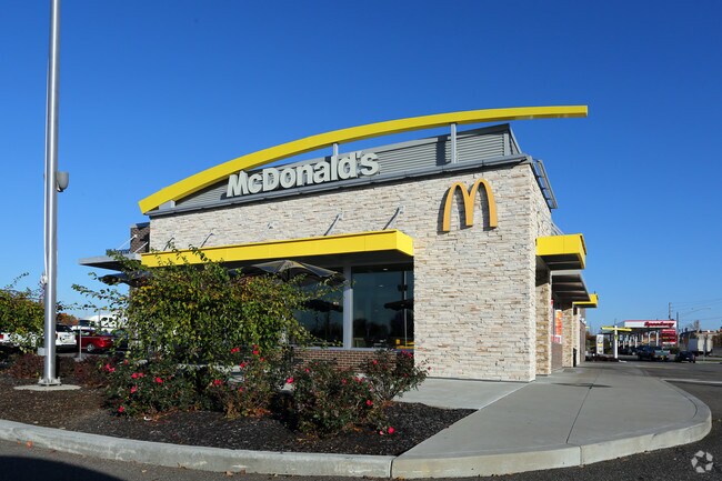
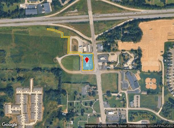
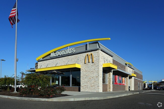
4223 State Route 43
04-032-10-00-001-007
Brimfield Crossings
Restaurantdrivein
BLK N-R BRIMFIELD CROSSINGS SD **TIF AGREEMENT
X
Portage
39133C0226D
Ohio
2024
2.55 AC
2024
Portage County
601501
Cleveland
4,893 SF
Akron, OH
DEMOGRAPHICS near 4223 State Route 43
1 Mile
3 Mile
5 Mile
2024 Total Population
3,622
23,122
71,060
2029 Population
3,684
23,405
71,546
Pop Growth 2024-2029
+ 1.71%
+ 1.22%
+ 0.68%
Average Age
40
37
39
2024 Total Households
1,502
9,536
28,996
HH Growth 2024-2029
+ 1.66%
+ 1.26%
+ 0.78%
Median Household Inc
$70,932
$61,512
$62,206
Avg Household Size
2.40
2.30
2.20
2024 Avg HH Vehicles
2.00
2.00
2.00
Median Home Value
$201,440
$211,443
$199,188
Median Year Built
1992
1979
1973
Nearby Places
Map Layers
Map Styles
 Street
 Aerial
- Restaurants
- Banks
- Shops
- Fitness
- Groceries
PUBLIC TRANSPORTATION
AIRPORT
Akron-Canton Regional
DRIVE
WALK
Distance
Akron-Canton Regional
30 min
21.8 mi
Cleveland-Hopkins International
DRIVE
WALK
Distance
Cleveland-Hopkins International
68 min
45.5 mi
Nearby Properties
Address
Land Use
TOTAL SIZE
Lot Size
Zoning
Address
Land Use
TOTAL SIZE
Lot Size
Zoning
139,790 SF
102.12 AC
Address
Land Use
TOTAL SIZE
Lot Size
Zoning
815,100 SF
66.78 AC
Address
Land Use
TOTAL SIZE
Lot Size
Zoning
173,811 SF
9.34 AC
Address
Land Use
TOTAL SIZE
Lot Size
Zoning
68,754 SF
25.80 AC
Address
Land Use
TOTAL SIZE
Lot Size
Zoning
179,055 SF
19.68 AC
Address
Land Use
TOTAL SIZE
Lot Size
Zoning
193,894 SF
24.63 AC
Address
Land Use
TOTAL SIZE
Lot Size
Zoning
310,705 SF
9.96 AC
Address
Land Use
TOTAL SIZE
Lot Size
Zoning
48,734 SF
18.12 AC
Address
Land Use
TOTAL SIZE
Lot Size
Zoning
216,994 SF
10.94 AC
Address
Land Use
TOTAL SIZE
Lot Size
Zoning
161,806 SF
1.92 AC
Address
Land Use
TOTAL SIZE
Lot Size
Zoning
91,286 SF
27.27 AC
Address
Land Use
TOTAL SIZE
Lot Size
Zoning
125,410 SF
119.68 AC
Address
Land Use
TOTAL SIZE
Lot Size
Zoning
212,628 SF
27.25 AC
Address
Land Use
TOTAL SIZE
Lot Size
Zoning
67,107 SF
9.29 AC
Address
Land Use
TOTAL SIZE
Lot Size
Zoning
168,889 SF
30.80 AC
Address
Land Use
TOTAL SIZE
Lot Size
Zoning
88,682 SF
11.55 AC
Address
Land Use
TOTAL SIZE
Lot Size
Zoning
68,649 SF
13.45 AC
Address
Land Use
TOTAL SIZE
Lot Size
Zoning
78,805 SF
9.13 AC
Address
Land Use
TOTAL SIZE
Lot Size
Zoning
250,693 SF
93.26 AC
Address
Land Use
TOTAL SIZE
Lot Size
Zoning
130,766 SF
16.45 AC
Address
Land Use
TOTAL SIZE
Lot Size
Zoning
62,390 SF
8.39 AC
Address
Land Use
TOTAL SIZE
Lot Size
Zoning
57,542 SF
9.44 AC
Address
Land Use
TOTAL SIZE
Lot Size
Zoning
117,966 SF
5.81 AC
Address
Land Use
TOTAL SIZE
Lot Size
Zoning
60,316 SF
13.94 AC
Address
Land Use
TOTAL SIZE
Lot Size
Zoning
13,924 SF
10.93 AC
Address
Land Use
TOTAL SIZE
Lot Size
Zoning
154,050 SF
20.36 AC
Address
Land Use
TOTAL SIZE
Lot Size
Zoning
138,154 SF
13.25 AC
Address
Land Use
TOTAL SIZE
Lot Size
Zoning
121,904 SF
10.53 AC
Address
Land Use
TOTAL SIZE
Lot Size
Zoning
110,238 SF
9.52 AC
Address
Land Use
TOTAL SIZE
Lot Size
Zoning
62,892 SF
8.36 AC
The World's #1 Commercial Real Estate Marketplace
Connect with us
© 2026 CoStar Group
The information above has been obtained from sources believed reliable. While we do not doubt its accuracy we have not verified it and make no guarantee, warranty or representation about it. It is your responsibility to independently confirm its accuracy and completeness. Any projections, opinions, assumptions, or estimates used are for example only and do not represent the current or future performance of the property. The value of this transaction to you depends on tax and other factors which should be evaluated by your tax, financial, and legal advisors. You and your advisors should conduct a careful, independent investigation of the property to determine to your satisfaction the suitability of the property for your needs.