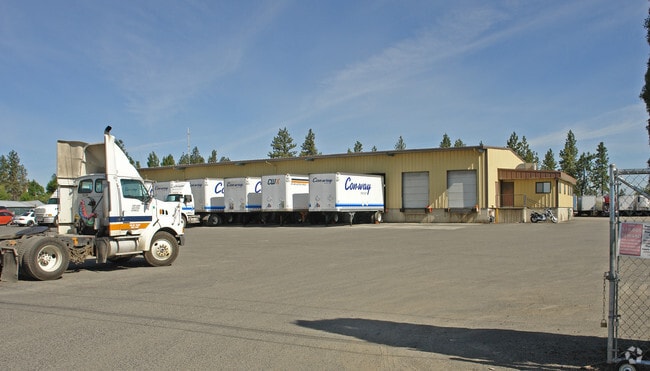
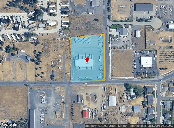
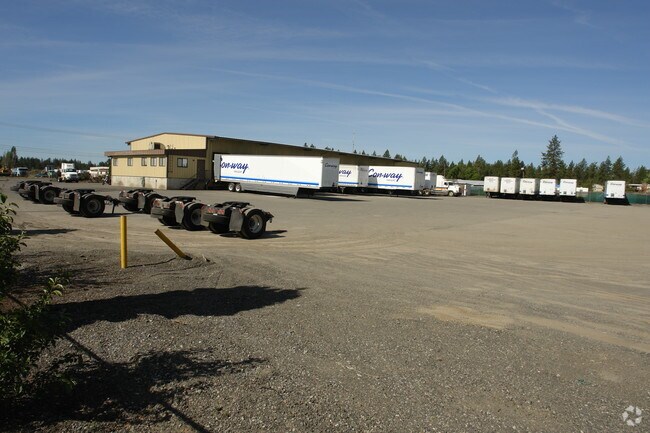
Property Record
6616 W Thorpe Rd, Spokane, WA 99224
NEARBY LISTINGS FOR SALE OR LEASE
Property Detail
6616 W Thorpe Rd
25334.0110
Sparks Five Acre
Wholesaleoutletdiscountstore
SPARKS FIVE ACRE TRACTS TR 17 EXC E10FT FOR FOSSEEN RD & EXC THAT PTN ON THE S CONTAINED IN THORPE RD R/W
X
Spokane
53063C0700D
Washington
2025
2.87 AC
2025
West Plains
013600
Spokane
11,810 SF
Spokane-Spokane Valley, WA
DEMOGRAPHICS near 6616 W Thorpe Rd
1 Mile
3 Mile
5 Mile
2024 Total Population
863
11,273
67,661
2029 Population
946
12,196
72,499
Pop Growth 2024-2029
+ 9.62%
+ 8.19%
+ 7.15%
Average Age
40
39
40
2024 Total Households
330
4,539
29,196
HH Growth 2024-2029
+ 9.70%
+ 8.53%
+ 7.51%
Median Household Inc
$69,121
$79,967
$63,299
Avg Household Size
2.60
2.50
2.20
2024 Avg HH Vehicles
2.00
2.00
2.00
Median Home Value
$315,865
$397,029
$407,259
Median Year Built
2002
1999
1975
Nearby Places
Map Layers
Map Styles
 Street
 Aerial
- Restaurants
- Banks
- Shops
- Fitness
- Groceries
PUBLIC TRANSPORTATION
COMMUTER RAIL
Spokane (Empire Builder - Amtrak)
DRIVE
WALK
Distance
Spokane (Empire Builder - Amtrak)
10 min
6.3 mi
AIRPORT
Spokane International
DRIVE
WALK
Distance
Spokane International
5 min
2.3 mi
Freight Ports
Port of Everett
DRIVE
WALK
Distance
Port of Everett
334 min
298.0 mi
Nearby Properties
Address
Land Use
TOTAL SIZE
Lot Size
Zoning
Address
Land Use
TOTAL SIZE
Lot Size
Zoning
2,689,133 SF
79.07 AC
LI
Address
Land Use
TOTAL SIZE
Lot Size
Zoning
702,957 SF
277.93 AC
Address
Land Use
TOTAL SIZE
Lot Size
Zoning
808,710 SF
646.44 AC
Address
Land Use
TOTAL SIZE
Lot Size
Zoning
306,250 SF
16.11 AC
LI
Address
Land Use
TOTAL SIZE
Lot Size
Zoning
562,448 SF
62 AC
LI
Address
Land Use
TOTAL SIZE
Lot Size
Zoning
118,996 SF
8.21 AC
LI
Address
Land Use
TOTAL SIZE
Lot Size
Zoning
197,933 SF
37.51 AC
UR
Address
Land Use
TOTAL SIZE
Lot Size
Zoning
278,722 SF
44.44 AC
RC
Address
Land Use
TOTAL SIZE
Lot Size
Zoning
303,597 SF
62.39 AC
LDR
Address
Land Use
TOTAL SIZE
Lot Size
Zoning
236,105 SF
5.01 AC
OR
Address
Land Use
TOTAL SIZE
Lot Size
Zoning
314,707 SF
16 AC
LI
Address
Land Use
TOTAL SIZE
Lot Size
Zoning
177,707 SF
44.44 AC
LI
Address
Land Use
TOTAL SIZE
Lot Size
Zoning
122,949 SF
11.07 AC
LI
Address
Land Use
TOTAL SIZE
Lot Size
Zoning
177,044 SF
14.71 AC
LDR
Address
Land Use
TOTAL SIZE
Lot Size
Zoning
159,706 SF
918.26 AC
LI
Address
Land Use
TOTAL SIZE
Lot Size
Zoning
59,171 SF
10.12 AC
Address
Land Use
TOTAL SIZE
Lot Size
Zoning
104,889 SF
21.60 AC
LI
Address
Land Use
TOTAL SIZE
Lot Size
Zoning
263,013 SF
10.12 AC
LI
Address
Land Use
TOTAL SIZE
Lot Size
Zoning
141,000 SF
14.82 AC
Address
Land Use
TOTAL SIZE
Lot Size
Zoning
238,830 SF
19.75 AC
LI
Address
Land Use
TOTAL SIZE
Lot Size
Zoning
508,598 SF
28.78 AC
LI
Address
Land Use
TOTAL SIZE
Lot Size
Zoning
387,963 SF
49.93 AC
LI
Address
Land Use
TOTAL SIZE
Lot Size
Zoning
108,962 SF
14.58 AC
Address
Land Use
TOTAL SIZE
Lot Size
Zoning
91,482 SF
5.13 AC
MDR
Address
Land Use
TOTAL SIZE
Lot Size
Zoning
101,970 SF
7.88 AC
LI
Address
Land Use
TOTAL SIZE
Lot Size
Zoning
82,519 SF
1.86 AC
RHD
Address
Land Use
TOTAL SIZE
Lot Size
Zoning
23,494 SF
8.32 AC
LI
Address
Land Use
TOTAL SIZE
Lot Size
Zoning
55,719 SF
9.94 AC
LI
Address
Land Use
TOTAL SIZE
Lot Size
Zoning
84,183 SF
11.07 AC
LI
Address
Land Use
TOTAL SIZE
Lot Size
Zoning
96,000 SF
6.72 AC
LI
The World's #1 Commercial Real Estate Marketplace
Connect with us
© 2026 CoStar Group
The information above has been obtained from sources believed reliable. While we do not doubt its accuracy we have not verified it and make no guarantee, warranty or representation about it. It is your responsibility to independently confirm its accuracy and completeness. Any projections, opinions, assumptions, or estimates used are for example only and do not represent the current or future performance of the property. The value of this transaction to you depends on tax and other factors which should be evaluated by your tax, financial, and legal advisors. You and your advisors should conduct a careful, independent investigation of the property to determine to your satisfaction the suitability of the property for your needs.