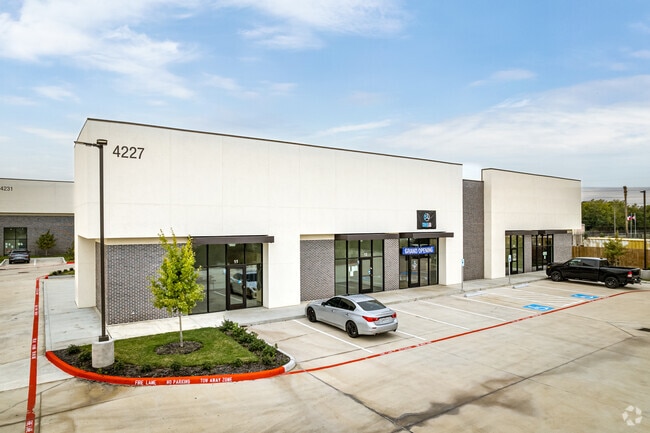
Property Record
4227 S Main St, Stafford, TX 77477
NEARBY LISTINGS FOR SALE OR LEASE
Property Detail
4227 S Main St
Houston
Stafford Business Condominiums
Houston-The Woodlands-Sugar Land, TX
STAFFORD BUSINESS CONDOMINIUMS, BUILDING 1, UNIT 15, 3.719% COMMON AREA INTEREST
7405-01-001-0150-910
Fort Bend
Commercialnec
Texas
2024
0.10 AC
2025
Southwest Far
671401
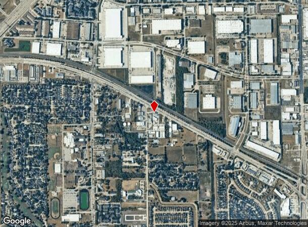
DEMOGRAPHICS near 4227 S Main St
1 Mile
3 Mile
5 Mile
2024 Total Population
9,294
94,039
361,648
2029 Population
11,133
108,801
402,827
Pop Growth 2024-2029
+ 19.79%
+ 15.70%
+ 11.39%
Average Age
39
40
38
2024 Total Households
3,634
34,278
126,195
HH Growth 2024-2029
+ 20.47%
+ 16.51%
+ 11.81%
Median Household Inc
$69,558
$67,903
$60,012
Avg Household Size
2.60
2.70
2.80
2024 Avg HH Vehicles
2.00
2.00
2.00
Median Home Value
$328,470
$265,207
$237,607
Median Year Built
1996
1988
1985
Nearby Places
Map Layers
Map Styles
 Street
 Aerial
- Restaurants
- Banks
- Shops
- Fitness
- Groceries
PUBLIC TRANSPORTATION
AIRPORT
William P Hobby
DRIVE
WALK
Distance
William P Hobby
34 min
21.9 mi
George Bush Intcntl/Houston
DRIVE
WALK
Distance
George Bush Intcntl/Houston
49 min
39.7 mi
Freight Ports
Port of Houston
DRIVE
WALK
Distance
Port of Houston
35 min
24.0 mi
SALE & LEASE HISTORY
LISTING DATE
SALE/LEASE

Sep 28, 2021
For Lease
Sep 10, 2024
For Lease
Oct 07, 2021
For Sale
May 10, 2021
For Sale
Jul 26, 2023
For Sale
Jul 21, 2022
For Lease
Feb 17, 2025
For Lease
Feb 02, 2024
For Lease
Dec 08, 2022
For Sale
Aug 10, 2023
For Sale
Nearby Properties
Address
Land Use
TOTAL SIZE
Lot Size
Zoning
Address
Land Use
TOTAL SIZE
Lot Size
Zoning
221,618 SF
6.50 AC
Address
Land Use
TOTAL SIZE
Lot Size
Zoning
7.46 AC
Address
Land Use
TOTAL SIZE
Lot Size
Zoning
257,051 SF
64.85 AC
Address
Land Use
TOTAL SIZE
Lot Size
Zoning
109,083 SF
20.81 AC
Address
Land Use
TOTAL SIZE
Lot Size
Zoning
12.98 AC
Address
Land Use
TOTAL SIZE
Lot Size
Zoning
11.58 AC
Address
Land Use
TOTAL SIZE
Lot Size
Zoning
12.08 AC
Address
Land Use
TOTAL SIZE
Lot Size
Zoning
816,006 SF
40.26 AC
Address
Land Use
TOTAL SIZE
Lot Size
Zoning
967,659 SF
75.03 AC
Address
Land Use
TOTAL SIZE
Lot Size
Zoning
422,123 SF
39.85 AC
Address
Land Use
TOTAL SIZE
Lot Size
Zoning
32,520 SF
34.98 AC
Address
Land Use
TOTAL SIZE
Lot Size
Zoning
85,273 SF
11.63 AC
Y
Address
Land Use
TOTAL SIZE
Lot Size
Zoning
93,310 SF
13.41 AC
Address
Land Use
TOTAL SIZE
Lot Size
Zoning
14,038 SF
23.83 AC
Address
Land Use
TOTAL SIZE
Lot Size
Zoning
76,385 SF
17.48 AC
Address
Land Use
TOTAL SIZE
Lot Size
Zoning
176,377 SF
40.41 AC
SM
Address
Land Use
TOTAL SIZE
Lot Size
Zoning
76,306 SF
15.84 AC
Address
Land Use
TOTAL SIZE
Lot Size
Zoning
127,458 SF
14.21 AC
Address
Land Use
TOTAL SIZE
Lot Size
Zoning
12.22 AC
Address
Land Use
TOTAL SIZE
Lot Size
Zoning
88,682 SF
10.52 AC
ASY
Address
Land Use
TOTAL SIZE
Lot Size
Zoning
61,006 SF
13.16 AC
X
Address
Land Use
TOTAL SIZE
Lot Size
Zoning
183,015 SF
9.91 AC
Address
Land Use
TOTAL SIZE
Lot Size
Zoning
149,261 SF
12.15 AC
SJ
Address
Land Use
TOTAL SIZE
Lot Size
Zoning
154,586 SF
10.93 AC
SY
Address
Land Use
TOTAL SIZE
Lot Size
Zoning
254,210 SF
10.59 AC
JT
Address
Land Use
TOTAL SIZE
Lot Size
Zoning
1,712 SF
17.93 AC
SM
Address
Land Use
TOTAL SIZE
Lot Size
Zoning
19.55 AC
S
Address
Land Use
TOTAL SIZE
Lot Size
Zoning
291,196 SF
30.06 AC
SXY
Address
Land Use
TOTAL SIZE
Lot Size
Zoning
259,117 SF
6.28 AC
YS
Address
Land Use
TOTAL SIZE
Lot Size
Zoning
490,720 SF
26.78 AC
S
The World's #1 Commercial Real Estate Marketplace
Connect with us
© 2025 CoStar Group
The information above has been obtained from sources believed reliable. While we do not doubt its accuracy we have not verified it and make no guarantee, warranty or representation about it. It is your responsibility to independently confirm its accuracy and completeness. Any projections, opinions, assumptions, or estimates used are for example only and do not represent the current or future performance of the property. The value of this transaction to you depends on tax and other factors which should be evaluated by your tax, financial, and legal advisors. You and your advisors should conduct a careful, independent investigation of the property to determine to your satisfaction the suitability of the property for your needs.