Property Record
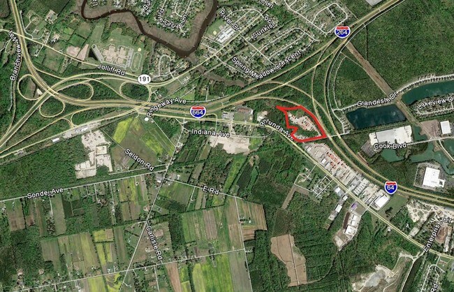
4229 Rotunda Ave, Chesapeake, VA 23321

Property Detail
4229 Rotunda Ave
0230000001490
SURVEY POR M E HOLLIDAY ESTATE 13.789 AC
Commercialacreage
CHESAPEAKE
M1: LIGHT
Virginia
AE The base floodplain where base flood elevations are provided. AE Zones are now used on new format FIRMs instead of A1-A30 Zones.
13.79 AC
2024
Western Branch
2025
Hampton Roads
021505
Virginia Beach-Chesapeake-Norfolk, VA-NC
NEARBY LISTINGS FOR SALE OR LEASE
DEMOGRAPHICS near 4229 Rotunda Ave
1 mile
3 mile
5 mile
2024 Total Population
4,062
38,848
117,408
2029 Population
4,081
38,709
117,961
Pop Growth 2024-2029
+ 0.47%
(0.36%)
+ 0.47%
Average Age
38
41
39
2024 Total Households
1,514
14,477
44,153
HH Growth 2024-2029
+ 0.40%
(0.48%)
+ 0.39%
Median Household Inc
$73,170
$78,223
$74,262
Avg Household Size
2.60
2.60
2.60
2024 Avg HH Vehicles
2.00
2.00
2.00
Median Home Value
$335,096
$287,319
$299,014
Median Year Built
1991
1973
1975
Nearby Places
Map Layers
Map Styles
 Street
 Aerial
Transit
 Traffic
 Biking
Places
Listings with unknown addresses are not visible on the map
- Restaurants
- Banks
- Shops
- Fitness
- Groceries
PUBLIC TRANSPORTATION
COMMUTER RAIL
Norfolk (Northeast Regional - Amtrak)
Drive
Walk
Distance
Norfolk (Northeast Regional - Amtrak)
17 min
9.0 mi
AIRPORT
Norfolk International
Drive
Walk
Distance
Norfolk International
29 min
15.4 mi
Newport News/Williamsburg International
Drive
Walk
Distance
Newport News/Williamsburg International
44 min
31.6 mi
Freight Ports
Virginia Port Authority - Portsmouth
Drive
Walk
Distance
Virginia Port Authority - Portsmouth
19 min
8.3 mi
SALE & LEASE HISTORY
LISTING DATE
SALE/LEASE

Sep 24, 2016
For Sale
Nearby Properties
Address
Land Use
TOTAL SIZE
Lot Size
Zoning
Address
Land Use
TOTAL SIZE
Lot Size
Zoning
250,000 SF
38 AC
MUH
Address
Land Use
TOTAL SIZE
Lot Size
Zoning
300,829 SF
38.40 AC
IL
Address
Land Use
TOTAL SIZE
Lot Size
Zoning
71,039 SF
22.69 AC
R10S: RESI
Address
Land Use
TOTAL SIZE
Lot Size
Zoning
1,684 SF
23.36 AC
RMF1: MULT
Address
Land Use
TOTAL SIZE
Lot Size
Zoning
120,471 SF
10.32 AC
M1: LIGHT
Address
Land Use
TOTAL SIZE
Lot Size
Zoning
295,000 SF
27.89 AC
M1: LIGHT
Address
Land Use
TOTAL SIZE
Lot Size
Zoning
206,652 SF
64.32 AC
A1: AGRICU
Address
Land Use
TOTAL SIZE
Lot Size
Zoning
333,833 SF
23.53 AC
M1: LIGHT
Address
Land Use
TOTAL SIZE
Lot Size
Zoning
241,397 SF
50.65 AC
M1: LIGHT
Address
Land Use
TOTAL SIZE
Lot Size
Zoning
195,550 SF
8.58 AC
M1: LIGHT
Address
Land Use
TOTAL SIZE
Lot Size
Zoning
29,828 SF
230.23 AC
MULTI: MUL
Address
Land Use
TOTAL SIZE
Lot Size
Zoning
121,200 SF
9.81 AC
PUD: PLANN
Address
Land Use
TOTAL SIZE
Lot Size
Zoning
181,723 SF
41.87 AC
M1: LIGHT
Address
Land Use
TOTAL SIZE
Lot Size
Zoning
274,700 SF
24.69 AC
UR
Address
Land Use
TOTAL SIZE
Lot Size
Zoning
143,220 SF
44.78 AC
M1: LIGHT
Address
Land Use
TOTAL SIZE
Lot Size
Zoning
130,510 SF
33.74 AC
M1: LIGHT
Address
Land Use
TOTAL SIZE
Lot Size
Zoning
85,266 SF
10.10 AC
M1: LIGHT
Address
Land Use
TOTAL SIZE
Lot Size
Zoning
205,470 SF
12.39 AC
URM
Address
Land Use
TOTAL SIZE
Lot Size
Zoning
114,956 SF
12.28 AC
B2: GENERA
Address
Land Use
TOTAL SIZE
Lot Size
Zoning
193,534 SF
17.99 AC
M1: LIGHT
Address
Land Use
TOTAL SIZE
Lot Size
Zoning
197,533 SF
15 AC
M1: LIGHT
Address
Land Use
TOTAL SIZE
Lot Size
Zoning
98,715 SF
20.64 AC
UR
Address
Land Use
TOTAL SIZE
Lot Size
Zoning
97,012 SF
5.40 AC
URM
Address
Land Use
TOTAL SIZE
Lot Size
Zoning
50,486 SF
11.50 AC
M1: LIGHT
Address
Land Use
TOTAL SIZE
Lot Size
Zoning
48,511 SF
20.71 AC
M1: LIGHT
Address
Land Use
TOTAL SIZE
Lot Size
Zoning
115,740 SF
12.07 AC
M1: LIGHT
Address
Land Use
TOTAL SIZE
Lot Size
Zoning
174,400 SF
10.97 AC
URM
Address
Land Use
TOTAL SIZE
Lot Size
Zoning
201,612 SF
12.54 AC
IL
Address
Land Use
TOTAL SIZE
Lot Size
Zoning
188,496 SF
12 AC
M1: LIGHT
Address
Land Use
TOTAL SIZE
Lot Size
Zoning
165,281 SF
14 AC
M1: LIGHT
The World's #1 Commercial Real Estate Marketplace
Connect with us
© 2026 CoStar Group
The information above has been obtained from sources believed reliable. While we do not doubt its accuracy we have not verified it and make no guarantee, warranty or representation about it. It is your responsibility to independently confirm its accuracy and completeness. Any projections, opinions, assumptions, or estimates used are for example only and do not represent the current or future performance of the property. The value of this transaction to you depends on tax and other factors which should be evaluated by your tax, financial, and legal advisors. You and your advisors should conduct a careful, independent investigation of the property to determine to your satisfaction the suitability of the property for your needs.