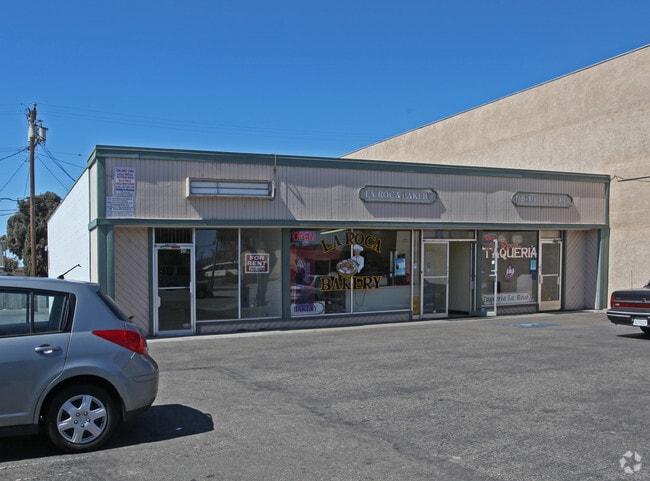
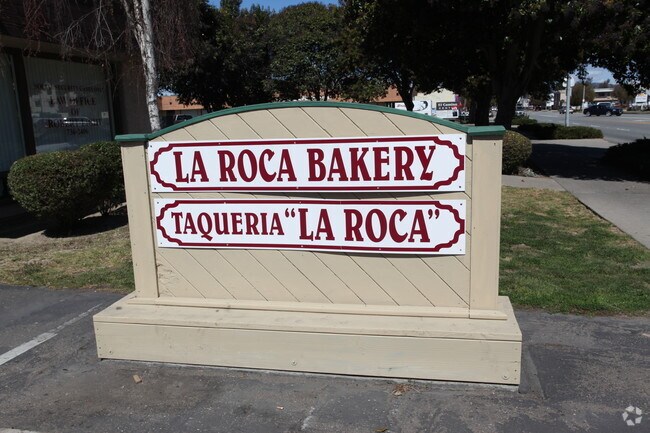
Property Record
423 N H St, Lompoc, CA 93436

Property Detail
423 N H St
Santa Maria-Santa Barbara, CA
LOTS 10 LOT 9 BLK 21
087-241-004
Santa Barbara
Storebuilding
California
C and X Area of minimal flood hazard, usually depicted on FIRMs as above the 500-year flood level.
42988
2024
0.16 AC
2025
Central SB County
002710
Santa Barbara/Sta Maria/Goleta
NEARBY LISTINGS FOR SALE OR LEASE
DEMOGRAPHICS near 423 N H St
1 mile
3 mile
5 mile
2025 Total Population
27,417
41,342
54,082
2030 Population
27,153
40,867
53,516
Pop Growth 2025-2030
(0.96%)
(1.15%)
(1.05%)
Average Age
36
37
38
2025 Total Households
9,251
13,954
17,558
HH Growth 2025-2030
(1.11%)
(1.30%)
(1.19%)
Median Household Inc
$56,427
$68,217
$73,451
Avg Household Size
2.90
2.90
2.80
2025 Avg HH Vehicles
2.00
2.00
2.00
Median Home Value
$417,848
$466,882
$487,921
Median Year Built
1972
1974
1972
Nearby Places
Map Layers
Map Styles
 Street
 Aerial
Transit
 Traffic
 Biking
Places
Listings with unknown addresses are not visible on the map
- Restaurants
- Banks
- Shops
- Fitness
- Groceries
PUBLIC TRANSPORTATION
COMMUTER RAIL
Lompoc-Surf Amtrak (Pacific Surfliner - Amtrak)
Drive
Walk
Distance
Lompoc-Surf Amtrak (Pacific Surfliner - Amtrak)
17 min
9.9 mi
Freight Ports
The Port of Hueneme
Drive
Walk
Distance
The Port of Hueneme
120 min
93.8 mi
Nearby Properties
Address
Land Use
TOTAL SIZE
Lot Size
Zoning
Address
Land Use
TOTAL SIZE
Lot Size
Zoning
13.68 AC
Address
Land Use
TOTAL SIZE
Lot Size
Zoning
960 SF
710.58 AC
AGII100
Address
Land Use
TOTAL SIZE
Lot Size
Zoning
9.42 AC
Address
Land Use
TOTAL SIZE
Lot Size
Zoning
7.37 AC
Address
Land Use
TOTAL SIZE
Lot Size
Zoning
2.20 AC
Address
Land Use
TOTAL SIZE
Lot Size
Zoning
12.86 AC
Address
Land Use
TOTAL SIZE
Lot Size
Zoning
4.85 AC
Address
Land Use
TOTAL SIZE
Lot Size
Zoning
4.71 AC
Address
Land Use
TOTAL SIZE
Lot Size
Zoning
6.55 AC
Address
Land Use
TOTAL SIZE
Lot Size
Zoning
2.78 AC
Address
Land Use
TOTAL SIZE
Lot Size
Zoning
1.09 AC
Address
Land Use
TOTAL SIZE
Lot Size
Zoning
2.17 AC
Address
Land Use
TOTAL SIZE
Lot Size
Zoning
0.99 AC
Address
Land Use
TOTAL SIZE
Lot Size
Zoning
7.34 AC
Address
Land Use
TOTAL SIZE
Lot Size
Zoning
12.02 AC
Address
Land Use
TOTAL SIZE
Lot Size
Zoning
4.36 AC
Address
Land Use
TOTAL SIZE
Lot Size
Zoning
2.35 AC
Address
Land Use
TOTAL SIZE
Lot Size
Zoning
Address
Land Use
TOTAL SIZE
Lot Size
Zoning
3.15 AC
Address
Land Use
TOTAL SIZE
Lot Size
Zoning
3.21 AC
Address
Land Use
TOTAL SIZE
Lot Size
Zoning
8.64 AC
Address
Land Use
TOTAL SIZE
Lot Size
Zoning
6.94 AC
Address
Land Use
TOTAL SIZE
Lot Size
Zoning
3.29 AC
Address
Land Use
TOTAL SIZE
Lot Size
Zoning
2.28 AC
Address
Land Use
TOTAL SIZE
Lot Size
Zoning
2.17 AC
Address
Land Use
TOTAL SIZE
Lot Size
Zoning
8.78 AC
Address
Land Use
TOTAL SIZE
Lot Size
Zoning
2.02 AC
Address
Land Use
TOTAL SIZE
Lot Size
Zoning
37.21 AC
Address
Land Use
TOTAL SIZE
Lot Size
Zoning
3.92 AC
Address
Land Use
TOTAL SIZE
Lot Size
Zoning
1.16 AC
The World's #1 Commercial Real Estate Marketplace
Connect with us
© 2026 CoStar Group
The information above has been obtained from sources believed reliable. While we do not doubt its accuracy we have not verified it and make no guarantee, warranty or representation about it. It is your responsibility to independently confirm its accuracy and completeness. Any projections, opinions, assumptions, or estimates used are for example only and do not represent the current or future performance of the property. The value of this transaction to you depends on tax and other factors which should be evaluated by your tax, financial, and legal advisors. You and your advisors should conduct a careful, independent investigation of the property to determine to your satisfaction the suitability of the property for your needs.