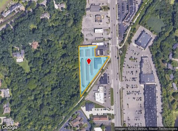
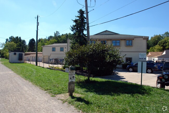
Property Record
4230 Orchard Lake Rd, West Bloomfield, MI 48323

NEARBY LISTINGS FOR SALE OR LEASE
Property Detail
4230 Orchard Lake Rd
Detroit-Warren-Dearborn, MI
Orchard Lake Square
18-15-428-021
T2N, R9E, SEC 15 ORCHARD LAKE SQUARE LOT 16 EXC BEG AT NE LOT COR, TH S 02-08-00 E 105 FT, TH S 34-05-30 W 4.96 FT, TH S 87-52-00 W 297.07 FT, TH N 02-08-00 W 109 FT, TH N 87-52-00 E 300 FT TO BEG, ALSO PART OF LOT 16 BEG AT PT DIST S 87-52-00 W 119.
Publicstorage
Oakland
X
Michigan
26125C0503F
16
2024
1.73 AC
2024
Lakes Area
154500
Detroit
39,783 SF
DEMOGRAPHICS near 4230 Orchard Lake Rd
1 Mile
3 Mile
5 Mile
2024 Total Population
5,283
50,991
152,554
2029 Population
5,221
50,626
151,421
Pop Growth 2024-2029
(1.17%)
(0.72%)
(0.74%)
Average Age
45
44
44
2024 Total Households
1,952
19,692
60,730
HH Growth 2024-2029
(1.13%)
(0.62%)
(0.68%)
Median Household Inc
$151,683
$123,979
$99,945
Avg Household Size
2.60
2.50
2.40
2024 Avg HH Vehicles
2.00
2.00
2.00
Median Home Value
$456,335
$408,729
$361,617
Median Year Built
1975
1976
1975
Nearby Places
Map Layers
Map Styles
 Street
 Aerial
- Restaurants
- Banks
- Shops
- Fitness
- Groceries
PUBLIC TRANSPORTATION
COMMUTER RAIL
Pontiac Amtrak Station (Wolverine - Amtrak)
DRIVE
WALK
Distance
Pontiac Amtrak Station (Wolverine - Amtrak)
14 min
6.6 mi
AIRPORT
Detroit Metro Wayne County
DRIVE
WALK
Distance
Detroit Metro Wayne County
46 min
34.5 mi
Windsor International
DRIVE
WALK
Distance
Windsor International
60 min
35.2 mi
Freight Ports
Port of Toledo
DRIVE
WALK
Distance
Port of Toledo
95 min
76.1 mi
Nearby Properties
Address
Land Use
TOTAL SIZE
Lot Size
Zoning
Address
Land Use
TOTAL SIZE
Lot Size
Zoning
315,206 SF
3.85 AC
AI
Address
Land Use
TOTAL SIZE
Lot Size
Zoning
121,382 SF
10.84 AC
BI
Address
Land Use
TOTAL SIZE
Lot Size
Zoning
411,118 SF
43.95 AC
AI
Address
Land Use
TOTAL SIZE
Lot Size
Zoning
204,652 SF
9.62 AC
BI
Address
Land Use
TOTAL SIZE
Lot Size
Zoning
274,691 SF
19.57 AC
AI
Address
Land Use
TOTAL SIZE
Lot Size
Zoning
167,790 SF
13.33 AC
BI
Address
Land Use
TOTAL SIZE
Lot Size
Zoning
89,878 SF
11.31 AC
BI
Address
Land Use
TOTAL SIZE
Lot Size
Zoning
243,820 SF
19.71 AC
AI
Address
Land Use
TOTAL SIZE
Lot Size
Zoning
45,893 SF
5.62 AC
AI
Address
Land Use
TOTAL SIZE
Lot Size
Zoning
253,037 SF
16.97 AC
AI
Address
Land Use
TOTAL SIZE
Lot Size
Zoning
139,227 SF
13.13 AC
BI
Address
Land Use
TOTAL SIZE
Lot Size
Zoning
198,917 SF
13.17 AC
AI
Address
Land Use
TOTAL SIZE
Lot Size
Zoning
97,626 SF
9.42 AC
BI
Address
Land Use
TOTAL SIZE
Lot Size
Zoning
0.96 AC
AI
Address
Land Use
TOTAL SIZE
Lot Size
Zoning
93,706 SF
1.13 AC
Address
Land Use
TOTAL SIZE
Lot Size
Zoning
84,297 SF
10 AC
BI
Address
Land Use
TOTAL SIZE
Lot Size
Zoning
47,573 SF
3.83 AC
BI
Address
Land Use
TOTAL SIZE
Lot Size
Zoning
50,927 SF
145.83 AC
Address
Land Use
TOTAL SIZE
Lot Size
Zoning
106.04 AC
RV
Address
Land Use
TOTAL SIZE
Lot Size
Zoning
128,882 SF
8.45 AC
BI
Address
Land Use
TOTAL SIZE
Lot Size
Zoning
88,380 SF
5.33 AC
BI
Address
Land Use
TOTAL SIZE
Lot Size
Zoning
70,251 SF
4.99 AC
BI
Address
Land Use
TOTAL SIZE
Lot Size
Zoning
124,185 SF
6.25 AC
AI
Address
Land Use
TOTAL SIZE
Lot Size
Zoning
61,320 SF
6.16 AC
BI
Address
Land Use
TOTAL SIZE
Lot Size
Zoning
58,790 SF
7.15 AC
BI
Address
Land Use
TOTAL SIZE
Lot Size
Zoning
79,104 SF
6.70 AC
BI
Address
Land Use
TOTAL SIZE
Lot Size
Zoning
50,295 SF
2.48 AC
BI
Address
Land Use
TOTAL SIZE
Lot Size
Zoning
38,738 SF
6.32 AC
BI
Address
Land Use
TOTAL SIZE
Lot Size
Zoning
25,155 SF
11.71 AC
BI
Address
Land Use
TOTAL SIZE
Lot Size
Zoning
79,852 SF
6.36 AC
AI
The World's #1 Commercial Real Estate Marketplace
Connect with us
© 2025 CoStar Group
The information above has been obtained from sources believed reliable. While we do not doubt its accuracy we have not verified it and make no guarantee, warranty or representation about it. It is your responsibility to independently confirm its accuracy and completeness. Any projections, opinions, assumptions, or estimates used are for example only and do not represent the current or future performance of the property. The value of this transaction to you depends on tax and other factors which should be evaluated by your tax, financial, and legal advisors. You and your advisors should conduct a careful, independent investigation of the property to determine to your satisfaction the suitability of the property for your needs.