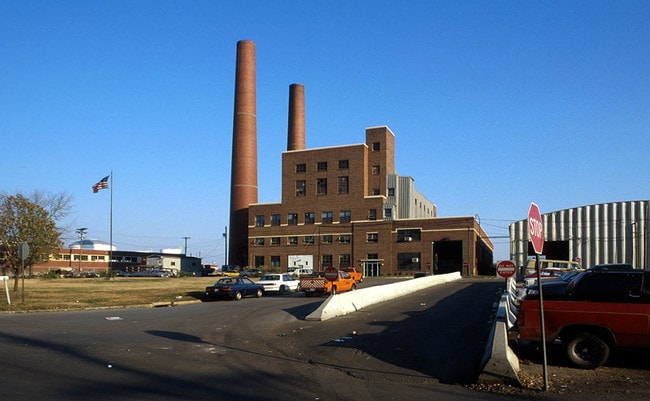
Property Record
4230 S 1St St, Saint Louis, MO 63111

NEARBY LISTINGS FOR SALE OR LEASE
Property Detail
4230 S 1St St
2614-00-0030-0
Mount Pleasant
Industrialgeneral
C. B. 2614 MISSOURI PACIFIC R R 24 ACRES SOUTH PART OF BLOCK
AE
St. Louis City
2903850103C
Missouri
0
24 AC
2025
St Louis City South
101400
St. Louis
41,264 SF
St. Louis, MO-IL
DEMOGRAPHICS near 4230 S 1St St
1 Mile
3 Mile
5 Mile
2024 Total Population
11,634
103,674
232,238
2029 Population
11,121
96,919
218,856
Pop Growth 2024-2029
(4.41%)
(6.52%)
(5.76%)
Average Age
38
38
39
2024 Total Households
4,923
47,705
110,340
HH Growth 2024-2029
(4.43%)
(6.53%)
(5.91%)
Median Household Inc
$36,775
$52,956
$54,142
Avg Household Size
2.20
2.10
2.00
2024 Avg HH Vehicles
1.00
1.00
1.00
Median Home Value
$134,891
$175,631
$174,778
Median Year Built
1946
1946
1948
Nearby Places
Map Layers
Map Styles
 Street
 Aerial
- Restaurants
- Banks
- Shops
- Fitness
- Groceries
PUBLIC TRANSPORTATION
COMMUTER RAIL
Union Station (Lambert Airport Shiloh-Scott - St. Louis MetroLink (MetroLink), Shrewsbury-Lansdowne I-44 Emerson Park - St. Louis MetroLink (MetroLink))
DRIVE
WALK
Distance
Union Station (Lambert Airport Shiloh-Scott - St. Louis MetroLink (MetroLink), Shrewsbury-Lansdowne I-44 Emerson Park - St. Louis MetroLink (MetroLink))
8 min
4.0 mi
Civic Center (Lambert Airport Shiloh-Scott - St. Louis MetroLink (MetroLink), Shrewsbury-Lansdowne I-44 Emerson Park - St. Louis MetroLink (MetroLink))
DRIVE
WALK
Distance
Civic Center (Lambert Airport Shiloh-Scott - St. Louis MetroLink (MetroLink), Shrewsbury-Lansdowne I-44 Emerson Park - St. Louis MetroLink (MetroLink))
9 min
4.3 mi
AIRPORT
St Louis Lambert International
DRIVE
WALK
Distance
St Louis Lambert International
29 min
19.0 mi
Scott AFB/Midamerica St Louis
DRIVE
WALK
Distance
Scott AFB/Midamerica St Louis
46 min
29.2 mi
Freight Ports
Port Milwaukee
DRIVE
WALK
Distance
Port Milwaukee
425 min
373.5 mi
Nearby Properties
Address
Land Use
TOTAL SIZE
Lot Size
Zoning
Address
Land Use
TOTAL SIZE
Lot Size
Zoning
5.61 AC
A
Address
Land Use
TOTAL SIZE
Lot Size
Zoning
229.57 AC
B
Address
Land Use
TOTAL SIZE
Lot Size
Zoning
177.77 AC
A
Address
Land Use
TOTAL SIZE
Lot Size
Zoning
275,012 SF
4.39 AC
C
Address
Land Use
TOTAL SIZE
Lot Size
Zoning
467,800 SF
1.30 AC
K
Address
Land Use
TOTAL SIZE
Lot Size
Zoning
220,982 SF
2.83 AC
HB
Address
Land Use
TOTAL SIZE
Lot Size
Zoning
114,000 SF
1.25 AC
J
Address
Land Use
TOTAL SIZE
Lot Size
Zoning
35,372 SF
1.78 AC
C
Address
Land Use
TOTAL SIZE
Lot Size
Zoning
124,541 SF
13.07 AC
G
Address
Land Use
TOTAL SIZE
Lot Size
Zoning
54,790 SF
0.87 AC
B
Address
Land Use
TOTAL SIZE
Lot Size
Zoning
273 SF
232.96 AC
Address
Land Use
TOTAL SIZE
Lot Size
Zoning
89,094 SF
9.91 AC
G
Address
Land Use
TOTAL SIZE
Lot Size
Zoning
86,292 SF
2.31 AC
H
Address
Land Use
TOTAL SIZE
Lot Size
Zoning
Address
Land Use
TOTAL SIZE
Lot Size
Zoning
6.99 AC
D
Address
Land Use
TOTAL SIZE
Lot Size
Zoning
353,728 SF
10.67 AC
K
Address
Land Use
TOTAL SIZE
Lot Size
Zoning
127,000 SF
6.75 AC
J
Address
Land Use
TOTAL SIZE
Lot Size
Zoning
50,060 SF
20.10 AC
K
Address
Land Use
TOTAL SIZE
Lot Size
Zoning
29.77 AC
A
Address
Land Use
TOTAL SIZE
Lot Size
Zoning
Address
Land Use
TOTAL SIZE
Lot Size
Zoning
39.88 AC
A
Address
Land Use
TOTAL SIZE
Lot Size
Zoning
125,850 SF
0.96 AC
G
Address
Land Use
TOTAL SIZE
Lot Size
Zoning
264,575 SF
1.50 AC
K
Address
Land Use
TOTAL SIZE
Lot Size
Zoning
88,456 SF
10.48 AC
H
Address
Land Use
TOTAL SIZE
Lot Size
Zoning
14.47 AC
C
Address
Land Use
TOTAL SIZE
Lot Size
Zoning
1.98 AC
D
Address
Land Use
TOTAL SIZE
Lot Size
Zoning
72,100 SF
6.34 AC
FB
Address
Land Use
TOTAL SIZE
Lot Size
Zoning
153,672 SF
8.20 AC
K
Address
Land Use
TOTAL SIZE
Lot Size
Zoning
26,375 SF
2.35 AC
G
Address
Land Use
TOTAL SIZE
Lot Size
Zoning
145,540 SF
13.66 AC
H
The World's #1 Commercial Real Estate Marketplace
Connect with us
© 2025 CoStar Group
The information above has been obtained from sources believed reliable. While we do not doubt its accuracy we have not verified it and make no guarantee, warranty or representation about it. It is your responsibility to independently confirm its accuracy and completeness. Any projections, opinions, assumptions, or estimates used are for example only and do not represent the current or future performance of the property. The value of this transaction to you depends on tax and other factors which should be evaluated by your tax, financial, and legal advisors. You and your advisors should conduct a careful, independent investigation of the property to determine to your satisfaction the suitability of the property for your needs.