Property Record
4233 E 38Th St, Indianapolis, IN 46218
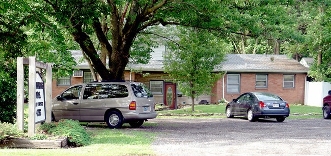


Property Detail
4233 E 38Th St
Indianapolis-Carmel-Greenwood, IN
FOREST MANOR EXTENSION L379 & W1/2 L380
49-07-21-136-072.000-101
Marion
Medicalbuilding
Indiana
ZO01
379
2024
0.28 AC
2025
Lawrence/East County
350600
Indianapolis
3,442 SF
NEARBY LISTINGS FOR SALE OR LEASE
DEMOGRAPHICS near 4233 E 38Th St
1 mile
3 mile
5 mile
2025 Total Population
13,011
98,164
285,221
2030 Population
13,496
100,481
292,282
Pop Growth 2025-2030
+ 3.73%
+ 2.36%
+ 2.48%
Average Age
40
38
37
2025 Total Households
5,434
41,659
124,182
HH Growth 2025-2030
+ 3.72%
+ 2.20%
+ 2.48%
Median Household Inc
$37,715
$53,463
$62,207
Avg Household Size
2.30
2.30
2.20
2025 Avg HH Vehicles
1.00
1.00
1.00
Median Home Value
$162,225
$202,333
$256,733
Median Year Built
1958
1956
1956
Nearby Places
Map Layers
Map Styles
 Street
 Aerial
Layers
 Traffic
 Biking
Places
Listings with unknown addresses are not visible on the map
- Restaurants
- Banks
- Shops
- Fitness
- Groceries
PUBLIC TRANSPORTATION
COMMUTER RAIL
Drive
Walk
Distance
15 min
7.5 mi
AIRPORT
Indianapolis International
Drive
Walk
Distance
Indianapolis International
35 min
21.3 mi
SALE & LEASE HISTORY
LISTING DATE
SALE/LEASE

Nov 22, 2019
For Sale
Aug 22, 2023
For Lease
Nearby Properties
Address
Land Use
TOTAL SIZE
Lot Size
Zoning
Address
Land Use
TOTAL SIZE
Lot Size
Zoning
25,146 SF
28.58 AC
ZO01
Address
Land Use
TOTAL SIZE
Lot Size
Zoning
143,890 SF
37.81 AC
ZO01
Address
Land Use
TOTAL SIZE
Lot Size
Zoning
866 SF
14.33 AC
ZO01
Address
Land Use
TOTAL SIZE
Lot Size
Zoning
4,588 SF
24.33 AC
ZO01
Address
Land Use
TOTAL SIZE
Lot Size
Zoning
25,340 SF
8.57 AC
ZO01
Address
Land Use
TOTAL SIZE
Lot Size
Zoning
2,142 SF
9.91 AC
ZO01
Address
Land Use
TOTAL SIZE
Lot Size
Zoning
3,200 SF
3.51 AC
ZO01
Address
Land Use
TOTAL SIZE
Lot Size
Zoning
5,670 SF
25.69 AC
Address
Land Use
TOTAL SIZE
Lot Size
Zoning
2.81 AC
ZO01
Address
Land Use
TOTAL SIZE
Lot Size
Zoning
55,047 SF
2.01 AC
ZO01
Address
Land Use
TOTAL SIZE
Lot Size
Zoning
1,903 SF
20.77 AC
ZO01
Address
Land Use
TOTAL SIZE
Lot Size
Zoning
1,528 SF
15.64 AC
ZO01
Address
Land Use
TOTAL SIZE
Lot Size
Zoning
268,930 SF
20.55 AC
ZO01
Address
Land Use
TOTAL SIZE
Lot Size
Zoning
66,953 SF
10.87 AC
ZO01
Address
Land Use
TOTAL SIZE
Lot Size
Zoning
925,384 SF
49.48 AC
ZO01
Address
Land Use
TOTAL SIZE
Lot Size
Zoning
29,624 SF
2.56 AC
ZO01
Address
Land Use
TOTAL SIZE
Lot Size
Zoning
1,865 SF
22.15 AC
ZO01
Address
Land Use
TOTAL SIZE
Lot Size
Zoning
14,482 SF
8.89 AC
ZO01
Address
Land Use
TOTAL SIZE
Lot Size
Zoning
4,692 SF
25.76 AC
Address
Land Use
TOTAL SIZE
Lot Size
Zoning
6,252 SF
17.02 AC
ZO01
Address
Land Use
TOTAL SIZE
Lot Size
Zoning
41,632 SF
9.17 AC
ZO01
Address
Land Use
TOTAL SIZE
Lot Size
Zoning
156,720 SF
6.18 AC
ZO01
Address
Land Use
TOTAL SIZE
Lot Size
Zoning
77,518 SF
11.69 AC
ZO01
Address
Land Use
TOTAL SIZE
Lot Size
Zoning
1,594 SF
6.47 AC
ZO01
Address
Land Use
TOTAL SIZE
Lot Size
Zoning
194,158 SF
19.29 AC
ZO01
Address
Land Use
TOTAL SIZE
Lot Size
Zoning
1,962 SF
8.66 AC
ZO01
Address
Land Use
TOTAL SIZE
Lot Size
Zoning
3,920 SF
26.08 AC
ZO01
Address
Land Use
TOTAL SIZE
Lot Size
Zoning
129,323 SF
12.29 AC
Address
Land Use
TOTAL SIZE
Lot Size
Zoning
520,902 SF
19.90 AC
ZO01
Address
Land Use
TOTAL SIZE
Lot Size
Zoning
593,228 SF
34.14 AC
ZO01
The World's #1 Commercial Real Estate Marketplace
Connect with us
© 2026 CoStar Group
The information above has been obtained from sources believed reliable. While we do not doubt its accuracy we have not verified it and make no guarantee, warranty or representation about it. It is your responsibility to independently confirm its accuracy and completeness. Any projections, opinions, assumptions, or estimates used are for example only and do not represent the current or future performance of the property. The value of this transaction to you depends on tax and other factors which should be evaluated by your tax, financial, and legal advisors. You and your advisors should conduct a careful, independent investigation of the property to determine to your satisfaction the suitability of the property for your needs.