Property Record
4236 N Verrado Way, Buckeye, AZ 85396


Current Lease Availabilities
NEARBY LISTINGS FOR SALE OR LEASE
Property Detail
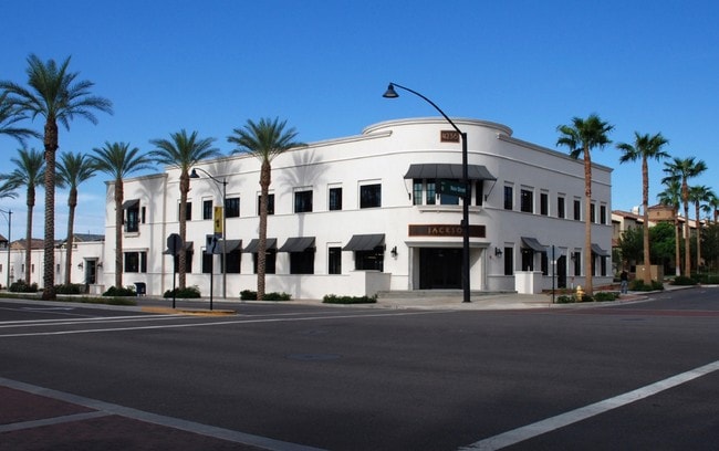
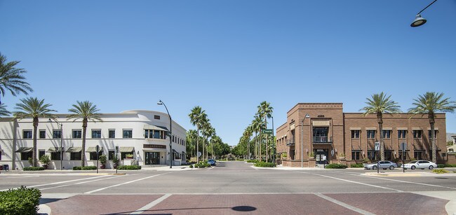
4236 N Verrado Way
502-79-116A
Verrado Parcel 5.702
Officebuilding
TH PT OF SE4 SEC 24 LY WI/IN FOL DESC PAR COM SE COR SEC 24 TH N 497F TO POB TH CONT N 333F S 89D W 553F S 06D E 325F S 89D E TO TPOB EX ANY PT LY WI/IN MCR 612-39 613-10 & EX TH PT LY WI-IN VERRADO PARCEL 5.703 MCR 641-41 & EX ANY PT LYING WI-IN VER
X
Maricopa
04013C2110L
Arizona
2025
1 AC
2025
West I-10
050620
Phoenix
23,969 SF
Phoenix-Mesa-Scottsdale, AZ
DEMOGRAPHICS near 4236 N Verrado Way
1 Mile
3 Mile
5 Mile
2024 Total Population
7,146
31,662
71,097
2029 Population
8,047
35,894
79,504
Pop Growth 2024-2029
+ 12.61%
+ 13.37%
+ 11.82%
Average Age
42
39
37
2024 Total Households
2,484
10,330
22,262
HH Growth 2024-2029
+ 13.33%
+ 13.76%
+ 12.07%
Median Household Inc
$149,906
$128,574
$104,667
Avg Household Size
2.80
3.00
3.10
2024 Avg HH Vehicles
2.00
2.00
2.00
Median Home Value
$568,523
$478,789
$424,963
Median Year Built
2010
2010
2010
Nearby Places
Map Layers
Map Styles
 Street
 Aerial
- Restaurants
- Banks
- Shops
- Fitness
- Groceries
PUBLIC TRANSPORTATION
AIRPORT
Phoenix Sky Harbor International
DRIVE
WALK
Distance
Phoenix Sky Harbor International
45 min
33.8 mi
Nearby Properties
Address
Land Use
TOTAL SIZE
Lot Size
Zoning
Address
Land Use
TOTAL SIZE
Lot Size
Zoning
166,213 SF
29.60 AC
PAD
Address
Land Use
TOTAL SIZE
Lot Size
Zoning
231,044 SF
48.70 AC
Address
Land Use
TOTAL SIZE
Lot Size
Zoning
179,632 SF
16.64 AC
PR
Address
Land Use
TOTAL SIZE
Lot Size
Zoning
152,901 SF
22.52 AC
Address
Land Use
TOTAL SIZE
Lot Size
Zoning
269,708 SF
15.51 AC
C2
Address
Land Use
TOTAL SIZE
Lot Size
Zoning
108,281 SF
11.95 AC
PC
Address
Land Use
TOTAL SIZE
Lot Size
Zoning
12,418 SF
54.25 AC
PC
Address
Land Use
TOTAL SIZE
Lot Size
Zoning
80,531 SF
7.51 AC
PAD
Address
Land Use
TOTAL SIZE
Lot Size
Zoning
40,300 SF
19.53 AC
CC
Address
Land Use
TOTAL SIZE
Lot Size
Zoning
44,463 SF
79.72 AC
RR
Address
Land Use
TOTAL SIZE
Lot Size
Zoning
64,720 SF
2.24 AC
PC
Address
Land Use
TOTAL SIZE
Lot Size
Zoning
34,356 SF
14.43 AC
CC
Address
Land Use
TOTAL SIZE
Lot Size
Zoning
38,713 SF
7.12 AC
PAD
Address
Land Use
TOTAL SIZE
Lot Size
Zoning
3,976 SF
1.38 AC
R-43
Address
Land Use
TOTAL SIZE
Lot Size
Zoning
31,223 SF
14.39 AC
C-C
Address
Land Use
TOTAL SIZE
Lot Size
Zoning
83,200 SF
1.25 AC
PC
Address
Land Use
TOTAL SIZE
Lot Size
Zoning
46,942 SF
52.81 AC
PR
Address
Land Use
TOTAL SIZE
Lot Size
Zoning
16.19 AC
Address
Land Use
TOTAL SIZE
Lot Size
Zoning
19,260 SF
3.13 AC
PAD
Address
Land Use
TOTAL SIZE
Lot Size
Zoning
Address
Land Use
TOTAL SIZE
Lot Size
Zoning
0.98 AC
P1
Address
Land Use
TOTAL SIZE
Lot Size
Zoning
21,974 SF
1.85 AC
Address
Land Use
TOTAL SIZE
Lot Size
Zoning
19,373 SF
4.84 AC
R-43
Address
Land Use
TOTAL SIZE
Lot Size
Zoning
0.16 AC
Address
Land Use
TOTAL SIZE
Lot Size
Zoning
8,142 SF
0.98 AC
PC
Address
Land Use
TOTAL SIZE
Lot Size
Zoning
0.15 AC
Address
Land Use
TOTAL SIZE
Lot Size
Zoning
0.15 AC
Address
Land Use
TOTAL SIZE
Lot Size
Zoning
8,696 SF
9.94 AC
C2
The World's #1 Commercial Real Estate Marketplace
Connect with us
© 2025 CoStar Group
The information above has been obtained from sources believed reliable. While we do not doubt its accuracy we have not verified it and make no guarantee, warranty or representation about it. It is your responsibility to independently confirm its accuracy and completeness. Any projections, opinions, assumptions, or estimates used are for example only and do not represent the current or future performance of the property. The value of this transaction to you depends on tax and other factors which should be evaluated by your tax, financial, and legal advisors. You and your advisors should conduct a careful, independent investigation of the property to determine to your satisfaction the suitability of the property for your needs.