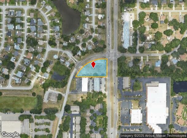
Property Record
4239 Little Rd, New Port Richey, FL 34655


NEARBY LISTINGS FOR SALE OR LEASE
Property Detail
4239 Little Rd
Tampa-St. Petersburg-Clearwater, FL
Little Road
14-26-16-0000-00300-0035
POR OF NE 1/4 OF SE 1/4 DESC AS COM AT SE COR SEC 14 TH ALG S BDY N89DG28 00W 60.00 FT TH ALG W R/W LINE BYPASS RD N00DG 43 47E 1316.71 FT FOR POB TH ALG S LINE OF NE 1/4 OF SE 1/4 N89DG 27 03W 351.16FT TH ALG SELY R/W LINE OF ST LAWRENCE DR 391.85 F
Commercialacreage
Pasco
AE
Florida
12101C0356G
35
2024
1.21 AC
2025
Pasco County
031705
Tampa/St Petersburg
DEMOGRAPHICS near 4239 Little Rd
1 Mile
3 Mile
5 Mile
2024 Total Population
9,710
61,671
158,448
2029 Population
11,619
74,140
190,307
Pop Growth 2024-2029
+ 19.66%
+ 20.22%
+ 20.11%
Average Age
48
44
44
2024 Total Households
4,461
25,682
67,312
HH Growth 2024-2029
+ 19.73%
+ 20.15%
+ 20.09%
Median Household Inc
$56,058
$61,203
$54,007
Avg Household Size
2.10
2.30
2.30
2024 Avg HH Vehicles
2.00
2.00
2.00
Median Home Value
$197,405
$244,720
$225,110
Median Year Built
1987
1988
1984
Nearby Places
Map Layers
Map Styles
 Street
 Aerial
- Restaurants
- Banks
- Shops
- Fitness
- Groceries
PUBLIC TRANSPORTATION
AIRPORT
St Pete-Clearwater International
DRIVE
WALK
Distance
St Pete-Clearwater International
39 min
24.4 mi
Tampa International
DRIVE
WALK
Distance
Tampa International
42 min
28.9 mi
Freight Ports
Port of Tampa Bay
DRIVE
WALK
Distance
Port of Tampa Bay
54 min
34.4 mi
Nearby Properties
Address
Land Use
TOTAL SIZE
Lot Size
Zoning
Address
Land Use
TOTAL SIZE
Lot Size
Zoning
339,446 SF
16.29 AC
MPUD
Address
Land Use
TOTAL SIZE
Lot Size
Zoning
384,700 SF
18.90 AC
MF3
Address
Land Use
TOTAL SIZE
Lot Size
Zoning
403,054 SF
117.69 AC
MPUD
Address
Land Use
TOTAL SIZE
Lot Size
Zoning
203,571 SF
13.82 AC
C2
Address
Land Use
TOTAL SIZE
Lot Size
Zoning
314,948 SF
55.04 AC
MPUD
Address
Land Use
TOTAL SIZE
Lot Size
Zoning
229,050 SF
36.13 AC
MPUD
Address
Land Use
TOTAL SIZE
Lot Size
Zoning
143,332 SF
17.40 AC
C2
Address
Land Use
TOTAL SIZE
Lot Size
Zoning
113,034 SF
15.21 AC
MPUD
Address
Land Use
TOTAL SIZE
Lot Size
Zoning
162,716 SF
16.56 AC
MF1
Address
Land Use
TOTAL SIZE
Lot Size
Zoning
171,378 SF
17.35 AC
MF1
Address
Land Use
TOTAL SIZE
Lot Size
Zoning
193,971 SF
4.50 AC
C1
Address
Land Use
TOTAL SIZE
Lot Size
Zoning
191,812 SF
17.61 AC
MPUD
Address
Land Use
TOTAL SIZE
Lot Size
Zoning
114,831 SF
7.98 AC
MF2
Address
Land Use
TOTAL SIZE
Lot Size
Zoning
59,874 SF
7.73 AC
MPUD
Address
Land Use
TOTAL SIZE
Lot Size
Zoning
116,607 SF
3.88 AC
MPUD
Address
Land Use
TOTAL SIZE
Lot Size
Zoning
83,958 SF
18.56 AC
MPUD
Address
Land Use
TOTAL SIZE
Lot Size
Zoning
135,600 SF
13.34 AC
MF1
Address
Land Use
TOTAL SIZE
Lot Size
Zoning
70,248 SF
27.90 AC
R4
Address
Land Use
TOTAL SIZE
Lot Size
Zoning
89,242 SF
14.28 AC
MPUD
Address
Land Use
TOTAL SIZE
Lot Size
Zoning
217,376 SF
22.12 AC
C2
Address
Land Use
TOTAL SIZE
Lot Size
Zoning
112,703 SF
8.43 AC
C2
Address
Land Use
TOTAL SIZE
Lot Size
Zoning
85,547 SF
16.13 AC
MPUD
Address
Land Use
TOTAL SIZE
Lot Size
Zoning
16,510 SF
41.69 AC
R1
Address
Land Use
TOTAL SIZE
Lot Size
Zoning
142,856 SF
20 AC
C
Address
Land Use
TOTAL SIZE
Lot Size
Zoning
85,600 SF
13.40 AC
C2
Address
Land Use
TOTAL SIZE
Lot Size
Zoning
89,308 SF
0.58 AC
C2
Address
Land Use
TOTAL SIZE
Lot Size
Zoning
75,844 SF
2.75 AC
C2
Address
Land Use
TOTAL SIZE
Lot Size
Zoning
90,231 SF
14.67 AC
C2
Address
Land Use
TOTAL SIZE
Lot Size
Zoning
93,304 SF
18.82 AC
MF1
Address
Land Use
TOTAL SIZE
Lot Size
Zoning
133,304 SF
13.48 AC
C2
The World's #1 Commercial Real Estate Marketplace
Connect with us
© 2025 CoStar Group
The information above has been obtained from sources believed reliable. While we do not doubt its accuracy we have not verified it and make no guarantee, warranty or representation about it. It is your responsibility to independently confirm its accuracy and completeness. Any projections, opinions, assumptions, or estimates used are for example only and do not represent the current or future performance of the property. The value of this transaction to you depends on tax and other factors which should be evaluated by your tax, financial, and legal advisors. You and your advisors should conduct a careful, independent investigation of the property to determine to your satisfaction the suitability of the property for your needs.