Property Record
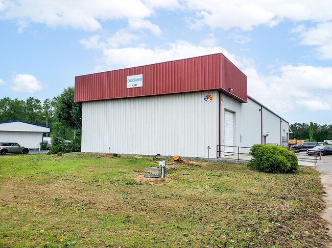
4241 Us Highway 70 E, Selma, NC 27576


Current Lease Availabilities
Property Detail
4241 Us Highway 70 E
12N11018B
PEEDIN 50/189 262300-
Warehouse
JOHNSTON
COM
North Carolina
B and X Area of moderate flood hazard, usually the area between the limits of the 100-year and 500-year floods.
1.65 AC
2025
Johnston County
2025
Raleigh/Durham
040301
Raleigh-Cary, NC
10,000 SF
NEARBY LISTINGS FOR SALE OR LEASE
DEMOGRAPHICS near 4241 Us Highway 70 E
1 mile
3 mile
5 mile
2025 Total Population
984
7,480
20,829
2030 Population
1,106
8,363
23,283
Pop Growth 2025-2030
+ 12.40%
+ 11.80%
+ 11.78%
Average Age
37
39
39
2025 Total Households
370
2,837
7,999
HH Growth 2025-2030
+ 12.16%
+ 11.84%
+ 11.80%
Median Household Inc
$76,894
$73,068
$61,367
Avg Household Size
2.60
2.60
2.60
2025 Avg HH Vehicles
3.00
2.00
2.00
Median Home Value
$189,758
$219,422
$203,783
Median Year Built
1990
1993
1989
Nearby Places
Map Layers
Map Styles
 Street
 Aerial
Layers
 Traffic
 Biking
Places
Listings with unknown addresses are not visible on the map
- Restaurants
- Banks
- Shops
- Fitness
- Groceries
PUBLIC TRANSPORTATION
COMMUTER RAIL
Selma (Carolinian - Amtrak, Palmetto - Amtrak)
Drive
Walk
Distance
Selma (Carolinian - Amtrak, Palmetto - Amtrak)
9 min
5.6 mi
Freight Ports
Port of Wilmington
Drive
Walk
Distance
Port of Wilmington
137 min
109.5 mi
Nearby Properties
Address
Land Use
TOTAL SIZE
Lot Size
Zoning
Address
Land Use
TOTAL SIZE
Lot Size
Zoning
134,742 SF
8.20 AC
IND
Address
Land Use
TOTAL SIZE
Lot Size
Zoning
54,009 SF
2.08 AC
COM
Address
Land Use
TOTAL SIZE
Lot Size
Zoning
20,602 SF
4.52 AC
COM
Address
Land Use
TOTAL SIZE
Lot Size
Zoning
19,854 SF
7.86 AC
COM
Address
Land Use
TOTAL SIZE
Lot Size
Zoning
34.19 AC
IND
Address
Land Use
TOTAL SIZE
Lot Size
Zoning
20,730 SF
7.77 AC
COM
Address
Land Use
TOTAL SIZE
Lot Size
Zoning
10,640 SF
1.86 AC
RES
Address
Land Use
TOTAL SIZE
Lot Size
Zoning
46,830 SF
22.60 AC
IND
Address
Land Use
TOTAL SIZE
Lot Size
Zoning
37,320 SF
6.32 AC
IND
Address
Land Use
TOTAL SIZE
Lot Size
Zoning
2,800 SF
13.40 AC
COM
Address
Land Use
TOTAL SIZE
Lot Size
Zoning
2,200 SF
17.33 AC
MHP
Address
Land Use
TOTAL SIZE
Lot Size
Zoning
27.63 AC
IND
Address
Land Use
TOTAL SIZE
Lot Size
Zoning
15.76 AC
IND
Address
Land Use
TOTAL SIZE
Lot Size
Zoning
40,940 SF
3.54 AC
IND
Address
Land Use
TOTAL SIZE
Lot Size
Zoning
26,000 SF
2.82 AC
COM
Address
Land Use
TOTAL SIZE
Lot Size
Zoning
32,374 SF
26.45 AC
COW
Address
Land Use
TOTAL SIZE
Lot Size
Zoning
14,848 SF
3.17 AC
RAG
Address
Land Use
TOTAL SIZE
Lot Size
Zoning
12,151 SF
1.46 AC
RES
Address
Land Use
TOTAL SIZE
Lot Size
Zoning
1,551 SF
2.50 AC
RES
Address
Land Use
TOTAL SIZE
Lot Size
Zoning
8,925 SF
7.64 AC
RAG
Address
Land Use
TOTAL SIZE
Lot Size
Zoning
5,688 SF
77.86 AC
COM
Address
Land Use
TOTAL SIZE
Lot Size
Zoning
1,512 SF
1.16 AC
COM
Address
Land Use
TOTAL SIZE
Lot Size
Zoning
3,775 SF
2.49 AC
COM
Address
Land Use
TOTAL SIZE
Lot Size
Zoning
7,675 SF
70.58 AC
COM
Address
Land Use
TOTAL SIZE
Lot Size
Zoning
968 SF
68.41 AC
RAG
Address
Land Use
TOTAL SIZE
Lot Size
Zoning
9,720 SF
13.12 AC
RAG
Address
Land Use
TOTAL SIZE
Lot Size
Zoning
9,000 SF
1.01 AC
COM
Address
Land Use
TOTAL SIZE
Lot Size
Zoning
10,300 SF
1.38 AC
COM
Address
Land Use
TOTAL SIZE
Lot Size
Zoning
10,040 SF
0.24 AC
RES
Address
Land Use
TOTAL SIZE
Lot Size
Zoning
10,666 SF
1.90 AC
COM
The World's #1 Commercial Real Estate Marketplace
Connect with us
© 2026 CoStar Group
The information above has been obtained from sources believed reliable. While we do not doubt its accuracy we have not verified it and make no guarantee, warranty or representation about it. It is your responsibility to independently confirm its accuracy and completeness. Any projections, opinions, assumptions, or estimates used are for example only and do not represent the current or future performance of the property. The value of this transaction to you depends on tax and other factors which should be evaluated by your tax, financial, and legal advisors. You and your advisors should conduct a careful, independent investigation of the property to determine to your satisfaction the suitability of the property for your needs.