Property Record
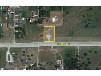
4245 E Highway 20, Collinsville, OK 74021


Property Detail
4245 E Highway 20
Tulsa, OK
LOT 12 BLOCK 5 LOOKING GLASS EXT LESS S'ERLY STRIP DEEDED TO ODOT FOR HWY 20 DESC AS BEG AT SW/C THEREOF; TH N00-58-49W 36.64
660005137
ROGERS
Privateutilityelectricwatergasnuclearsolarwindetc
Oklahoma
B and X Area of moderate flood hazard, usually the area between the limits of the 100-year and 500-year floods.
12
2025
0.82 AC
2025
Rogers County
005403
Tulsa
1,800 SF
NEARBY LISTINGS FOR SALE OR LEASE
-
-
View all Collinsville listings for sale on LoopNet.com
DEMOGRAPHICS near 4245 E Highway 20
1 mile
3 mile
5 mile
2025 Total Population
1,618
9,803
36,056
2030 Population
1,698
10,287
37,579
Pop Growth 2025-2030
+ 4.94%
+ 4.94%
+ 4.22%
Average Age
39
41
39
2025 Total Households
546
3,414
12,930
HH Growth 2025-2030
+ 5.13%
+ 5.01%
+ 4.25%
Median Household Inc
$82,894
$98,186
$91,793
Avg Household Size
2.90
2.80
2.80
2025 Avg HH Vehicles
3.00
3.00
2.00
Median Home Value
$233,557
$296,026
$293,178
Median Year Built
2000
1998
2002
Nearby Places
Map Layers
Map Styles
 Street
 Aerial
Layers
 Traffic
 Biking
Places
Listings with unknown addresses are not visible on the map
- Restaurants
- Banks
- Shops
- Fitness
- Groceries
PUBLIC TRANSPORTATION
AIRPORT
Tulsa International
Drive
Walk
Distance
Tulsa International
22 min
15.4 mi
Freight Ports
Drive
Walk
Distance
19 min
9.9 mi
Nearby Properties
Address
Land Use
TOTAL SIZE
Lot Size
Zoning
Address
Land Use
TOTAL SIZE
Lot Size
Zoning
288 SF
3.95 AC
Address
Land Use
TOTAL SIZE
Lot Size
Zoning
27,000 SF
4.44 AC
Address
Land Use
TOTAL SIZE
Lot Size
Zoning
9,230 SF
1.34 AC
Address
Land Use
TOTAL SIZE
Lot Size
Zoning
22,500 SF
7.62 AC
Address
Land Use
TOTAL SIZE
Lot Size
Zoning
22,512 SF
3.62 AC
Address
Land Use
TOTAL SIZE
Lot Size
Zoning
3,390 SF
1.11 AC
Address
Land Use
TOTAL SIZE
Lot Size
Zoning
600 SF
3.04 AC
Address
Land Use
TOTAL SIZE
Lot Size
Zoning
3,309 SF
1.15 AC
Address
Land Use
TOTAL SIZE
Lot Size
Zoning
3,600 SF
2.65 AC
Address
Land Use
TOTAL SIZE
Lot Size
Zoning
7.03 AC
Address
Land Use
TOTAL SIZE
Lot Size
Zoning
3,625 SF
1.25 AC
Address
Land Use
TOTAL SIZE
Lot Size
Zoning
4,064 SF
149.85 AC
Address
Land Use
TOTAL SIZE
Lot Size
Zoning
384 SF
9.01 AC
Address
Land Use
TOTAL SIZE
Lot Size
Zoning
2,765 SF
0.65 AC
Address
Land Use
TOTAL SIZE
Lot Size
Zoning
1,606 SF
1.99 AC
Address
Land Use
TOTAL SIZE
Lot Size
Zoning
5,600 SF
1.07 AC
Address
Land Use
TOTAL SIZE
Lot Size
Zoning
3,870 SF
1.57 AC
Address
Land Use
TOTAL SIZE
Lot Size
Zoning
36.44 AC
Address
Land Use
TOTAL SIZE
Lot Size
Zoning
2,800 SF
2.10 AC
Address
Land Use
TOTAL SIZE
Lot Size
Zoning
920 SF
2.90 AC
Address
Land Use
TOTAL SIZE
Lot Size
Zoning
1.99 AC
Address
Land Use
TOTAL SIZE
Lot Size
Zoning
3,000 SF
0.46 AC
Address
Land Use
TOTAL SIZE
Lot Size
Zoning
Address
Land Use
TOTAL SIZE
Lot Size
Zoning
2.72 AC
Address
Land Use
TOTAL SIZE
Lot Size
Zoning
4.87 AC
Address
Land Use
TOTAL SIZE
Lot Size
Zoning
3.95 AC
Address
Land Use
TOTAL SIZE
Lot Size
Zoning
5.29 AC
Address
Land Use
TOTAL SIZE
Lot Size
Zoning
1,998 SF
4.80 AC
Address
Land Use
TOTAL SIZE
Lot Size
Zoning
3.99 AC
Address
Land Use
TOTAL SIZE
Lot Size
Zoning
6.49 AC
The World's #1 Commercial Real Estate Marketplace
Connect with us
© 2026 CoStar Group
The information above has been obtained from sources believed reliable. While we do not doubt its accuracy we have not verified it and make no guarantee, warranty or representation about it. It is your responsibility to independently confirm its accuracy and completeness. Any projections, opinions, assumptions, or estimates used are for example only and do not represent the current or future performance of the property. The value of this transaction to you depends on tax and other factors which should be evaluated by your tax, financial, and legal advisors. You and your advisors should conduct a careful, independent investigation of the property to determine to your satisfaction the suitability of the property for your needs.