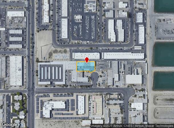
Property Record
42461 Ritter Cir, Palm Desert, CA 92211


NEARBY LISTINGS FOR SALE OR LEASE
Property Detail
42461 Ritter Cir
Riverside-San Bernardino-Ontario, CA
Parcel Map No. 17191
634-260-004
.52 ACRES NET IN PAR 5 PM 130/060 PM 17191 CM 87/93-105
Lightindustrial
Riverside
X
California
06065C2226H
5
2024
0.52 AC
2025
Coachella Valley
044928
Inland Empire (California)
11,628 SF
DEMOGRAPHICS near 42461 Ritter Cir
1 Mile
3 Mile
5 Mile
2024 Total Population
8,610
71,554
131,758
2029 Population
9,478
79,275
145,586
Pop Growth 2024-2029
+ 10.08%
+ 10.79%
+ 10.49%
Average Age
48
52
52
2024 Total Households
3,696
34,143
62,224
HH Growth 2024-2029
+ 10.04%
+ 10.67%
+ 10.41%
Median Household Inc
$93,288
$77,019
$83,169
Avg Household Size
2.20
2.00
2.00
2024 Avg HH Vehicles
2.00
2.00
2.00
Median Home Value
$618,284
$580,515
$611,836
Median Year Built
1990
1986
1988
Nearby Places
Map Layers
Map Styles
 Street
 Aerial
- Restaurants
- Banks
- Shops
- Fitness
- Groceries
PUBLIC TRANSPORTATION
AIRPORT
Palm Springs International
DRIVE
WALK
Distance
Palm Springs International
22 min
18.0 mi
SALE & LEASE HISTORY
LISTING DATE
SALE/LEASE

Nov 22, 2016
For Sale
Nov 07, 2018
For Lease
Nov 03, 2016
For Lease
Mar 13, 2017
For Sale
Jul 25, 2018
For Sale
Jul 08, 2018
For Lease
Aug 20, 2018
For Lease
Nearby Properties
Address
Land Use
TOTAL SIZE
Lot Size
Zoning
Address
Land Use
TOTAL SIZE
Lot Size
Zoning
34,292 SF
34.67 AC
R112M
Address
Land Use
TOTAL SIZE
Lot Size
Zoning
52,981 SF
16.98 AC
Address
Land Use
TOTAL SIZE
Lot Size
Zoning
400,240 SF
9.40 AC
PR060
Address
Land Use
TOTAL SIZE
Lot Size
Zoning
2,169 SF
21.30 AC
Address
Land Use
TOTAL SIZE
Lot Size
Zoning
42,225 SF
20.83 AC
HW
Address
Land Use
TOTAL SIZE
Lot Size
Zoning
488,725 SF
24.17 AC
C1
Address
Land Use
TOTAL SIZE
Lot Size
Zoning
217,730 SF
8.64 AC
R1010
Address
Land Use
TOTAL SIZE
Lot Size
Zoning
110,000 SF
39.46 AC
Address
Land Use
TOTAL SIZE
Lot Size
Zoning
15.90 AC
Address
Land Use
TOTAL SIZE
Lot Size
Zoning
32,576 SF
19.40 AC
CBOOK
Address
Land Use
TOTAL SIZE
Lot Size
Zoning
306,484 SF
17.64 AC
OS
Address
Land Use
TOTAL SIZE
Lot Size
Zoning
164,751 SF
8.25 AC
Address
Land Use
TOTAL SIZE
Lot Size
Zoning
214,678 SF
6.43 AC
Address
Land Use
TOTAL SIZE
Lot Size
Zoning
146,996 SF
6.75 AC
R1010
Address
Land Use
TOTAL SIZE
Lot Size
Zoning
166,750 SF
10.69 AC
PR-5
Address
Land Use
TOTAL SIZE
Lot Size
Zoning
284,977 SF
23.95 AC
Address
Land Use
TOTAL SIZE
Lot Size
Zoning
136,875 SF
8.87 AC
O
Address
Land Use
TOTAL SIZE
Lot Size
Zoning
150,818 SF
2.02 AC
R3
Address
Land Use
TOTAL SIZE
Lot Size
Zoning
58,823 SF
5.87 AC
C-N
Address
Land Use
TOTAL SIZE
Lot Size
Zoning
41,533 SF
1.38 AC
C1SP
Address
Land Use
TOTAL SIZE
Lot Size
Zoning
209,000 SF
7.12 AC
Address
Land Use
TOTAL SIZE
Lot Size
Zoning
82,028 SF
8.32 AC
PR6
Address
Land Use
TOTAL SIZE
Lot Size
Zoning
131,298 SF
10.06 AC
CPS
Address
Land Use
TOTAL SIZE
Lot Size
Zoning
65,000 SF
9.51 AC
Address
Land Use
TOTAL SIZE
Lot Size
Zoning
86,064 SF
6.95 AC
Address
Land Use
TOTAL SIZE
Lot Size
Zoning
50,318 SF
0.87 AC
PR060
Address
Land Use
TOTAL SIZE
Lot Size
Zoning
61,100 SF
5.82 AC
Address
Land Use
TOTAL SIZE
Lot Size
Zoning
64,836 SF
5.91 AC
HW
Address
Land Use
TOTAL SIZE
Lot Size
Zoning
139,677 SF
10.49 AC
HW
Address
Land Use
TOTAL SIZE
Lot Size
Zoning
52,871 SF
4.13 AC
The World's #1 Commercial Real Estate Marketplace
Connect with us
© 2025 CoStar Group
The information above has been obtained from sources believed reliable. While we do not doubt its accuracy we have not verified it and make no guarantee, warranty or representation about it. It is your responsibility to independently confirm its accuracy and completeness. Any projections, opinions, assumptions, or estimates used are for example only and do not represent the current or future performance of the property. The value of this transaction to you depends on tax and other factors which should be evaluated by your tax, financial, and legal advisors. You and your advisors should conduct a careful, independent investigation of the property to determine to your satisfaction the suitability of the property for your needs.