Property Record
4247 Bonsack Rd, Roanoke, VA 24012


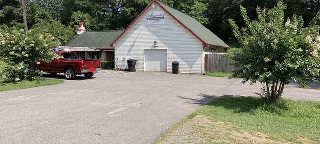
Property Detail
4247 Bonsack Rd
040.18-01-34
PT LT 1 WILLIAM COOK SUR
Commercialnec
Roanoke
C2
Virginia
B and X Area of moderate flood hazard, usually the area between the limits of the 100-year and 500-year floods.
1
2025
0.99 AC
2025
Southeast Roanoke
031202
Roanoke
960 SF
Roanoke, VA
NEARBY LISTINGS FOR SALE OR LEASE
DEMOGRAPHICS near 4247 Bonsack Rd
1 mile
3 mile
5 mile
2025 Total Population
3,395
25,853
83,657
2030 Population
3,425
26,004
83,819
Pop Growth 2025-2030
+ 0.88%
+ 0.58%
+ 0.19%
Average Age
45
42
41
2025 Total Households
1,373
10,826
34,925
HH Growth 2025-2030
+ 0.87%
+ 0.57%
+ 0.20%
Median Household Inc
$84,058
$73,723
$61,225
Avg Household Size
2.40
2.30
2.30
2025 Avg HH Vehicles
2.00
2.00
2.00
Median Home Value
$340,086
$281,570
$233,130
Median Year Built
1993
1981
1971
Nearby Places
Map Layers
Map Styles
 Street
 Aerial
Transit
 Traffic
 Biking
Places
Listings with unknown addresses are not visible on the map
- Restaurants
- Banks
- Shops
- Fitness
- Groceries
PUBLIC TRANSPORTATION
COMMUTER RAIL
Roanoke (Northeast Regional - Amtrak)
Drive
Walk
Distance
Roanoke (Northeast Regional - Amtrak)
11 min
5.4 mi
AIRPORT
Roanoke/Blacksburg Regional (Woodrum Field)
Drive
Walk
Distance
Roanoke/Blacksburg Regional (Woodrum Field)
17 min
8.5 mi
Freight Ports
Virginia Port Authority - Richmond
Drive
Walk
Distance
Virginia Port Authority - Richmond
208 min
156.7 mi
SALE & LEASE HISTORY
LISTING DATE
SALE/LEASE

Aug 02, 2019
For Sale
Nearby Properties
Address
Land Use
TOTAL SIZE
Lot Size
Zoning
Address
Land Use
TOTAL SIZE
Lot Size
Zoning
214,543 SF
38.29 AC
R1S
Address
Land Use
TOTAL SIZE
Lot Size
Zoning
4,901 SF
17.41 AC
MXPUD
Address
Land Use
TOTAL SIZE
Lot Size
Zoning
24,126 SF
20.11 AC
R3
Address
Land Use
TOTAL SIZE
Lot Size
Zoning
402,320 SF
42.13 AC
I1C
Address
Land Use
TOTAL SIZE
Lot Size
Zoning
387,684 SF
27.44 AC
I-1
Address
Land Use
TOTAL SIZE
Lot Size
Zoning
40.12 AC
M-1
Address
Land Use
TOTAL SIZE
Lot Size
Zoning
142,048 SF
21.38 AC
I-1
Address
Land Use
TOTAL SIZE
Lot Size
Zoning
2,193 SF
2,914.16 AC
AG3
Address
Land Use
TOTAL SIZE
Lot Size
Zoning
609,211 SF
41.01 AC
I1C
Address
Land Use
TOTAL SIZE
Lot Size
Zoning
29.63 AC
I-1
Address
Land Use
TOTAL SIZE
Lot Size
Zoning
19,594 SF
11.15 AC
RMF
Address
Land Use
TOTAL SIZE
Lot Size
Zoning
57,985 SF
12.66 AC
R1
Address
Land Use
TOTAL SIZE
Lot Size
Zoning
11,694 SF
12.05 AC
RMF
Address
Land Use
TOTAL SIZE
Lot Size
Zoning
1,109 SF
13.44 AC
INPUD
Address
Land Use
TOTAL SIZE
Lot Size
Zoning
446,526 SF
28.10 AC
I-1
Address
Land Use
TOTAL SIZE
Lot Size
Zoning
391,945 SF
25 AC
I1C
Address
Land Use
TOTAL SIZE
Lot Size
Zoning
14,418 SF
6.47 AC
RMF
Address
Land Use
TOTAL SIZE
Lot Size
Zoning
333,572 SF
20 AC
I-1
Address
Land Use
TOTAL SIZE
Lot Size
Zoning
183,960 SF
27.63 AC
C2
Address
Land Use
TOTAL SIZE
Lot Size
Zoning
39,354 SF
7.37 AC
RMF
Address
Land Use
TOTAL SIZE
Lot Size
Zoning
48.26 AC
I-1
Address
Land Use
TOTAL SIZE
Lot Size
Zoning
63,648 SF
11.51 AC
INPUD
Address
Land Use
TOTAL SIZE
Lot Size
Zoning
69,212 SF
19.65 AC
R3S
Address
Land Use
TOTAL SIZE
Lot Size
Zoning
123,019 SF
21.84 AC
I-1
Address
Land Use
TOTAL SIZE
Lot Size
Zoning
134,019 SF
14.84 AC
C2
Address
Land Use
TOTAL SIZE
Lot Size
Zoning
83,159 SF
15.49 AC
C2S
Address
Land Use
TOTAL SIZE
Lot Size
Zoning
35,582 SF
16.36 AC
I2S
Address
Land Use
TOTAL SIZE
Lot Size
Zoning
184,144 SF
10.90 AC
I-1
Address
Land Use
TOTAL SIZE
Lot Size
Zoning
11,694 SF
5.20 AC
RMF
Address
Land Use
TOTAL SIZE
Lot Size
Zoning
9.14 AC
M-2
The World's #1 Commercial Real Estate Marketplace
Connect with us
© 2026 CoStar Group
The information above has been obtained from sources believed reliable. While we do not doubt its accuracy we have not verified it and make no guarantee, warranty or representation about it. It is your responsibility to independently confirm its accuracy and completeness. Any projections, opinions, assumptions, or estimates used are for example only and do not represent the current or future performance of the property. The value of this transaction to you depends on tax and other factors which should be evaluated by your tax, financial, and legal advisors. You and your advisors should conduct a careful, independent investigation of the property to determine to your satisfaction the suitability of the property for your needs.