Property Record
4249 Claxter Ct Ne, Salem, OR 97301
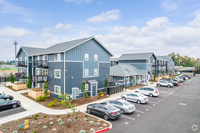

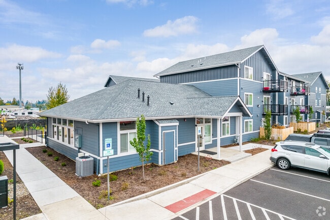
Property Detail
4249 Claxter Ct Ne
526001
PP 2019-050 LOT 1 & ADJ AC ACRES 3.18
Multifamilydwelling
MARION
CO
Oregon
B and X Area of moderate flood hazard, usually the area between the limits of the 100-year and 500-year floods.
1
0
3.18 AC
2025
Northgate
000400
Portland
74,688 SF
Salem, OR
NEARBY LISTINGS FOR SALE OR LEASE
DEMOGRAPHICS near 4249 Claxter Ct Ne
1 mile
3 mile
5 mile
2025 Total Population
17,912
112,761
190,169
2030 Population
18,198
113,846
192,131
Pop Growth 2025-2030
+ 1.60%
+ 0.96%
+ 1.03%
Average Age
34
38
38
2025 Total Households
6,171
39,831
67,476
HH Growth 2025-2030
+ 1.69%
+ 1.06%
+ 1.11%
Median Household Inc
$47,777
$63,999
$67,909
Avg Household Size
2.80
2.70
2.70
2025 Avg HH Vehicles
2.00
2.00
2.00
Median Home Value
$360,267
$376,479
$398,286
Median Year Built
1979
1978
1977
Nearby Places
Map Layers
Map Styles
 Street
 Aerial
Transit
 Traffic
 Biking
Places
Listings with unknown addresses are not visible on the map
- Restaurants
- Banks
- Shops
- Fitness
- Groceries
PUBLIC TRANSPORTATION
COMMUTER RAIL
Salem (Amtrak Cascades - Amtrak, Coast Starlight - Amtrak)
Drive
Walk
Distance
Salem (Amtrak Cascades - Amtrak, Coast Starlight - Amtrak)
14 min
8.1 mi
Freight Ports
Port of Portland
Drive
Walk
Distance
Port of Portland
61 min
46.4 mi
SALE & LEASE HISTORY
LISTING DATE
SALE/LEASE

Apr 23, 2018
For Sale
Nearby Properties
Address
Land Use
TOTAL SIZE
Lot Size
Zoning
Address
Land Use
TOTAL SIZE
Lot Size
Zoning
58,868 SF
38.09 AC
P; RM
Address
Land Use
TOTAL SIZE
Lot Size
Zoning
236,837 SF
20.76 AC
PE
Address
Land Use
TOTAL SIZE
Lot Size
Zoning
118,829 SF
3.49 AC
CB
Address
Land Use
TOTAL SIZE
Lot Size
Zoning
532,684 SF
158.53 AC
PA
Address
Land Use
TOTAL SIZE
Lot Size
Zoning
94,577 SF
10.65 AC
PA
Address
Land Use
TOTAL SIZE
Lot Size
Zoning
236,632 SF
24.45 AC
CO
Address
Land Use
TOTAL SIZE
Lot Size
Zoning
318,068 SF
14.57 AC
RM2
Address
Land Use
TOTAL SIZE
Lot Size
Zoning
393,453 SF
24.18 AC
CR
Address
Land Use
TOTAL SIZE
Lot Size
Zoning
1,490 SF
17.41 AC
PA
Address
Land Use
TOTAL SIZE
Lot Size
Zoning
84,940 SF
16.75 AC
IBP
Address
Land Use
TOTAL SIZE
Lot Size
Zoning
164,539 SF
8.98 AC
CR; RM2
Address
Land Use
TOTAL SIZE
Lot Size
Zoning
253,189 SF
12.83 AC
RM2
Address
Land Use
TOTAL SIZE
Lot Size
Zoning
171,702 SF
16.02 AC
CR
Address
Land Use
TOTAL SIZE
Lot Size
Zoning
68,512 SF
9.09 AC
P
Address
Land Use
TOTAL SIZE
Lot Size
Zoning
115,561 SF
26.70 AC
PE; RA
Address
Land Use
TOTAL SIZE
Lot Size
Zoning
29.36 AC
IG; CR
Address
Land Use
TOTAL SIZE
Lot Size
Zoning
161,418 SF
4.48 AC
MU
Address
Land Use
TOTAL SIZE
Lot Size
Zoning
74,496 SF
11.65 AC
IC
Address
Land Use
TOTAL SIZE
Lot Size
Zoning
55,589 SF
6.20 AC
PH
Address
Land Use
TOTAL SIZE
Lot Size
Zoning
152,896 SF
9.56 AC
CR
Address
Land Use
TOTAL SIZE
Lot Size
Zoning
134,440 SF
12.25 AC
IBP
Address
Land Use
TOTAL SIZE
Lot Size
Zoning
Address
Land Use
TOTAL SIZE
Lot Size
Zoning
42,077 SF
8.54 AC
P
Address
Land Use
TOTAL SIZE
Lot Size
Zoning
150,649 SF
3.67 AC
MU
Address
Land Use
TOTAL SIZE
Lot Size
Zoning
216,460 SF
CO
Address
Land Use
TOTAL SIZE
Lot Size
Zoning
171,349 SF
6.88 AC
RM
Address
Land Use
TOTAL SIZE
Lot Size
Zoning
101,921 SF
3.76 AC
MU
Address
Land Use
TOTAL SIZE
Lot Size
Zoning
3,149 SF
4.43 AC
PE
Address
Land Use
TOTAL SIZE
Lot Size
Zoning
74,549 SF
1.62 AC
IC
The World's #1 Commercial Real Estate Marketplace
Connect with us
© 2026 CoStar Group
The information above has been obtained from sources believed reliable. While we do not doubt its accuracy we have not verified it and make no guarantee, warranty or representation about it. It is your responsibility to independently confirm its accuracy and completeness. Any projections, opinions, assumptions, or estimates used are for example only and do not represent the current or future performance of the property. The value of this transaction to you depends on tax and other factors which should be evaluated by your tax, financial, and legal advisors. You and your advisors should conduct a careful, independent investigation of the property to determine to your satisfaction the suitability of the property for your needs.