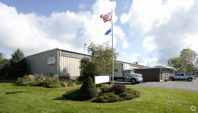
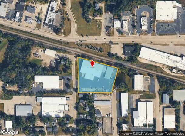
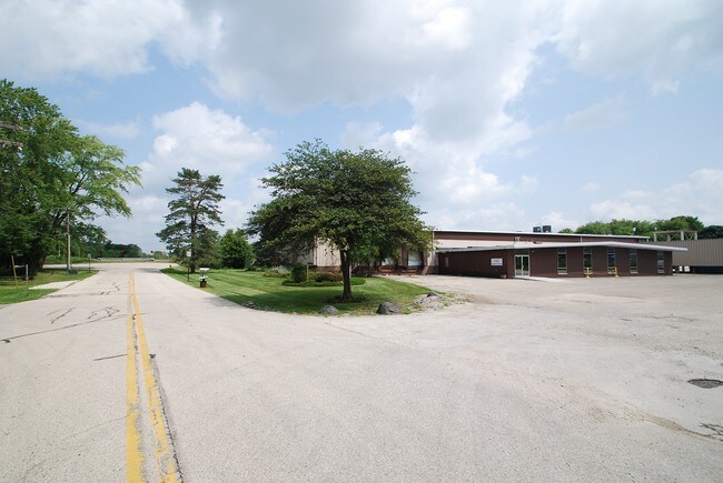
Property Record
425 S Lapham St, Oconomowoc, WI 53066
NEARBY LISTINGS FOR SALE OR LEASE
Property Detail
425 S Lapham St
Milwaukee-Waukesha-West Allis, WI
Lymans Subdivision
OCOC-0589-101-002
LOT 1 CSM #9646 VOL 88/344 REC IN DOC #3082687 REDIV LOTS 1 & 3 LYMANS SUBDIVISION SUMMIT PT NE1/4 SEC 4 T7N R17E
Commercialnec
Waukesha
X
Wisconsin
55133C0151G
1,3
2024
2.29 AC
2024
NE/Delafield
204302
Milwaukee/Madison
DEMOGRAPHICS near 425 S Lapham St
1 Mile
3 Mile
5 Mile
2024 Total Population
7,416
28,539
41,089
2029 Population
7,799
29,855
42,639
Pop Growth 2024-2029
+ 5.16%
+ 4.61%
+ 3.77%
Average Age
43
43
43
2024 Total Households
3,310
11,771
16,583
HH Growth 2024-2029
+ 5.14%
+ 4.65%
+ 3.83%
Median Household Inc
$82,218
$101,599
$103,950
Avg Household Size
2.20
2.40
2.40
2024 Avg HH Vehicles
2.00
2.00
2.00
Median Home Value
$279,039
$362,424
$383,244
Median Year Built
1975
1987
1985
Nearby Places
Map Layers
Map Styles
 Street
 Aerial
- Restaurants
- Banks
- Shops
- Fitness
- Groceries
PUBLIC TRANSPORTATION
AIRPORT
General Mitchell International
DRIVE
WALK
Distance
General Mitchell International
53 min
38.3 mi
Freight Ports
Port Milwaukee
DRIVE
WALK
Distance
Port Milwaukee
46 min
34.8 mi
SALE & LEASE HISTORY
LISTING DATE
SALE/LEASE

Jul 30, 2018
For Sale
Nearby Properties
Address
Land Use
TOTAL SIZE
Lot Size
Zoning
Address
Land Use
TOTAL SIZE
Lot Size
Zoning
52.93 AC
Address
Land Use
TOTAL SIZE
Lot Size
Zoning
25.09 AC
Address
Land Use
TOTAL SIZE
Lot Size
Zoning
85.90 AC
Address
Land Use
TOTAL SIZE
Lot Size
Zoning
Address
Land Use
TOTAL SIZE
Lot Size
Zoning
12.32 AC
Address
Land Use
TOTAL SIZE
Lot Size
Zoning
Address
Land Use
TOTAL SIZE
Lot Size
Zoning
Address
Land Use
TOTAL SIZE
Lot Size
Zoning
11.16 AC
Address
Land Use
TOTAL SIZE
Lot Size
Zoning
12.01 AC
Address
Land Use
TOTAL SIZE
Lot Size
Zoning
Address
Land Use
TOTAL SIZE
Lot Size
Zoning
Address
Land Use
TOTAL SIZE
Lot Size
Zoning
Address
Land Use
TOTAL SIZE
Lot Size
Zoning
Address
Land Use
TOTAL SIZE
Lot Size
Zoning
Address
Land Use
TOTAL SIZE
Lot Size
Zoning
8.92 AC
Address
Land Use
TOTAL SIZE
Lot Size
Zoning
22.10 AC
Address
Land Use
TOTAL SIZE
Lot Size
Zoning
Address
Land Use
TOTAL SIZE
Lot Size
Zoning
Address
Land Use
TOTAL SIZE
Lot Size
Zoning
Address
Land Use
TOTAL SIZE
Lot Size
Zoning
Address
Land Use
TOTAL SIZE
Lot Size
Zoning
Address
Land Use
TOTAL SIZE
Lot Size
Zoning
17.86 AC
Address
Land Use
TOTAL SIZE
Lot Size
Zoning
Address
Land Use
TOTAL SIZE
Lot Size
Zoning
Address
Land Use
TOTAL SIZE
Lot Size
Zoning
Address
Land Use
TOTAL SIZE
Lot Size
Zoning
3.52 AC
Address
Land Use
TOTAL SIZE
Lot Size
Zoning
Address
Land Use
TOTAL SIZE
Lot Size
Zoning
Address
Land Use
TOTAL SIZE
Lot Size
Zoning
Address
Land Use
TOTAL SIZE
Lot Size
Zoning
The World's #1 Commercial Real Estate Marketplace
Connect with us
© 2025 CoStar Group
The information above has been obtained from sources believed reliable. While we do not doubt its accuracy we have not verified it and make no guarantee, warranty or representation about it. It is your responsibility to independently confirm its accuracy and completeness. Any projections, opinions, assumptions, or estimates used are for example only and do not represent the current or future performance of the property. The value of this transaction to you depends on tax and other factors which should be evaluated by your tax, financial, and legal advisors. You and your advisors should conduct a careful, independent investigation of the property to determine to your satisfaction the suitability of the property for your needs.