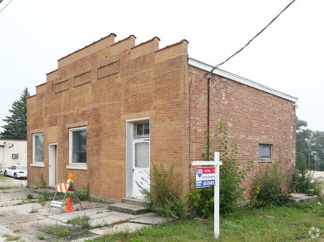
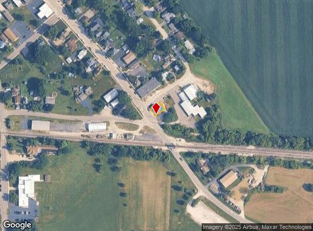
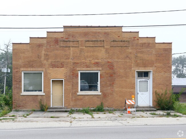
Property Record
425 S Main St, Burlington, IL 60109
NEARBY LISTINGS FOR SALE OR LEASE
-
-
View all Burlington listings for sale on LoopNet.com
Property Detail
425 S Main St
04-10-107-013
Commercial
Commercialnec
Kane
X
Illinois
17089C0125H
0.70 AC
2024
Western East/West Corr
2024
Chicago
850703
Chicago-Naperville-Elgin, IL-IN
840 SF
DEMOGRAPHICS near 425 S Main St
1 mile
3 mile
5 mile
2024 Total Population
1,067
3,272
9,043
2029 Population
1,031
3,216
8,949
Pop Growth 2024-2029
(3.37%)
(1.71%)
(1.04%)
Average Age
44
41
40
2024 Total Households
411
1,189
3,284
HH Growth 2024-2029
(3.65%)
(1.85%)
(1.19%)
Median Household Inc
$106,919
$106,741
$102,047
Avg Household Size
2.60
2.70
2.70
2024 Avg HH Vehicles
3.00
3.00
2.00
Median Home Value
$372,844
$346,285
$327,769
Median Year Built
1976
1986
1991
Nearby Places
Map Layers
Map Styles
 Street
 Aerial
Transit
 Traffic
 Biking
Places
Listings with unknown addresses are not visible on the map
- Restaurants
- Banks
- Shops
- Fitness
- Groceries
PUBLIC TRANSPORTATION
AIRPORT
Chicago/Rockford International
Drive
Walk
Distance
Chicago/Rockford International
61 min
38.5 mi
Chicago O'Hare International
Drive
Walk
Distance
Chicago O'Hare International
57 min
43.7 mi
Nearby Properties
Address
Land Use
TOTAL SIZE
Lot Size
Zoning
Address
Land Use
TOTAL SIZE
Lot Size
Zoning
Address
Land Use
TOTAL SIZE
Lot Size
Zoning
Address
Land Use
TOTAL SIZE
Lot Size
Zoning
55,292 SF
3.58 AC
Address
Land Use
TOTAL SIZE
Lot Size
Zoning
12,883 SF
0.87 AC
Address
Land Use
TOTAL SIZE
Lot Size
Zoning
15,377 SF
61.10 AC
Address
Land Use
TOTAL SIZE
Lot Size
Zoning
9,824 SF
16.98 AC
Address
Land Use
TOTAL SIZE
Lot Size
Zoning
3.81 AC
Address
Land Use
TOTAL SIZE
Lot Size
Zoning
1.16 AC
Address
Land Use
TOTAL SIZE
Lot Size
Zoning
4,057 SF
28.31 AC
Address
Land Use
TOTAL SIZE
Lot Size
Zoning
3,715 SF
81.78 AC
Address
Land Use
TOTAL SIZE
Lot Size
Zoning
1.79 AC
Address
Land Use
TOTAL SIZE
Lot Size
Zoning
27.01 AC
Address
Land Use
TOTAL SIZE
Lot Size
Zoning
2,098 SF
100 AC
F DISTRICT
Address
Land Use
TOTAL SIZE
Lot Size
Zoning
3,631 SF
16.22 AC
F DISTRICT
Address
Land Use
TOTAL SIZE
Lot Size
Zoning
3,151 SF
2.52 AC
B3 DISTRIC
Address
Land Use
TOTAL SIZE
Lot Size
Zoning
4,050 SF
25.90 AC
Address
Land Use
TOTAL SIZE
Lot Size
Zoning
3,042 SF
8.12 AC
Address
Land Use
TOTAL SIZE
Lot Size
Zoning
Address
Land Use
TOTAL SIZE
Lot Size
Zoning
3,339 SF
0.95 AC
B2 DISTRIC
Address
Land Use
TOTAL SIZE
Lot Size
Zoning
Address
Land Use
TOTAL SIZE
Lot Size
Zoning
9,356 SF
15 AC
Address
Land Use
TOTAL SIZE
Lot Size
Zoning
6,658 SF
1.48 AC
B2 DISTRIC
Address
Land Use
TOTAL SIZE
Lot Size
Zoning
6,224 SF
6.94 AC
Address
Land Use
TOTAL SIZE
Lot Size
Zoning
11,145 SF
11.86 AC
Address
Land Use
TOTAL SIZE
Lot Size
Zoning
Address
Land Use
TOTAL SIZE
Lot Size
Zoning
7,053 SF
26.39 AC
Address
Land Use
TOTAL SIZE
Lot Size
Zoning
4,362 SF
18.88 AC
Address
Land Use
TOTAL SIZE
Lot Size
Zoning
9,399 SF
0.78 AC
The World's #1 Commercial Real Estate Marketplace
Connect with us
© 2026 CoStar Group
The information above has been obtained from sources believed reliable. While we do not doubt its accuracy we have not verified it and make no guarantee, warranty or representation about it. It is your responsibility to independently confirm its accuracy and completeness. Any projections, opinions, assumptions, or estimates used are for example only and do not represent the current or future performance of the property. The value of this transaction to you depends on tax and other factors which should be evaluated by your tax, financial, and legal advisors. You and your advisors should conduct a careful, independent investigation of the property to determine to your satisfaction the suitability of the property for your needs.