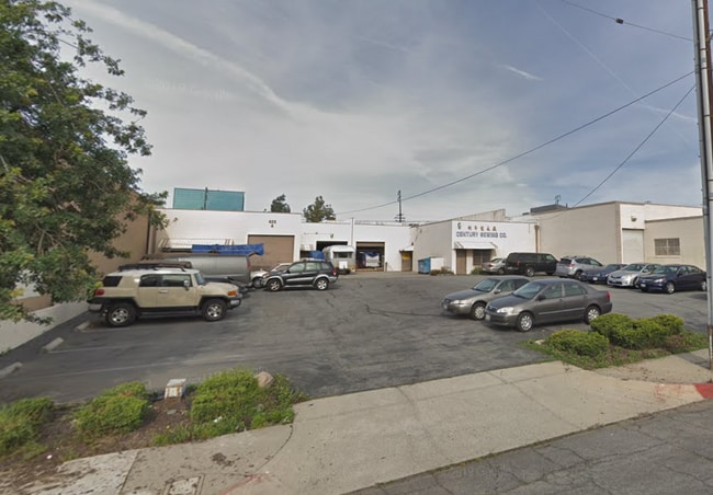
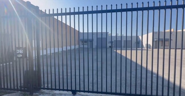
Property Record
425 S Raymond Ave, Alhambra, CA 91803

NEARBY LISTINGS FOR SALE OR LEASE
Property Detail
425 S Raymond Ave
Los Angeles-Long Beach-Glendale, CA
Subdivision #1 Of Dolgeville
5342-020-033
*TR=SUB NO 1 OF DOLGEVILLE LOT 7 BLK 4
Lightindustrial
Los Angeles
X
California
06037C1635F
7
2024
0.23 AC
2025
Lower San Gabriel Valley
480802
Los Angeles
4,870 SF
DEMOGRAPHICS near 425 S Raymond Ave
1 Mile
3 Mile
5 Mile
2024 Total Population
33,857
251,987
695,481
2029 Population
32,857
243,980
670,305
Pop Growth 2024-2029
(2.95%)
(3.18%)
(3.62%)
Average Age
42
42
41
2024 Total Households
12,011
87,075
233,107
HH Growth 2024-2029
(3.18%)
(3.40%)
(3.77%)
Median Household Inc
$71,686
$81,196
$76,459
Avg Household Size
2.70
2.80
2.90
2024 Avg HH Vehicles
2.00
2.00
2.00
Median Home Value
$752,385
$818,923
$810,325
Median Year Built
1960
1958
1957
Nearby Places
Map Layers
Map Styles
 Street
 Aerial
- Restaurants
- Banks
- Shops
- Fitness
- Groceries
PUBLIC TRANSPORTATION
COMMUTER RAIL
Union Station (91 Line - Southern California Regional Rail Authority (Metrolink), Antelope Valley Line - Southern California Regional Rail Authority (Metrolink), Orange County Line - Southern California Regional Rail Authority (Metrolink), Riverside Line - Southern California Regional Rail Authority (Metrolink), San Bernardino Line - Southern California Regional Rail Authority (Metrolink), Ventura County Line - Southern California Regional Rail Authority (Metrolink))
DRIVE
WALK
Distance
Union Station (91 Line - Southern California Regional Rail Authority (Metrolink), Antelope Valley Line - Southern California Regional Rail Authority (Metrolink), Orange County Line - Southern California Regional Rail Authority (Metrolink), Riverside Line - Southern California Regional Rail Authority (Metrolink), San Bernardino Line - Southern California Regional Rail Authority (Metrolink), Ventura County Line - Southern California Regional Rail Authority (Metrolink))
13 min
7.2 mi
AIRPORT
Bob Hope
DRIVE
WALK
Distance
Bob Hope
30 min
21.7 mi
Long Beach (Daugherty Field)
DRIVE
WALK
Distance
Long Beach (Daugherty Field)
32 min
21.9 mi
Los Angeles International
DRIVE
WALK
Distance
Los Angeles International
36 min
23.1 mi
Freight Ports
Port of Long Beach
DRIVE
WALK
Distance
Port of Long Beach
34 min
24.7 mi
SALE & LEASE HISTORY
LISTING DATE
SALE/LEASE

Jun 18, 2020
For Sale
Jan 16, 2024
For Lease
Nearby Properties
Address
Land Use
TOTAL SIZE
Lot Size
Zoning
Address
Land Use
TOTAL SIZE
Lot Size
Zoning
534,225 SF
Address
Land Use
TOTAL SIZE
Lot Size
Zoning
460,590 SF
23.95 AC
ALMPD*
Address
Land Use
TOTAL SIZE
Lot Size
Zoning
11,590 SF
14.43 AC
PSC*
Address
Land Use
TOTAL SIZE
Lot Size
Zoning
516,474 SF
4.37 AC
ALCBD/DRD*
Address
Land Use
TOTAL SIZE
Lot Size
Zoning
247,960 SF
1.99 AC
SLC3
Address
Land Use
TOTAL SIZE
Lot Size
Zoning
593,133 SF
SLR1YY
Address
Land Use
TOTAL SIZE
Lot Size
Zoning
151,450 SF
6.59 AC
MPSP*
Address
Land Use
TOTAL SIZE
Lot Size
Zoning
220,717 SF
2.14 AC
MPSP*
Address
Land Use
TOTAL SIZE
Lot Size
Zoning
220,142 SF
9.92 AC
SLR1VV
Address
Land Use
TOTAL SIZE
Lot Size
Zoning
198,728 SF
2.50 AC
SLR3YY
Address
Land Use
TOTAL SIZE
Lot Size
Zoning
116,480 SF
11.81 AC
MPC2
Address
Land Use
TOTAL SIZE
Lot Size
Zoning
320,844 SF
6.45 AC
SLCHR*
Address
Land Use
TOTAL SIZE
Lot Size
Zoning
77,778 SF
2.87 AC
ALRPD*
Address
Land Use
TOTAL SIZE
Lot Size
Zoning
87,236 SF
2.62 AC
SPP*
Address
Land Use
TOTAL SIZE
Lot Size
Zoning
85,890 SF
2.33 AC
MPR2SCH*
Address
Land Use
TOTAL SIZE
Lot Size
Zoning
131,209 SF
1.51 AC
PSC-
Address
Land Use
TOTAL SIZE
Lot Size
Zoning
130,189 SF
6.59 AC
MPOPCD*
Address
Land Use
TOTAL SIZE
Lot Size
Zoning
146,264 SF
1.87 AC
LAMR1
Address
Land Use
TOTAL SIZE
Lot Size
Zoning
288,700 SF
6.19 AC
MPOP*
Address
Land Use
TOTAL SIZE
Lot Size
Zoning
155,339 SF
3.99 AC
LAMR1
Address
Land Use
TOTAL SIZE
Lot Size
Zoning
203,860 SF
1.92 AC
MPSP*
Address
Land Use
TOTAL SIZE
Lot Size
Zoning
48,018 SF
2.64 AC
SLC3*
Address
Land Use
TOTAL SIZE
Lot Size
Zoning
119,883 SF
5.93 AC
MPOP*
Address
Land Use
TOTAL SIZE
Lot Size
Zoning
54,368 SF
1.20 AC
SLR3YY
Address
Land Use
TOTAL SIZE
Lot Size
Zoning
82,188 SF
1.20 AC
ALCBD/DRD*
Address
Land Use
TOTAL SIZE
Lot Size
Zoning
121,733 SF
5.59 AC
ALMPD*
Address
Land Use
TOTAL SIZE
Lot Size
Zoning
41,761 SF
3.25 AC
ALCPD-R1*
Address
Land Use
TOTAL SIZE
Lot Size
Zoning
45,327 SF
9.50 AC
PSP*
Address
Land Use
TOTAL SIZE
Lot Size
Zoning
60,919 SF
1.47 AC
SLR3YY
Address
Land Use
TOTAL SIZE
Lot Size
Zoning
170,198 SF
3.84 AC
MPOP
The World's #1 Commercial Real Estate Marketplace
Connect with us
© 2025 CoStar Group
The information above has been obtained from sources believed reliable. While we do not doubt its accuracy we have not verified it and make no guarantee, warranty or representation about it. It is your responsibility to independently confirm its accuracy and completeness. Any projections, opinions, assumptions, or estimates used are for example only and do not represent the current or future performance of the property. The value of this transaction to you depends on tax and other factors which should be evaluated by your tax, financial, and legal advisors. You and your advisors should conduct a careful, independent investigation of the property to determine to your satisfaction the suitability of the property for your needs.