Property Record
425 Seminole St, Essington, PA 19029


NEARBY LISTINGS FOR SALE OR LEASE
Property Detail
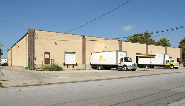
425 Seminole St
45-00-01813-03
1 STY CB WAREHSE 1.663 ACRES
Warehouse
Delaware
AE
Pennsylvania
34015C0057F
1.66 AC
2024
Delaware County
2025
Philadelphia
403701
Philadelphia-Camden-Wilmington, PA-NJ-DE-MD
21,472 SF
DEMOGRAPHICS near 425 Seminole St
1 Mile
3 Mile
5 Mile
2024 Total Population
2,716
67,052
246,002
2029 Population
2,703
66,501
243,549
Pop Growth 2024-2029
(0.48%)
(0.82%)
(1.00%)
Average Age
43
40
39
2024 Total Households
1,145
26,663
93,138
HH Growth 2024-2029
(0.52%)
(0.85%)
(1.05%)
Median Household Inc
$57,154
$66,446
$61,881
Avg Household Size
2.30
2.50
2.50
2024 Avg HH Vehicles
2.00
2.00
1.00
Median Home Value
$169,230
$180,169
$183,923
Median Year Built
1955
1954
1953
Nearby Places
Map Layers
Map Styles
 Street
 Aerial
- Restaurants
- Banks
- Shops
- Fitness
- Groceries
PUBLIC TRANSPORTATION
COMMUTER RAIL
Airport Terminal B (R1 - Southeastern Pennsylvania Transportation Authority Regional Rail (SEPTA Regional Rail))
DRIVE
WALK
Distance
Airport Terminal B (R1 - Southeastern Pennsylvania Transportation Authority Regional Rail (SEPTA Regional Rail))
6 min
2.4 mi
Airport Terminal C and D (R1 - Southeastern Pennsylvania Transportation Authority Regional Rail (SEPTA Regional Rail))
DRIVE
WALK
Distance
Airport Terminal C and D (R1 - Southeastern Pennsylvania Transportation Authority Regional Rail (SEPTA Regional Rail))
10 min
2.6 mi
AIRPORT
Philadelphia International
DRIVE
WALK
Distance
Philadelphia International
7 min
2.6 mi
Trenton Mercer
DRIVE
WALK
Distance
Trenton Mercer
68 min
44.6 mi
Freight Ports
Broadway Terminal - Pier 5
DRIVE
WALK
Distance
Broadway Terminal - Pier 5
25 min
12.6 mi
Nearby Properties
Address
Land Use
TOTAL SIZE
Lot Size
Zoning
Address
Land Use
TOTAL SIZE
Lot Size
Zoning
653.90 AC
Address
Land Use
TOTAL SIZE
Lot Size
Zoning
678,227 SF
850.40 AC
SPAIR
Address
Land Use
TOTAL SIZE
Lot Size
Zoning
762,100 SF
Address
Land Use
TOTAL SIZE
Lot Size
Zoning
488,254 SF
31.56 AC
I2
Address
Land Use
TOTAL SIZE
Lot Size
Zoning
995,943 SF
212.65 AC
Address
Land Use
TOTAL SIZE
Lot Size
Zoning
89,456 SF
27.06 AC
Address
Land Use
TOTAL SIZE
Lot Size
Zoning
97,810 SF
40 AC
I3
Address
Land Use
TOTAL SIZE
Lot Size
Zoning
175,978 SF
15.95 AC
Address
Land Use
TOTAL SIZE
Lot Size
Zoning
161,141 SF
170.40 AC
Address
Land Use
TOTAL SIZE
Lot Size
Zoning
164,182 SF
Address
Land Use
TOTAL SIZE
Lot Size
Zoning
323,248 SF
2.90 AC
SPAIR
Address
Land Use
TOTAL SIZE
Lot Size
Zoning
111.06 AC
MIBP
Address
Land Use
TOTAL SIZE
Lot Size
Zoning
47.40 AC
C2
Address
Land Use
TOTAL SIZE
Lot Size
Zoning
112,896 SF
95 AC
Address
Land Use
TOTAL SIZE
Lot Size
Zoning
975.62 AC
Address
Land Use
TOTAL SIZE
Lot Size
Zoning
226,764 SF
5.72 AC
CMX3
Address
Land Use
TOTAL SIZE
Lot Size
Zoning
800,029 SF
112.10 AC
Address
Land Use
TOTAL SIZE
Lot Size
Zoning
63.53 AC
CMX3
Address
Land Use
TOTAL SIZE
Lot Size
Zoning
156,079 SF
13.44 AC
Address
Land Use
TOTAL SIZE
Lot Size
Zoning
241,578 SF
14 AC
Address
Land Use
TOTAL SIZE
Lot Size
Zoning
96,500 SF
6.11 AC
CMX3
Address
Land Use
TOTAL SIZE
Lot Size
Zoning
73.82 AC
M
Address
Land Use
TOTAL SIZE
Lot Size
Zoning
64,995 SF
132 AC
Address
Land Use
TOTAL SIZE
Lot Size
Zoning
16,990 SF
221.09 AC
SPPOA
Address
Land Use
TOTAL SIZE
Lot Size
Zoning
34.58 AC
Address
Land Use
TOTAL SIZE
Lot Size
Zoning
86.10 AC
Address
Land Use
TOTAL SIZE
Lot Size
Zoning
192,000 SF
6.40 AC
CMX3
Address
Land Use
TOTAL SIZE
Lot Size
Zoning
246,303 SF
11 AC
RM2
Address
Land Use
TOTAL SIZE
Lot Size
Zoning
307,425 SF
18.88 AC
I3
Address
Land Use
TOTAL SIZE
Lot Size
Zoning
160,959 SF
7.97 AC
RM2
The World's #1 Commercial Real Estate Marketplace
Connect with us
© 2026 CoStar Group
The information above has been obtained from sources believed reliable. While we do not doubt its accuracy we have not verified it and make no guarantee, warranty or representation about it. It is your responsibility to independently confirm its accuracy and completeness. Any projections, opinions, assumptions, or estimates used are for example only and do not represent the current or future performance of the property. The value of this transaction to you depends on tax and other factors which should be evaluated by your tax, financial, and legal advisors. You and your advisors should conduct a careful, independent investigation of the property to determine to your satisfaction the suitability of the property for your needs.