Property Record
425 Yopp Rd, Jacksonville, NC 28540


Property Detail
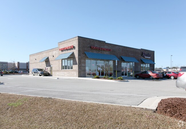
425 Yopp Rd
073374
L21 YOPP RD RELOC
Commercialnec
ONSLOW
CC
North Carolina
AE The base floodplain where base flood elevations are provided. AE Zones are now used on new format FIRMs instead of A1-A30 Zones.
21
2025
15.78 AC
2025
North Carolina Southeast Area
001102
Other Market Areas
140,403 SF
Jacksonville, NC
NEARBY LISTINGS FOR SALE OR LEASE
DEMOGRAPHICS near 425 Yopp Rd
1 mile
3 mile
5 mile
2025 Total Population
2,703
27,285
63,397
2030 Population
2,934
28,532
66,055
Pop Growth 2025-2030
+ 8.55%
+ 4.57%
+ 4.19%
Average Age
35
33
33
2025 Total Households
1,196
8,635
22,532
HH Growth 2025-2030
+ 8.86%
+ 5.74%
+ 4.69%
Median Household Inc
$50,652
$58,331
$60,456
Avg Household Size
2.20
2.40
2.50
2025 Avg HH Vehicles
2.00
2.00
2.00
Median Home Value
$177,212
$222,968
$218,745
Median Year Built
1982
1977
1988
Nearby Places
Map Layers
Map Styles
 Street
 Aerial
Transit
 Traffic
 Biking
Places
Listings with unknown addresses are not visible on the map
- Restaurants
- Banks
- Shops
- Fitness
- Groceries
PUBLIC TRANSPORTATION
AIRPORT
Albert J Ellis
Drive
Walk
Distance
Albert J Ellis
26 min
12.7 mi
Freight Ports
Port of Morehead City
Drive
Walk
Distance
Port of Morehead City
73 min
46.2 mi
Nearby Properties
Address
Land Use
TOTAL SIZE
Lot Size
Zoning
Address
Land Use
TOTAL SIZE
Lot Size
Zoning
189,717 SF
1.93 AC
DTB
Address
Land Use
TOTAL SIZE
Lot Size
Zoning
38,147 SF
3.14 AC
DTB
Address
Land Use
TOTAL SIZE
Lot Size
Zoning
94,547 SF
6.37 AC
DTB
Address
Land Use
TOTAL SIZE
Lot Size
Zoning
211,186 SF
22.08 AC
CC
Address
Land Use
TOTAL SIZE
Lot Size
Zoning
93,849 SF
60 AC
HB
Address
Land Use
TOTAL SIZE
Lot Size
Zoning
88,907 SF
13.48 AC
O-I
Address
Land Use
TOTAL SIZE
Lot Size
Zoning
94,263 SF
5.88 AC
DTB
Address
Land Use
TOTAL SIZE
Lot Size
Zoning
464 SF
458.49 AC
H-IN
Address
Land Use
TOTAL SIZE
Lot Size
Zoning
79,581 SF
35 AC
O+I
Address
Land Use
TOTAL SIZE
Lot Size
Zoning
2,480 SF
11.59 AC
RMF-HD
Address
Land Use
TOTAL SIZE
Lot Size
Zoning
65,800 SF
28.82 AC
IND-H
Address
Land Use
TOTAL SIZE
Lot Size
Zoning
11,064 SF
17.85 AC
RMF-HD
Address
Land Use
TOTAL SIZE
Lot Size
Zoning
58,570 SF
8.95 AC
DTB
Address
Land Use
TOTAL SIZE
Lot Size
Zoning
36,567 SF
25.60 AC
HB
Address
Land Use
TOTAL SIZE
Lot Size
Zoning
7,550 SF
18.40 AC
RSF-7
Address
Land Use
TOTAL SIZE
Lot Size
Zoning
18,480 SF
93 AC
IND
Address
Land Use
TOTAL SIZE
Lot Size
Zoning
39,552 SF
20.17 AC
RSF-7
Address
Land Use
TOTAL SIZE
Lot Size
Zoning
17,939 SF
5.80 AC
DTB
Address
Land Use
TOTAL SIZE
Lot Size
Zoning
62,733 SF
12.80 AC
RMF-HD
Address
Land Use
TOTAL SIZE
Lot Size
Zoning
22,128 SF
12.38 AC
OI
Address
Land Use
TOTAL SIZE
Lot Size
Zoning
67,945 SF
2.35 AC
DTB
Address
Land Use
TOTAL SIZE
Lot Size
Zoning
29,117 SF
25.52 AC
CC
Address
Land Use
TOTAL SIZE
Lot Size
Zoning
29,476 SF
4.95 AC
CC
Address
Land Use
TOTAL SIZE
Lot Size
Zoning
46,116 SF
1.20 AC
DTB
Address
Land Use
TOTAL SIZE
Lot Size
Zoning
39,443 SF
14.02 AC
RSF-7
Address
Land Use
TOTAL SIZE
Lot Size
Zoning
37,601 SF
7.60 AC
DTB
Address
Land Use
TOTAL SIZE
Lot Size
Zoning
4,788 SF
21.71 AC
OI
Address
Land Use
TOTAL SIZE
Lot Size
Zoning
10,001 SF
5.86 AC
CC
Address
Land Use
TOTAL SIZE
Lot Size
Zoning
17,356 SF
2.26 AC
RMF-LD
The World's #1 Commercial Real Estate Marketplace
Connect with us
© 2026 CoStar Group
The information above has been obtained from sources believed reliable. While we do not doubt its accuracy we have not verified it and make no guarantee, warranty or representation about it. It is your responsibility to independently confirm its accuracy and completeness. Any projections, opinions, assumptions, or estimates used are for example only and do not represent the current or future performance of the property. The value of this transaction to you depends on tax and other factors which should be evaluated by your tax, financial, and legal advisors. You and your advisors should conduct a careful, independent investigation of the property to determine to your satisfaction the suitability of the property for your needs.