Property Record
4250 Cerrillos Rd, Santa Fe, NM 87507

NEARBY LISTINGS FOR SALE OR LEASE
Property Detail
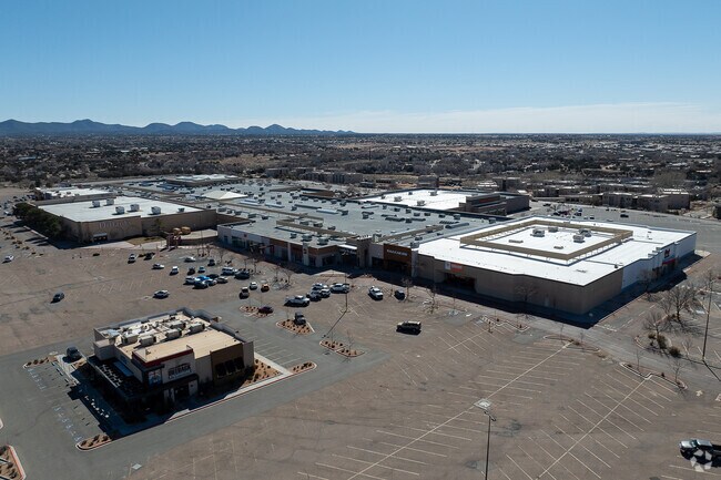
4250 Cerrillos Rd
Santa Fe, NM
Villa Linda Mall S/D
018310958
T16N R9E S8, VILLA LINDA MALLS/D, LOT 1-A5, 3.145 AC~
Commercialnec
Santa Fe
X
New Mexico
35049C0394D
1
2025
16.75 AC
2025
Southwest Santa Fe
010318
Other Market Areas
DEMOGRAPHICS near 4250 Cerrillos Rd
1 Mile
3 Mile
5 Mile
2024 Total Population
10,782
58,594
89,205
2029 Population
11,068
59,964
91,170
Pop Growth 2024-2029
+ 2.65%
+ 2.34%
+ 2.20%
Average Age
39
41
44
2024 Total Households
4,311
23,071
38,348
HH Growth 2024-2029
+ 2.85%
+ 2.22%
+ 2.16%
Median Household Inc
$53,704
$61,272
$64,922
Avg Household Size
2.40
2.40
2.20
2024 Avg HH Vehicles
2.00
2.00
2.00
Median Home Value
$266,141
$281,833
$332,930
Median Year Built
1999
1993
1990
Nearby Places
Map Layers
Map Styles
 Street
 Aerial
- Restaurants
- Banks
- Shops
- Fitness
- Groceries
PUBLIC TRANSPORTATION
COMMUTER RAIL
Zia Road Rail Runner Station (NMRX - Rio Metro Regional Transit District)
DRIVE
WALK
Distance
Zia Road Rail Runner Station (NMRX - Rio Metro Regional Transit District)
10 min
3.8 mi
Zia Road (Rail Runner Express - New Mexico Rail Runner Express)
DRIVE
WALK
Distance
Zia Road (Rail Runner Express - New Mexico Rail Runner Express)
10 min
3.8 mi
AIRPORT
Santa Fe Regional
DRIVE
WALK
Distance
Santa Fe Regional
11 min
5.1 mi
Freight Ports
Tulsa Port Of Catoosa
DRIVE
WALK
Distance
Tulsa Port Of Catoosa
693 min
656.4 mi
Nearby Properties
Address
Land Use
TOTAL SIZE
Lot Size
Zoning
Address
Land Use
TOTAL SIZE
Lot Size
Zoning
166.80 AC
Address
Land Use
TOTAL SIZE
Lot Size
Zoning
38.57 AC
Address
Land Use
TOTAL SIZE
Lot Size
Zoning
130.13 AC
Address
Land Use
TOTAL SIZE
Lot Size
Zoning
40.65 AC
Address
Land Use
TOTAL SIZE
Lot Size
Zoning
12.88 AC
Address
Land Use
TOTAL SIZE
Lot Size
Zoning
11.84 AC
Address
Land Use
TOTAL SIZE
Lot Size
Zoning
11.40 AC
Address
Land Use
TOTAL SIZE
Lot Size
Zoning
7.30 AC
Address
Land Use
TOTAL SIZE
Lot Size
Zoning
Address
Land Use
TOTAL SIZE
Lot Size
Zoning
8.02 AC
Address
Land Use
TOTAL SIZE
Lot Size
Zoning
5.59 AC
Address
Land Use
TOTAL SIZE
Lot Size
Zoning
Address
Land Use
TOTAL SIZE
Lot Size
Zoning
11.98 AC
Address
Land Use
TOTAL SIZE
Lot Size
Zoning
17.04 AC
Address
Land Use
TOTAL SIZE
Lot Size
Zoning
Address
Land Use
TOTAL SIZE
Lot Size
Zoning
14.64 AC
Address
Land Use
TOTAL SIZE
Lot Size
Zoning
13.79 AC
Address
Land Use
TOTAL SIZE
Lot Size
Zoning
14.18 AC
Address
Land Use
TOTAL SIZE
Lot Size
Zoning
17.81 AC
Address
Land Use
TOTAL SIZE
Lot Size
Zoning
25.42 AC
Address
Land Use
TOTAL SIZE
Lot Size
Zoning
15.78 AC
Address
Land Use
TOTAL SIZE
Lot Size
Zoning
6.01 AC
Address
Land Use
TOTAL SIZE
Lot Size
Zoning
2,544 SF
6.09 AC
Address
Land Use
TOTAL SIZE
Lot Size
Zoning
4.58 AC
Address
Land Use
TOTAL SIZE
Lot Size
Zoning
11.51 AC
Address
Land Use
TOTAL SIZE
Lot Size
Zoning
Address
Land Use
TOTAL SIZE
Lot Size
Zoning
6.18 AC
Address
Land Use
TOTAL SIZE
Lot Size
Zoning
2,040 SF
18 AC
Address
Land Use
TOTAL SIZE
Lot Size
Zoning
13.01 AC
Address
Land Use
TOTAL SIZE
Lot Size
Zoning
445 SF
5.40 AC
The World's #1 Commercial Real Estate Marketplace
Connect with us
© 2026 CoStar Group
The information above has been obtained from sources believed reliable. While we do not doubt its accuracy we have not verified it and make no guarantee, warranty or representation about it. It is your responsibility to independently confirm its accuracy and completeness. Any projections, opinions, assumptions, or estimates used are for example only and do not represent the current or future performance of the property. The value of this transaction to you depends on tax and other factors which should be evaluated by your tax, financial, and legal advisors. You and your advisors should conduct a careful, independent investigation of the property to determine to your satisfaction the suitability of the property for your needs.