Property Record
4250 E Renner Rd, Richardson, TX 75082
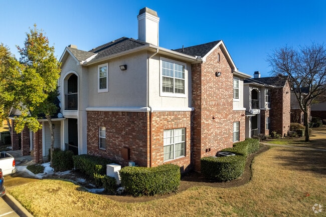


Property Detail
4250 E Renner Rd
R-3723-00A-0020-1
BRECKINRIDGE POINTE, BLK A, LOT 2
Multifamilydwelling
Collin
PD-MF2
Texas
B and X Area of moderate flood hazard, usually the area between the limits of the 100-year and 500-year floods.
2
2025
11.92 AC
2025
Plano
032017
Dallas/Ft Worth
247,952 SF
Dallas-Fort Worth-Arlington, TX
NEARBY LISTINGS FOR SALE OR LEASE
-
-
View all Richardson listings for sale on LoopNet.com
DEMOGRAPHICS near 4250 E Renner Rd
1 mile
3 mile
5 mile
2025 Total Population
13,903
92,812
268,166
2030 Population
15,612
102,774
293,134
Pop Growth 2025-2030
+ 12.29%
+ 10.73%
+ 9.31%
Average Age
37
40
39
2025 Total Households
4,652
32,357
96,104
HH Growth 2025-2030
+ 12.27%
+ 10.69%
+ 9.47%
Median Household Inc
$119,364
$117,101
$103,213
Avg Household Size
2.90
2.80
2.70
2025 Avg HH Vehicles
2.00
2.00
2.00
Median Home Value
$615,559
$476,552
$412,774
Median Year Built
2001
1998
1996
Nearby Places
Map Layers
Map Styles
 Street
 Aerial
Transit
 Traffic
 Biking
Places
Listings with unknown addresses are not visible on the map
- Restaurants
- Banks
- Shops
- Fitness
- Groceries
PUBLIC TRANSPORTATION
AIRPORT
Dallas Love Field
Drive
Walk
Distance
Dallas Love Field
33 min
23.1 mi
Dallas-Fort Worth International
Drive
Walk
Distance
Dallas-Fort Worth International
39 min
31.2 mi
Freight Ports
Port of Shreveport
Drive
Walk
Distance
Port of Shreveport
224 min
200.2 mi
Nearby Properties
Address
Land Use
TOTAL SIZE
Lot Size
Zoning
Address
Land Use
TOTAL SIZE
Lot Size
Zoning
479,209 SF
19.97 AC
Address
Land Use
TOTAL SIZE
Lot Size
Zoning
453,635 SF
19.04 AC
RT
Address
Land Use
TOTAL SIZE
Lot Size
Zoning
630,247 SF
42 AC
Z239
Address
Land Use
TOTAL SIZE
Lot Size
Zoning
766,245 SF
49.94 AC
COMM
Address
Land Use
TOTAL SIZE
Lot Size
Zoning
164,843 SF
24.94 AC
Address
Land Use
TOTAL SIZE
Lot Size
Zoning
418,520 SF
103.29 AC
Address
Land Use
TOTAL SIZE
Lot Size
Zoning
242,201 SF
14.54 AC
RT
Address
Land Use
TOTAL SIZE
Lot Size
Zoning
490,285 SF
29.66 AC
LC/PD-A
Address
Land Use
TOTAL SIZE
Lot Size
Zoning
768,061 SF
42.03 AC
Z02
Address
Land Use
TOTAL SIZE
Lot Size
Zoning
523,703 SF
67.08 AC
ED
Address
Land Use
TOTAL SIZE
Lot Size
Zoning
279,693 SF
19.86 AC
Z239
Address
Land Use
TOTAL SIZE
Lot Size
Zoning
548,300 SF
17.29 AC
Z239
Address
Land Use
TOTAL SIZE
Lot Size
Zoning
374,266 SF
19.42 AC
Z239
Address
Land Use
TOTAL SIZE
Lot Size
Zoning
360,673 SF
7.89 AC
PD-207 R
Address
Land Use
TOTAL SIZE
Lot Size
Zoning
502,554 SF
31.06 AC
MF-M
Address
Land Use
TOTAL SIZE
Lot Size
Zoning
353,347 SF
17 AC
Z02
Address
Land Use
TOTAL SIZE
Lot Size
Zoning
450,481 SF
10.73 AC
PD-207 R
Address
Land Use
TOTAL SIZE
Lot Size
Zoning
137,772 SF
11.79 AC
LC/PD-A
Address
Land Use
TOTAL SIZE
Lot Size
Zoning
829,390 SF
66.56 AC
1-M-1
Address
Land Use
TOTAL SIZE
Lot Size
Zoning
287,833 SF
9.81 AC
PD-207 R
Address
Land Use
TOTAL SIZE
Lot Size
Zoning
181,200 SF
15.11 AC
Address
Land Use
TOTAL SIZE
Lot Size
Zoning
388,059 SF
21.80 AC
Z239
Address
Land Use
TOTAL SIZE
Lot Size
Zoning
385,735 SF
13.13 AC
Address
Land Use
TOTAL SIZE
Lot Size
Zoning
310,860 SF
21.88 AC
MF-M
Address
Land Use
TOTAL SIZE
Lot Size
Zoning
365,761 SF
22.88 AC
COMM
Address
Land Use
TOTAL SIZE
Lot Size
Zoning
241,478 SF
7.86 AC
PD-207 R
Address
Land Use
TOTAL SIZE
Lot Size
Zoning
303,169 SF
19.67 AC
Z239
Address
Land Use
TOTAL SIZE
Lot Size
Zoning
276,236 SF
8.96 AC
Z239
Address
Land Use
TOTAL SIZE
Lot Size
Zoning
280,598 SF
7.36 AC
Z239
Address
Land Use
TOTAL SIZE
Lot Size
Zoning
236,820 SF
17.54 AC
The World's #1 Commercial Real Estate Marketplace
Connect with us
© 2026 CoStar Group
The information above has been obtained from sources believed reliable. While we do not doubt its accuracy we have not verified it and make no guarantee, warranty or representation about it. It is your responsibility to independently confirm its accuracy and completeness. Any projections, opinions, assumptions, or estimates used are for example only and do not represent the current or future performance of the property. The value of this transaction to you depends on tax and other factors which should be evaluated by your tax, financial, and legal advisors. You and your advisors should conduct a careful, independent investigation of the property to determine to your satisfaction the suitability of the property for your needs.