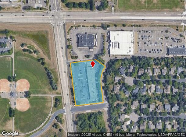
Property Record
4250 Lexington Ave S, Saint Paul, MN 55123


NEARBY LISTINGS FOR SALE OR LEASE
Property Detail
4250 Lexington Ave S
Minneapolis-St. Paul-Bloomington, MN-WI
Eagan Center 1St Addition
10-22405-01-010
EAGAN CENTER 1ST ADDITION 1 1
Commercialnec
Dakota
X
Minnesota
27053C0500F
10
2024
2.41 AC
2024
Eagan
060732
Minneapolis/St Paul
18,430 SF
DEMOGRAPHICS near 4250 Lexington Ave S
1 Mile
3 Mile
5 Mile
2024 Total Population
6,947
54,707
131,494
2029 Population
7,031
55,780
134,292
Pop Growth 2024-2029
+ 1.21%
+ 1.96%
+ 2.13%
Average Age
40
40
40
2024 Total Households
2,489
20,925
50,464
HH Growth 2024-2029
+ 1.21%
+ 2.01%
+ 2.14%
Median Household Inc
$133,689
$111,811
$104,929
Avg Household Size
2.80
2.50
2.50
2024 Avg HH Vehicles
2.00
2.00
2.00
Median Home Value
$365,211
$382,600
$363,344
Median Year Built
1985
1987
1988
Nearby Places
Map Layers
Map Styles
 Street
 Aerial
- Restaurants
- Banks
- Shops
- Fitness
- Groceries
PUBLIC TRANSPORTATION
AIRPORT
Minneapolis-St Paul International/Wold-Chamberlain
DRIVE
WALK
Distance
Minneapolis-St Paul International/Wold-Chamberlain
19 min
9.7 mi
Freight Ports
Port Milwaukee
DRIVE
WALK
Distance
Port Milwaukee
377 min
339.2 mi
SALE & LEASE HISTORY
LISTING DATE
SALE/LEASE

Sep 25, 2016
For Lease
Mar 29, 2022
For Lease
Jan 15, 2018
For Lease
Nearby Properties
Address
Land Use
TOTAL SIZE
Lot Size
Zoning
Address
Land Use
TOTAL SIZE
Lot Size
Zoning
466,503 SF
28.74 AC
Address
Land Use
TOTAL SIZE
Lot Size
Zoning
587,427 SF
87.26 AC
Address
Land Use
TOTAL SIZE
Lot Size
Zoning
Address
Land Use
TOTAL SIZE
Lot Size
Zoning
264,370 SF
36.39 AC
Address
Land Use
TOTAL SIZE
Lot Size
Zoning
383,495 SF
15.41 AC
Address
Land Use
TOTAL SIZE
Lot Size
Zoning
291,589 SF
6.77 AC
Address
Land Use
TOTAL SIZE
Lot Size
Zoning
246,636 SF
7.20 AC
Address
Land Use
TOTAL SIZE
Lot Size
Zoning
206,818 SF
2.84 AC
Address
Land Use
TOTAL SIZE
Lot Size
Zoning
314,237 SF
10.63 AC
Address
Land Use
TOTAL SIZE
Lot Size
Zoning
240,316 SF
9.57 AC
Address
Land Use
TOTAL SIZE
Lot Size
Zoning
201,481 SF
6.69 AC
Address
Land Use
TOTAL SIZE
Lot Size
Zoning
Address
Land Use
TOTAL SIZE
Lot Size
Zoning
170,292 SF
2.08 AC
Address
Land Use
TOTAL SIZE
Lot Size
Zoning
247,451 SF
9.57 AC
Address
Land Use
TOTAL SIZE
Lot Size
Zoning
110,979 SF
9.65 AC
Address
Land Use
TOTAL SIZE
Lot Size
Zoning
278,320 SF
31.12 AC
Address
Land Use
TOTAL SIZE
Lot Size
Zoning
159,341 SF
2.82 AC
Address
Land Use
TOTAL SIZE
Lot Size
Zoning
1,339,582 SF
78.22 AC
Address
Land Use
TOTAL SIZE
Lot Size
Zoning
162,372 SF
9.11 AC
Address
Land Use
TOTAL SIZE
Lot Size
Zoning
281,133 SF
23.21 AC
Address
Land Use
TOTAL SIZE
Lot Size
Zoning
97,109 SF
9.57 AC
Address
Land Use
TOTAL SIZE
Lot Size
Zoning
205,920 SF
16.68 AC
Address
Land Use
TOTAL SIZE
Lot Size
Zoning
153,197 SF
4.44 AC
Address
Land Use
TOTAL SIZE
Lot Size
Zoning
217,832 SF
15.13 AC
Address
Land Use
TOTAL SIZE
Lot Size
Zoning
131,259 SF
3.57 AC
Address
Land Use
TOTAL SIZE
Lot Size
Zoning
312,265 SF
28.42 AC
Address
Land Use
TOTAL SIZE
Lot Size
Zoning
240,439 SF
14.85 AC
Address
Land Use
TOTAL SIZE
Lot Size
Zoning
171,714 SF
7.22 AC
Address
Land Use
TOTAL SIZE
Lot Size
Zoning
200,000 SF
13.12 AC
The World's #1 Commercial Real Estate Marketplace
Connect with us
© 2026 CoStar Group
The information above has been obtained from sources believed reliable. While we do not doubt its accuracy we have not verified it and make no guarantee, warranty or representation about it. It is your responsibility to independently confirm its accuracy and completeness. Any projections, opinions, assumptions, or estimates used are for example only and do not represent the current or future performance of the property. The value of this transaction to you depends on tax and other factors which should be evaluated by your tax, financial, and legal advisors. You and your advisors should conduct a careful, independent investigation of the property to determine to your satisfaction the suitability of the property for your needs.