Property Record
4250 Massachusetts Ave Se, Washington, DC 20019

NEARBY LISTINGS FOR SALE OR LEASE
Property Detail
4250 Massachusetts Ave Se
Washington-Arlington-Alexandria, DC-VA-MD-WV
Fort Dupont Park
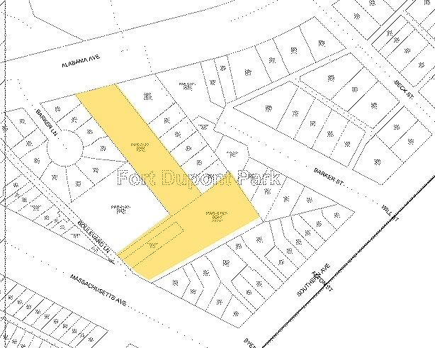
5367-0051
SQUARE 5367 LOT 0051 NBHD: FORT DUPONT PARK
Publichealthcarefacility
District of Columbia
X
District of Columbia
24033C0230E
51
0
1.71 AC
2025
Southeast
009902
Washington, DC
53,000 SF
DEMOGRAPHICS near 4250 Massachusetts Ave Se
1 Mile
3 Mile
5 Mile
2024 Total Population
20,505
218,174
528,360
2029 Population
19,165
204,929
499,342
Pop Growth 2024-2029
(6.53%)
(6.07%)
(5.49%)
Average Age
41
38
38
2024 Total Households
8,485
89,032
226,740
HH Growth 2024-2029
(7.26%)
(6.74%)
(6.09%)
Median Household Inc
$66,831
$59,083
$73,500
Avg Household Size
2.40
2.30
2.20
2024 Avg HH Vehicles
1.00
1.00
1.00
Median Home Value
$329,045
$357,528
$391,039
Median Year Built
1955
1962
1967
Nearby Places
Map Layers
Map Styles
 Street
 Aerial
- Restaurants
- Banks
- Shops
- Fitness
- Groceries
PUBLIC TRANSPORTATION
COMMUTER RAIL
L'Enfant (Fredericksburg Line - Virginia Railway Express, Manassas Line - Virginia Railway Express)
DRIVE
WALK
Distance
L'Enfant (Fredericksburg Line - Virginia Railway Express, Manassas Line - Virginia Railway Express)
11 min
5.1 mi
Union Station (Red Line - Washington Metropolitan Area Transit Authority Metrorail (Metrorail))
DRIVE
WALK
Distance
Union Station (Red Line - Washington Metropolitan Area Transit Authority Metrorail (Metrorail))
13 min
5.3 mi
AIRPORT
Ronald Reagan Washington Ntl
DRIVE
WALK
Distance
Ronald Reagan Washington Ntl
20 min
9.1 mi
Baltimore/Washington International Thurgood Marshall
DRIVE
WALK
Distance
Baltimore/Washington International Thurgood Marshall
47 min
30.3 mi
Washington Dulles International
DRIVE
WALK
Distance
Washington Dulles International
57 min
33.4 mi
Freight Ports
Port of Baltimore
DRIVE
WALK
Distance
Port of Baltimore
55 min
36.6 mi
Nearby Properties
Address
Land Use
TOTAL SIZE
Lot Size
Zoning
Address
Land Use
TOTAL SIZE
Lot Size
Zoning
21.28 AC
GOV
Address
Land Use
TOTAL SIZE
Lot Size
Zoning
169.85 AC
R-2;RA-1;U
Address
Land Use
TOTAL SIZE
Lot Size
Zoning
2,131,229 SF
144.34 AC
AG
Address
Land Use
TOTAL SIZE
Lot Size
Zoning
30,000 SF
819.17 AC
PDR-1;RA-1
Address
Land Use
TOTAL SIZE
Lot Size
Zoning
36.52 AC
HE-2;HE-3;
Address
Land Use
TOTAL SIZE
Lot Size
Zoning
236,535 SF
12.54 AC
R-2
Address
Land Use
TOTAL SIZE
Lot Size
Zoning
241,725 SF
4.71 AC
MU-7B;PDR-
Address
Land Use
TOTAL SIZE
Lot Size
Zoning
234,260 SF
1.39 AC
MU-4
Address
Land Use
TOTAL SIZE
Lot Size
Zoning
62.03 AC
UNZONED
Address
Land Use
TOTAL SIZE
Lot Size
Zoning
18,570 SF
1.78 AC
R-3
Address
Land Use
TOTAL SIZE
Lot Size
Zoning
229,238 SF
1.51 AC
MU-7B
Address
Land Use
TOTAL SIZE
Lot Size
Zoning
192,440 SF
7.67 AC
R-2;RA-1
Address
Land Use
TOTAL SIZE
Lot Size
Zoning
264,723 SF
MU-4
Address
Land Use
TOTAL SIZE
Lot Size
Zoning
107,130 SF
2.98 AC
R-2;RA-1
Address
Land Use
TOTAL SIZE
Lot Size
Zoning
419,689 SF
66.84 AC
PDR-1;PDR-
Address
Land Use
TOTAL SIZE
Lot Size
Zoning
308,000 SF
1.76 AC
HE-1;HE-2
Address
Land Use
TOTAL SIZE
Lot Size
Zoning
132,000 SF
RA-1
Address
Land Use
TOTAL SIZE
Lot Size
Zoning
262,236 SF
15.26 AC
MU-8B
Address
Land Use
TOTAL SIZE
Lot Size
Zoning
352,146 SF
6.32 AC
RA-2
Address
Land Use
TOTAL SIZE
Lot Size
Zoning
181,530 SF
4.72 AC
R-2
Address
Land Use
TOTAL SIZE
Lot Size
Zoning
62,797 SF
0.55 AC
R2
Address
Land Use
TOTAL SIZE
Lot Size
Zoning
157,680 SF
0.60 AC
MU-7B
Address
Land Use
TOTAL SIZE
Lot Size
Zoning
92,511 SF
1.48 AC
RA-1
Address
Land Use
TOTAL SIZE
Lot Size
Zoning
25.33 AC
UNZONED
Address
Land Use
TOTAL SIZE
Lot Size
Zoning
207,338 SF
3.07 AC
PDR-4
Address
Land Use
TOTAL SIZE
Lot Size
Zoning
441,127 SF
2.72 AC
RF-1
Address
Land Use
TOTAL SIZE
Lot Size
Zoning
232,095 SF
8.25 AC
RA-2
Address
Land Use
TOTAL SIZE
Lot Size
Zoning
99,540 SF
3.81 AC
HE-1;HE-2
Address
Land Use
TOTAL SIZE
Lot Size
Zoning
10.63 AC
RMF20
Address
Land Use
TOTAL SIZE
Lot Size
Zoning
123,950 SF
4.65 AC
R-2
The World's #1 Commercial Real Estate Marketplace
Connect with us
© 2026 CoStar Group
The information above has been obtained from sources believed reliable. While we do not doubt its accuracy we have not verified it and make no guarantee, warranty or representation about it. It is your responsibility to independently confirm its accuracy and completeness. Any projections, opinions, assumptions, or estimates used are for example only and do not represent the current or future performance of the property. The value of this transaction to you depends on tax and other factors which should be evaluated by your tax, financial, and legal advisors. You and your advisors should conduct a careful, independent investigation of the property to determine to your satisfaction the suitability of the property for your needs.