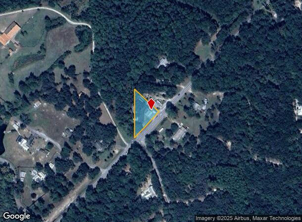
Property Record
4250 State Highway 20 W, Freeport, FL 32439
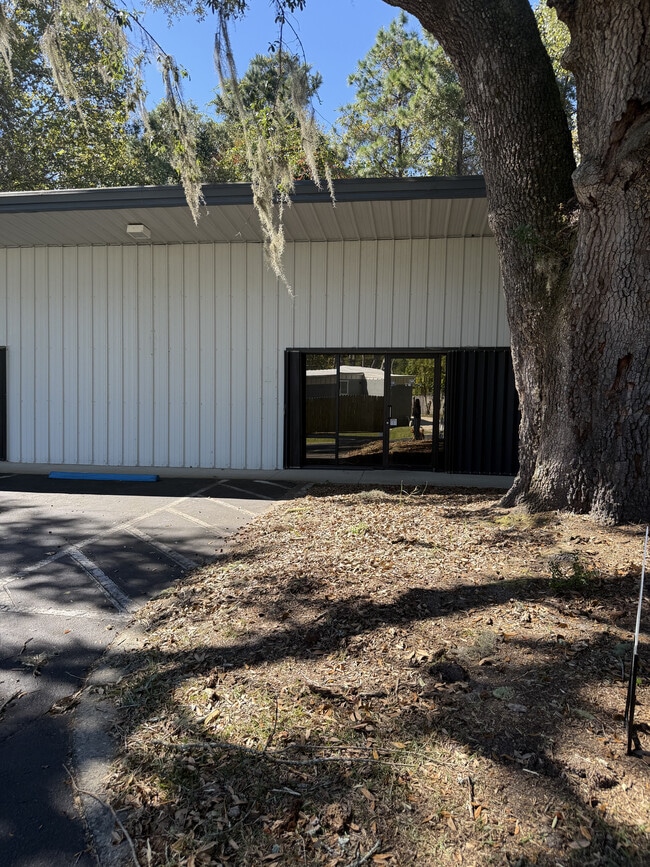
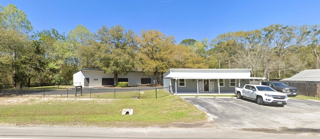
This Property Is For Sale
Current Lease Availabilities
NEARBY LISTINGS FOR SALE OR LEASE
Property Detail
4250 State Highway 20 W
12-1S-20-32000-060-0010
COM AT PT WHERE N ROW LN OF ST RD 20 CROSSES N BDRY LN OF THE S 16 AC OF NE1/4 OF SW1/4 SEC 12-1S-20W, SWLY ALG ROW LN 450 FT, N TO A PT 300FT W OF POB, E 300FT ALG N BDRY LN OF SAID 16-ACRE TRACT TO POB, EXCEPT THE FOLLOWING DESC PRCL: THAT PORTION
Storemultistory
Walton
X
Florida
12131C0415H
10
2025
0.66 AC
2025
Florida Panhandle Area
950306
Other Market Areas
6,487 SF
Crestview-Fort Walton Beach-Destin, FL
DEMOGRAPHICS near 4250 State Highway 20 W
1 Mile
3 Mile
5 Mile
2024 Total Population
368
3,750
8,302
2029 Population
427
4,522
10,101
Pop Growth 2024-2029
+ 16.03%
+ 20.59%
+ 21.67%
Average Age
42
40
39
2024 Total Households
147
1,399
3,083
HH Growth 2024-2029
+ 14.97%
+ 20.80%
+ 21.83%
Median Household Inc
$49,999
$52,241
$50,909
Avg Household Size
2.40
2.70
2.70
2024 Avg HH Vehicles
2.00
2.00
2.00
Median Home Value
$229,166
$316,518
$293,972
Median Year Built
2000
2010
2010
Nearby Places
Map Layers
Map Styles
 Street
 Aerial
- Restaurants
- Banks
- Shops
- Fitness
- Groceries
PUBLIC TRANSPORTATION
AIRPORT
Eglin AFB/Destin-Ft Walton Beach
DRIVE
WALK
Distance
Eglin AFB/Destin-Ft Walton Beach
53 min
24.5 mi
Northwest Florida Beaches International
DRIVE
WALK
Distance
Northwest Florida Beaches International
50 min
35.8 mi
Freight Ports
Port of Panama City
DRIVE
WALK
Distance
Port of Panama City
67 min
46.4 mi
Nearby Properties
Address
Land Use
TOTAL SIZE
Lot Size
Zoning
Address
Land Use
TOTAL SIZE
Lot Size
Zoning
1.02 AC
EG
Address
Land Use
TOTAL SIZE
Lot Size
Zoning
64,883 SF
4.88 AC
GC
Address
Land Use
TOTAL SIZE
Lot Size
Zoning
12,472 SF
10.63 AC
Address
Land Use
TOTAL SIZE
Lot Size
Zoning
16,297 SF
13.93 AC
Address
Land Use
TOTAL SIZE
Lot Size
Zoning
248.65 AC
BYALAQ
Address
Land Use
TOTAL SIZE
Lot Size
Zoning
21.47 AC
Address
Land Use
TOTAL SIZE
Lot Size
Zoning
9,044 SF
4.40 AC
Address
Land Use
TOTAL SIZE
Lot Size
Zoning
17,562 SF
9.67 AC
Address
Land Use
TOTAL SIZE
Lot Size
Zoning
600 AC
EG
Address
Land Use
TOTAL SIZE
Lot Size
Zoning
18,420 SF
4.51 AC
Address
Land Use
TOTAL SIZE
Lot Size
Zoning
8,140 SF
2.50 AC
MUNI
Address
Land Use
TOTAL SIZE
Lot Size
Zoning
10,942 SF
1.19 AC
GC
Address
Land Use
TOTAL SIZE
Lot Size
Zoning
640 AC
EG
Address
Land Use
TOTAL SIZE
Lot Size
Zoning
640 AC
EG
Address
Land Use
TOTAL SIZE
Lot Size
Zoning
924 SF
14.10 AC
BYALAQ
Address
Land Use
TOTAL SIZE
Lot Size
Zoning
Address
Land Use
TOTAL SIZE
Lot Size
Zoning
18,154 SF
4.04 AC
Address
Land Use
TOTAL SIZE
Lot Size
Zoning
Address
Land Use
TOTAL SIZE
Lot Size
Zoning
0.69 AC
BYALAQ
Address
Land Use
TOTAL SIZE
Lot Size
Zoning
960 SF
40 AC
Address
Land Use
TOTAL SIZE
Lot Size
Zoning
784 SF
6.47 AC
BYALAQ
Address
Land Use
TOTAL SIZE
Lot Size
Zoning
7,240 SF
4.13 AC
BYALAQ
Address
Land Use
TOTAL SIZE
Lot Size
Zoning
38,429 SF
19.83 AC
HI
Address
Land Use
TOTAL SIZE
Lot Size
Zoning
2,860 SF
0.92 AC
HAMBAY
Address
Land Use
TOTAL SIZE
Lot Size
Zoning
3,605 SF
0.26 AC
HAMBAY
Address
Land Use
TOTAL SIZE
Lot Size
Zoning
0.39 AC
BAYN
Address
Land Use
TOTAL SIZE
Lot Size
Zoning
0.38 AC
BAYN
The World's #1 Commercial Real Estate Marketplace
Connect with us
© 2026 CoStar Group
The information above has been obtained from sources believed reliable. While we do not doubt its accuracy we have not verified it and make no guarantee, warranty or representation about it. It is your responsibility to independently confirm its accuracy and completeness. Any projections, opinions, assumptions, or estimates used are for example only and do not represent the current or future performance of the property. The value of this transaction to you depends on tax and other factors which should be evaluated by your tax, financial, and legal advisors. You and your advisors should conduct a careful, independent investigation of the property to determine to your satisfaction the suitability of the property for your needs.