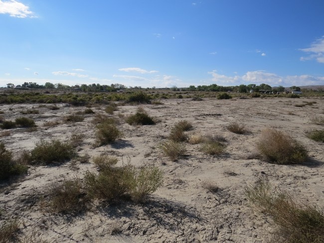
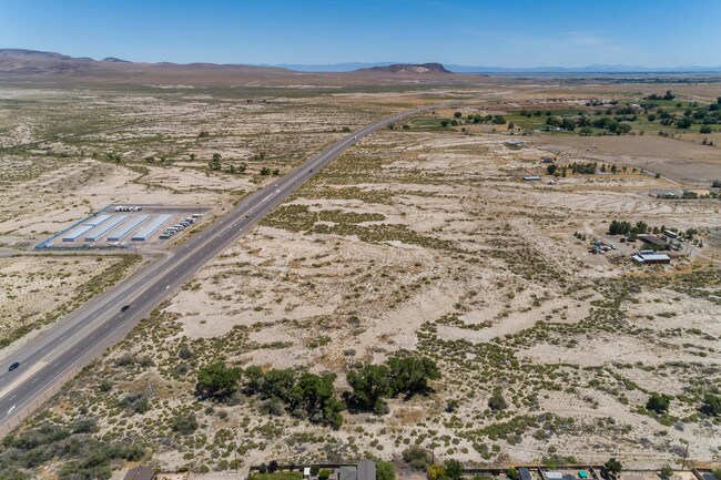
Property Record
4255 E Highway 50A, Fernley, NV 89408


Property Detail
4255 E Highway 50A
021-306-11
23-20-25 FR NE4
Industrialacreage
LYON
I
Nevada
B and X Area of moderate flood hazard, usually the area between the limits of the 100-year and 500-year floods.
23.99 AC
2026
Lyon County
2025
Reno/Sparks
960107
Reno, NV
NEARBY LISTINGS FOR SALE OR LEASE
DEMOGRAPHICS near 4255 E Highway 50A
1 mile
3 mile
5 mile
2025 Total Population
2,487
4,368
12,585
2030 Population
2,610
4,604
13,310
Pop Growth 2025-2030
+ 4.95%
+ 5.40%
+ 5.76%
Average Age
42
41
39
2025 Total Households
908
1,553
4,340
HH Growth 2025-2030
+ 5.07%
+ 5.41%
+ 5.78%
Median Household Inc
$106,600
$105,346
$92,211
Avg Household Size
2.70
2.80
2.90
2025 Avg HH Vehicles
3.00
3.00
3.00
Median Home Value
$364,211
$369,070
$377,674
Median Year Built
2000
2002
2002
Nearby Places
Map Layers
Map Styles
 Street
 Aerial
Layers
 Traffic
 Biking
Places
Listings with unknown addresses are not visible on the map
- Restaurants
- Banks
- Shops
- Fitness
- Groceries
PUBLIC TRANSPORTATION
AIRPORT
Reno/Tahoe International
Drive
Walk
Distance
Reno/Tahoe International
52 min
40.7 mi
SALE & LEASE HISTORY
LISTING DATE
SALE/LEASE

Sep 24, 2016
For Sale
May 30, 2019
For Sale
Jul 31, 2017
For Sale
Jan 17, 2017
For Sale
Apr 21, 2021
For Sale
Nearby Properties
Address
Land Use
TOTAL SIZE
Lot Size
Zoning
Address
Land Use
TOTAL SIZE
Lot Size
Zoning
216,930 SF
13.15 AC
Address
Land Use
TOTAL SIZE
Lot Size
Zoning
61,961 SF
6.26 AC
PF
Address
Land Use
TOTAL SIZE
Lot Size
Zoning
80.23 AC
RR1
Address
Land Use
TOTAL SIZE
Lot Size
Zoning
5,360 SF
105.61 AC
I
Address
Land Use
TOTAL SIZE
Lot Size
Zoning
6,400 SF
4.85 AC
I
Address
Land Use
TOTAL SIZE
Lot Size
Zoning
2,406 SF
112.39 AC
RR5
Address
Land Use
TOTAL SIZE
Lot Size
Zoning
14.64 AC
C2
Address
Land Use
TOTAL SIZE
Lot Size
Zoning
2,612 SF
5 AC
SF20
Address
Land Use
TOTAL SIZE
Lot Size
Zoning
1,848 SF
9.20 AC
PF
Address
Land Use
TOTAL SIZE
Lot Size
Zoning
10 AC
C2
Address
Land Use
TOTAL SIZE
Lot Size
Zoning
10 AC
C2
Address
Land Use
TOTAL SIZE
Lot Size
Zoning
81.31 AC
PD
Address
Land Use
TOTAL SIZE
Lot Size
Zoning
2,671 SF
0.21 AC
PD
Address
Land Use
TOTAL SIZE
Lot Size
Zoning
4,500 SF
1 AC
RR
Address
Land Use
TOTAL SIZE
Lot Size
Zoning
2,671 SF
0.21 AC
PD
Address
Land Use
TOTAL SIZE
Lot Size
Zoning
3,870 SF
47.53 AC
SF6
Address
Land Use
TOTAL SIZE
Lot Size
Zoning
2,349 SF
0.21 AC
PD
Address
Land Use
TOTAL SIZE
Lot Size
Zoning
2,404 SF
5 AC
I
Address
Land Use
TOTAL SIZE
Lot Size
Zoning
1,923 SF
0.21 AC
PD
Address
Land Use
TOTAL SIZE
Lot Size
Zoning
2,085 SF
0.21 AC
PD
Address
Land Use
TOTAL SIZE
Lot Size
Zoning
2,085 SF
0.21 AC
PD
Address
Land Use
TOTAL SIZE
Lot Size
Zoning
3,840 SF
160.48 AC
SF6
Address
Land Use
TOTAL SIZE
Lot Size
Zoning
2,440 SF
4.50 AC
RR5
Address
Land Use
TOTAL SIZE
Lot Size
Zoning
26.55 AC
C-2
Address
Land Use
TOTAL SIZE
Lot Size
Zoning
1,923 SF
0.21 AC
PD
Address
Land Use
TOTAL SIZE
Lot Size
Zoning
1,607 SF
0.26 AC
PD
Address
Land Use
TOTAL SIZE
Lot Size
Zoning
1,909 SF
0.19 AC
PD
Address
Land Use
TOTAL SIZE
Lot Size
Zoning
1,900 SF
0.21 AC
SF9
The World's #1 Commercial Real Estate Marketplace
Connect with us
© 2026 CoStar Group
The information above has been obtained from sources believed reliable. While we do not doubt its accuracy we have not verified it and make no guarantee, warranty or representation about it. It is your responsibility to independently confirm its accuracy and completeness. Any projections, opinions, assumptions, or estimates used are for example only and do not represent the current or future performance of the property. The value of this transaction to you depends on tax and other factors which should be evaluated by your tax, financial, and legal advisors. You and your advisors should conduct a careful, independent investigation of the property to determine to your satisfaction the suitability of the property for your needs.