Property Record
426 Edwards Rd, Lyman, SC 29365

This Property Is For Sale
Property Detail
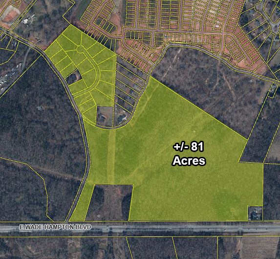
426 Edwards Rd
Spartanburg, SC
N SIDE E WADE HAMPTON BLVD & E SIDE EDWARDS LN PB 186-138
5-14-00-146.00
SPARTANBURG
Residentialacreage
South Carolina
B and X Area of moderate flood hazard, usually the area between the limits of the 100-year and 500-year floods.
0.62 AC
2024
Upper Spartanburg County
2025
Greenville/Spartanburg
023004
NEARBY LISTINGS FOR SALE OR LEASE
DEMOGRAPHICS near 426 Edwards Rd
1 mile
3 mile
5 mile
2025 Total Population
3,635
23,068
60,530
2030 Population
4,087
25,763
67,275
Pop Growth 2025-2030
+ 12.43%
+ 11.68%
+ 11.14%
Average Age
37
38
38
2025 Total Households
1,302
8,618
23,091
HH Growth 2025-2030
+ 12.44%
+ 11.72%
+ 11.16%
Median Household Inc
$73,682
$62,360
$64,418
Avg Household Size
2.80
2.60
2.60
2025 Avg HH Vehicles
2.00
2.00
2.00
Median Home Value
$260,336
$245,184
$248,854
Median Year Built
2010
1997
1994
Nearby Places
Map Layers
Map Styles
 Street
 Aerial
Layers
 Traffic
 Biking
Places
Listings with unknown addresses are not visible on the map
- Restaurants
- Banks
- Shops
- Fitness
- Groceries
PUBLIC TRANSPORTATION
AIRPORT
Greenville Spartanburg International
Drive
Walk
Distance
Greenville Spartanburg International
17 min
8.4 mi
Freight Ports
North Charleston Terminal
Drive
Walk
Distance
North Charleston Terminal
231 min
202.4 mi
Nearby Properties
Address
Land Use
TOTAL SIZE
Lot Size
Zoning
Address
Land Use
TOTAL SIZE
Lot Size
Zoning
227,627 SF
21.37 AC
Address
Land Use
TOTAL SIZE
Lot Size
Zoning
Address
Land Use
TOTAL SIZE
Lot Size
Zoning
111.08 AC
Address
Land Use
TOTAL SIZE
Lot Size
Zoning
42.27 AC
Address
Land Use
TOTAL SIZE
Lot Size
Zoning
2,088 SF
40.12 AC
Address
Land Use
TOTAL SIZE
Lot Size
Zoning
1,798 SF
9.63 AC
Address
Land Use
TOTAL SIZE
Lot Size
Zoning
28.26 AC
Address
Land Use
TOTAL SIZE
Lot Size
Zoning
67,938 SF
8.02 AC
Address
Land Use
TOTAL SIZE
Lot Size
Zoning
217,788 SF
23.50 AC
Address
Land Use
TOTAL SIZE
Lot Size
Zoning
20,621 SF
8.01 AC
Address
Land Use
TOTAL SIZE
Lot Size
Zoning
7,002 SF
6.66 AC
Address
Land Use
TOTAL SIZE
Lot Size
Zoning
31,301 SF
5 AC
Address
Land Use
TOTAL SIZE
Lot Size
Zoning
21,402 SF
9.01 AC
Address
Land Use
TOTAL SIZE
Lot Size
Zoning
11,289 SF
10.30 AC
Address
Land Use
TOTAL SIZE
Lot Size
Zoning
3,921 SF
5.35 AC
Address
Land Use
TOTAL SIZE
Lot Size
Zoning
Address
Land Use
TOTAL SIZE
Lot Size
Zoning
15,422 SF
5.28 AC
Address
Land Use
TOTAL SIZE
Lot Size
Zoning
3,373 SF
1.22 AC
Address
Land Use
TOTAL SIZE
Lot Size
Zoning
3,369 SF
0.57 AC
Address
Land Use
TOTAL SIZE
Lot Size
Zoning
4,325 SF
0.34 AC
Address
Land Use
TOTAL SIZE
Lot Size
Zoning
5,279 SF
0.63 AC
Address
Land Use
TOTAL SIZE
Lot Size
Zoning
10,684 SF
11.39 AC
Address
Land Use
TOTAL SIZE
Lot Size
Zoning
3,340 SF
0.19 AC
Address
Land Use
TOTAL SIZE
Lot Size
Zoning
3,066 SF
0.58 AC
Address
Land Use
TOTAL SIZE
Lot Size
Zoning
3,157 SF
0.34 AC
Address
Land Use
TOTAL SIZE
Lot Size
Zoning
3,486 SF
4.31 AC
Address
Land Use
TOTAL SIZE
Lot Size
Zoning
71,373 SF
5.18 AC
Address
Land Use
TOTAL SIZE
Lot Size
Zoning
4,504 SF
0.43 AC
Address
Land Use
TOTAL SIZE
Lot Size
Zoning
3,292 SF
0.57 AC
Address
Land Use
TOTAL SIZE
Lot Size
Zoning
47,718 SF
7.83 AC
The World's #1 Commercial Real Estate Marketplace
Connect with us
© 2026 CoStar Group
The information above has been obtained from sources believed reliable. While we do not doubt its accuracy we have not verified it and make no guarantee, warranty or representation about it. It is your responsibility to independently confirm its accuracy and completeness. Any projections, opinions, assumptions, or estimates used are for example only and do not represent the current or future performance of the property. The value of this transaction to you depends on tax and other factors which should be evaluated by your tax, financial, and legal advisors. You and your advisors should conduct a careful, independent investigation of the property to determine to your satisfaction the suitability of the property for your needs.