Property Record
426 Moores Mill Rd, Bel Air, MD 21014
NEARBY LISTINGS FOR SALE OR LEASE
-
-
View all Bel Air listings for sale on LoopNet.com
Property Detail
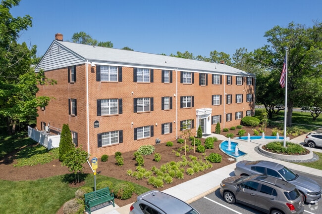
426 Moores Mill Rd
Baltimore-Columbia-Towson, MD
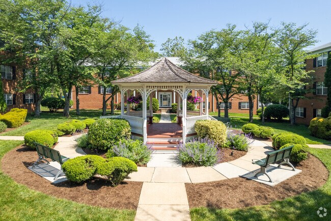
Warwick Apts
03-011968
1.83 ACRES 800 CANDLELIGHT DRIVE WARWICK APARTMENTS
Multifamilydwelling
Harford
AE
Maryland
24025C0161E
3.74 AC
2025
Bel Air
2025
Baltimore
303802
DEMOGRAPHICS near 426 Moores Mill Rd
1 Mile
3 Mile
5 Mile
2024 Total Population
10,984
64,313
100,879
2029 Population
11,259
66,023
103,480
Pop Growth 2024-2029
+ 2.50%
+ 2.66%
+ 2.58%
Average Age
41
41
42
2024 Total Households
4,347
24,256
37,272
HH Growth 2024-2029
+ 2.58%
+ 2.75%
+ 2.66%
Median Household Inc
$88,071
$107,033
$111,002
Avg Household Size
2.40
2.60
2.70
2024 Avg HH Vehicles
2.00
2.00
2.00
Median Home Value
$310,567
$365,307
$381,914
Median Year Built
1985
1987
1988
Nearby Places
Map Layers
Map Styles
 Street
 Aerial
- Restaurants
- Banks
- Shops
- Fitness
- Groceries
Nearby Properties
Address
Land Use
TOTAL SIZE
Lot Size
Zoning
Address
Land Use
TOTAL SIZE
Lot Size
Zoning
363,713 SF
6.96 AC
B3
Address
Land Use
TOTAL SIZE
Lot Size
Zoning
270,700 SF
31.09 AC
B3 R3
Address
Land Use
TOTAL SIZE
Lot Size
Zoning
51,475 SF
7.85 AC
C1
Address
Land Use
TOTAL SIZE
Lot Size
Zoning
42,087 SF
17.21 AC
B3
Address
Land Use
TOTAL SIZE
Lot Size
Zoning
8,503 SF
20.86 AC
B3
Address
Land Use
TOTAL SIZE
Lot Size
Zoning
197,191 SF
12.94 AC
R2
Address
Land Use
TOTAL SIZE
Lot Size
Zoning
5,674 SF
288 AC
R4
Address
Land Use
TOTAL SIZE
Lot Size
Zoning
49,611 SF
49.52 AC
AG
Address
Land Use
TOTAL SIZE
Lot Size
Zoning
161,723 SF
72.26 AC
R1
Address
Land Use
TOTAL SIZE
Lot Size
Zoning
223,629 SF
29.38 AC
M1
Address
Land Use
TOTAL SIZE
Lot Size
Zoning
228 AC
COS
Address
Land Use
TOTAL SIZE
Lot Size
Zoning
55,164 SF
16.22 AC
B2
Address
Land Use
TOTAL SIZE
Lot Size
Zoning
13.02 AC
R3
Address
Land Use
TOTAL SIZE
Lot Size
Zoning
52,224 SF
10.38 AC
B1
Address
Land Use
TOTAL SIZE
Lot Size
Zoning
12.38 AC
R2
Address
Land Use
TOTAL SIZE
Lot Size
Zoning
6,084 SF
6.03 AC
B2
Address
Land Use
TOTAL SIZE
Lot Size
Zoning
85,798 SF
1.51 AC
Address
Land Use
TOTAL SIZE
Lot Size
Zoning
101,236 SF
23.52 AC
R1
Address
Land Use
TOTAL SIZE
Lot Size
Zoning
113,276 SF
2.19 AC
B2A
Address
Land Use
TOTAL SIZE
Lot Size
Zoning
78,264 SF
16.71 AC
AG
Address
Land Use
TOTAL SIZE
Lot Size
Zoning
1,496 SF
11.55 AC
M1
Address
Land Use
TOTAL SIZE
Lot Size
Zoning
52,245 SF
2.43 AC
R3/B1
Address
Land Use
TOTAL SIZE
Lot Size
Zoning
74,842 SF
0.77 AC
B2 B3
Address
Land Use
TOTAL SIZE
Lot Size
Zoning
5.87 AC
R2
Address
Land Use
TOTAL SIZE
Lot Size
Zoning
10.73 AC
B2
Address
Land Use
TOTAL SIZE
Lot Size
Zoning
229,355 SF
59.83 AC
R2
Address
Land Use
TOTAL SIZE
Lot Size
Zoning
46,247 SF
10.45 AC
R2 B2
Address
Land Use
TOTAL SIZE
Lot Size
Zoning
46,174 SF
5 AC
R2
Address
Land Use
TOTAL SIZE
Lot Size
Zoning
132,779 SF
10.20 AC
B3
Address
Land Use
TOTAL SIZE
Lot Size
Zoning
35.99 AC
R2
The World's #1 Commercial Real Estate Marketplace
Connect with us
© 2025 CoStar Group
The information above has been obtained from sources believed reliable. While we do not doubt its accuracy we have not verified it and make no guarantee, warranty or representation about it. It is your responsibility to independently confirm its accuracy and completeness. Any projections, opinions, assumptions, or estimates used are for example only and do not represent the current or future performance of the property. The value of this transaction to you depends on tax and other factors which should be evaluated by your tax, financial, and legal advisors. You and your advisors should conduct a careful, independent investigation of the property to determine to your satisfaction the suitability of the property for your needs.