Property Record
426 Park St, Sun Prairie, WI 53590

NEARBY LISTINGS FOR SALE OR LEASE
Property Detail
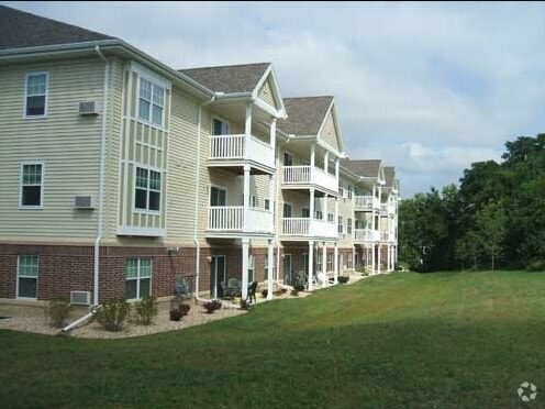
426 Park St
Madison, WI
Cannery Square
0811-081-0210-2
LOT 1 CSM 11715 CS71/323&326-4/3/2006 F/K/A CANNERY SQUARE LOT 9 DESCR AS SEC 5- 8-11 PRT SE1/4SE1/4 & SEC 8-8-11 PRT NE1/4NE1/4 (3.811 ACRES) SUBJ TO SIDEWALK E SMT IN DOC #4306561
Commercialnec
Dane
AE
Wisconsin
55025C0287H
1,9
2024
3.81 AC
2024
Outer Sun Prairie
011600
Milwaukee/Madison
63,663 SF
DEMOGRAPHICS near 426 Park St
1 Mile
3 Mile
5 Mile
2024 Total Population
9,455
34,914
50,747
2029 Population
9,820
36,230
52,726
Pop Growth 2024-2029
+ 3.86%
+ 3.77%
+ 3.90%
Average Age
39
38
38
2024 Total Households
3,885
13,896
20,397
HH Growth 2024-2029
+ 3.96%
+ 3.95%
+ 4.11%
Median Household Inc
$72,470
$83,841
$89,096
Avg Household Size
2.30
2.50
2.40
2024 Avg HH Vehicles
2.00
2.00
2.00
Median Home Value
$270,804
$313,969
$319,277
Median Year Built
1979
1993
1996
Nearby Places
Map Layers
Map Styles
 Street
 Aerial
- Restaurants
- Banks
- Shops
- Fitness
- Groceries
PUBLIC TRANSPORTATION
AIRPORT
Dane County Regional/Truax Field
DRIVE
WALK
Distance
Dane County Regional/Truax Field
19 min
11.0 mi
Freight Ports
Port Milwaukee
DRIVE
WALK
Distance
Port Milwaukee
88 min
74.3 mi
Nearby Properties
Address
Land Use
TOTAL SIZE
Lot Size
Zoning
Address
Land Use
TOTAL SIZE
Lot Size
Zoning
Address
Land Use
TOTAL SIZE
Lot Size
Zoning
58,272 SF
136.54 AC
SO
Address
Land Use
TOTAL SIZE
Lot Size
Zoning
8.56 AC
Address
Land Use
TOTAL SIZE
Lot Size
Zoning
26.32 AC
Address
Land Use
TOTAL SIZE
Lot Size
Zoning
4.64 AC
Address
Land Use
TOTAL SIZE
Lot Size
Zoning
31,986 SF
5 AC
PD
Address
Land Use
TOTAL SIZE
Lot Size
Zoning
46,902 SF
5.28 AC
PD
Address
Land Use
TOTAL SIZE
Lot Size
Zoning
Address
Land Use
TOTAL SIZE
Lot Size
Zoning
Address
Land Use
TOTAL SIZE
Lot Size
Zoning
70,080 SF
3.21 AC
Address
Land Use
TOTAL SIZE
Lot Size
Zoning
26,854 SF
8.25 AC
UR12
Address
Land Use
TOTAL SIZE
Lot Size
Zoning
147,310 SF
14.68 AC
SC
Address
Land Use
TOTAL SIZE
Lot Size
Zoning
12.16 AC
Address
Land Use
TOTAL SIZE
Lot Size
Zoning
Address
Land Use
TOTAL SIZE
Lot Size
Zoning
430,172 SF
18.33 AC
SI
Address
Land Use
TOTAL SIZE
Lot Size
Zoning
Address
Land Use
TOTAL SIZE
Lot Size
Zoning
15.38 AC
Address
Land Use
TOTAL SIZE
Lot Size
Zoning
22,866 SF
5.39 AC
PD
Address
Land Use
TOTAL SIZE
Lot Size
Zoning
16,464 SF
7.37 AC
UR12
Address
Land Use
TOTAL SIZE
Lot Size
Zoning
2.80 AC
PD
Address
Land Use
TOTAL SIZE
Lot Size
Zoning
55,581 SF
3.35 AC
PD
Address
Land Use
TOTAL SIZE
Lot Size
Zoning
155,550 SF
21.13 AC
SI
Address
Land Use
TOTAL SIZE
Lot Size
Zoning
24.49 AC
Address
Land Use
TOTAL SIZE
Lot Size
Zoning
15.24 AC
ABA
Address
Land Use
TOTAL SIZE
Lot Size
Zoning
15,288 SF
14.55 AC
UR12
Address
Land Use
TOTAL SIZE
Lot Size
Zoning
20,560 SF
6.63 AC
UR12
Address
Land Use
TOTAL SIZE
Lot Size
Zoning
39,676 SF
2.57 AC
UC
Address
Land Use
TOTAL SIZE
Lot Size
Zoning
1.76 AC
Address
Land Use
TOTAL SIZE
Lot Size
Zoning
59,500 SF
8.37 AC
PD
Address
Land Use
TOTAL SIZE
Lot Size
Zoning
12.24 AC
The World's #1 Commercial Real Estate Marketplace
Connect with us
© 2025 CoStar Group
The information above has been obtained from sources believed reliable. While we do not doubt its accuracy we have not verified it and make no guarantee, warranty or representation about it. It is your responsibility to independently confirm its accuracy and completeness. Any projections, opinions, assumptions, or estimates used are for example only and do not represent the current or future performance of the property. The value of this transaction to you depends on tax and other factors which should be evaluated by your tax, financial, and legal advisors. You and your advisors should conduct a careful, independent investigation of the property to determine to your satisfaction the suitability of the property for your needs.