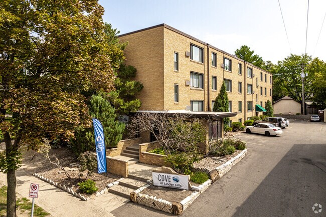
Property Record
4261 Sheridan Ave S, Minneapolis, MN 55410
NEARBY LISTINGS FOR SALE OR LEASE
Property Detail
4261 Sheridan Ave S
Minneapolis-St. Paul-Bloomington, MN-WI
First Division Of Remington Park
08-028-24-42-0007
LOT 027 BLOCK 005 A FIRST DIVISION OF REMINGTON PARK LOTS 27 AND 28 100.00 X 170.00
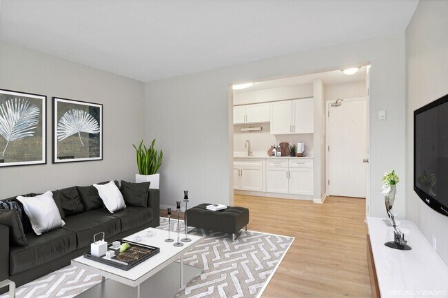
Apartment
Hennepin
X
Minnesota
27053C0362F
27
2024
0.39 AC
2024
East Linden Hills
109100
Minneapolis/St Paul
18,876 SF
DEMOGRAPHICS near 4261 Sheridan Ave S
1 Mile
3 Mile
5 Mile
2024 Total Population
12,615
178,755
442,485
2029 Population
12,375
175,818
436,174
Pop Growth 2024-2029
(1.90%)
(1.64%)
(1.43%)
Average Age
41
38
39
2024 Total Households
5,127
80,710
201,446
HH Growth 2024-2029
(2.03%)
(1.63%)
(1.36%)
Median Household Inc
$130,823
$89,793
$78,772
Avg Household Size
2.40
2.10
2.10
2024 Avg HH Vehicles
2.00
2.00
1.00
Median Home Value
$676,849
$429,401
$366,202
Median Year Built
1947
1952
1959
Nearby Places
Map Layers
Map Styles
 Street
 Aerial
- Restaurants
- Banks
- Shops
- Fitness
- Groceries
PUBLIC TRANSPORTATION
COMMUTER RAIL
Target Field Station (Northstar Corridor - Northstar Commuter Rail)
DRIVE
WALK
Distance
Target Field Station (Northstar Corridor - Northstar Commuter Rail)
16 min
5.4 mi
AIRPORT
Minneapolis-St Paul International/Wold-Chamberlain
DRIVE
WALK
Distance
Minneapolis-St Paul International/Wold-Chamberlain
20 min
10.7 mi
Freight Ports
Port Milwaukee
DRIVE
WALK
Distance
Port Milwaukee
385 min
342.7 mi
Nearby Properties
Address
Land Use
TOTAL SIZE
Lot Size
Zoning
Address
Land Use
TOTAL SIZE
Lot Size
Zoning
275,782 SF
2.40 AC
C3A
Address
Land Use
TOTAL SIZE
Lot Size
Zoning
659,076 SF
1.45 AC
C3A
Address
Land Use
TOTAL SIZE
Lot Size
Zoning
45.77 AC
Address
Land Use
TOTAL SIZE
Lot Size
Zoning
19,726 SF
2.08 AC
PCD1
Address
Land Use
TOTAL SIZE
Lot Size
Zoning
1.50 AC
Address
Land Use
TOTAL SIZE
Lot Size
Zoning
3.51 AC
Address
Land Use
TOTAL SIZE
Lot Size
Zoning
Address
Land Use
TOTAL SIZE
Lot Size
Zoning
4,497,396 SF
11.05 AC
Address
Land Use
TOTAL SIZE
Lot Size
Zoning
264,176 SF
1.61 AC
OR2
Address
Land Use
TOTAL SIZE
Lot Size
Zoning
390,060 SF
3.11 AC
Address
Land Use
TOTAL SIZE
Lot Size
Zoning
406,842 SF
1.59 AC
Address
Land Use
TOTAL SIZE
Lot Size
Zoning
1.74 AC
Address
Land Use
TOTAL SIZE
Lot Size
Zoning
7,614 SF
2.01 AC
PCD3
Address
Land Use
TOTAL SIZE
Lot Size
Zoning
398,595 SF
1.91 AC
Address
Land Use
TOTAL SIZE
Lot Size
Zoning
288,096 SF
10.19 AC
Address
Land Use
TOTAL SIZE
Lot Size
Zoning
94,827 SF
5.86 AC
RMD
Address
Land Use
TOTAL SIZE
Lot Size
Zoning
524,556 SF
4.56 AC
Address
Land Use
TOTAL SIZE
Lot Size
Zoning
379,488 SF
2.68 AC
Address
Land Use
TOTAL SIZE
Lot Size
Zoning
340,330 SF
2.22 AC
Address
Land Use
TOTAL SIZE
Lot Size
Zoning
233,886 SF
1.63 AC
R5
Address
Land Use
TOTAL SIZE
Lot Size
Zoning
Address
Land Use
TOTAL SIZE
Lot Size
Zoning
2.23 AC
Address
Land Use
TOTAL SIZE
Lot Size
Zoning
127,084 SF
17.21 AC
Address
Land Use
TOTAL SIZE
Lot Size
Zoning
244,941 SF
5.24 AC
Address
Land Use
TOTAL SIZE
Lot Size
Zoning
239,539 SF
1.29 AC
OR2
Address
Land Use
TOTAL SIZE
Lot Size
Zoning
295,036 SF
1.82 AC
R6
Address
Land Use
TOTAL SIZE
Lot Size
Zoning
424,327 SF
2.16 AC
Address
Land Use
TOTAL SIZE
Lot Size
Zoning
2.28 AC
Address
Land Use
TOTAL SIZE
Lot Size
Zoning
47,847 SF
2.36 AC
Address
Land Use
TOTAL SIZE
Lot Size
Zoning
346,787 SF
1.94 AC
R3
The World's #1 Commercial Real Estate Marketplace
Connect with us
© 2025 CoStar Group
The information above has been obtained from sources believed reliable. While we do not doubt its accuracy we have not verified it and make no guarantee, warranty or representation about it. It is your responsibility to independently confirm its accuracy and completeness. Any projections, opinions, assumptions, or estimates used are for example only and do not represent the current or future performance of the property. The value of this transaction to you depends on tax and other factors which should be evaluated by your tax, financial, and legal advisors. You and your advisors should conduct a careful, independent investigation of the property to determine to your satisfaction the suitability of the property for your needs.