Property Record
4268 N I 55 N, Jackson, MS 39211
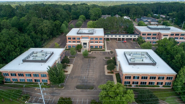


Property Detail
4268 N I 55 N
Jackson, MS
BEG 153.48 FT N & 106.08 FT E NE COR LOT 1 CANTONDALE SUBN S 15.89 FT W 18.42 N 158.17 FT E 159.47 FT NELY 35.39 FT N 26.33 FT E 37.43 FT N 43.01 FT E 288.29 FT S 199.7 FT W 288.29 FT S 249.11 FT E 162 FT S 153.34 FT E 320.01 FT NLY 69.81 FT ELY 15.2
0452-0005-000
Hinds
Commercialnec
Mississippi
B and X Area of moderate flood hazard, usually the area between the limits of the 100-year and 500-year floods.
1
2024
19,602 AC
2025
North Jackson
001400
Jackson
33,960 SF
NEARBY LISTINGS FOR SALE OR LEASE
DEMOGRAPHICS near 4268 N I 55 N
1 mile
3 mile
5 mile
2025 Total Population
6,733
44,981
98,844
2030 Population
6,404
43,050
96,944
Pop Growth 2025-2030
(4.89%)
(4.29%)
(1.92%)
Average Age
39
39
39
2025 Total Households
3,053
19,797
43,450
HH Growth 2025-2030
(5.18%)
(4.39%)
(1.97%)
Median Household Inc
$73,717
$52,879
$48,386
Avg Household Size
2.10
2.20
2.10
2025 Avg HH Vehicles
2.00
2.00
2.00
Median Home Value
$289,314
$183,483
$157,217
Median Year Built
1968
1967
1972
Nearby Places
Map Layers
Map Styles
 Street
 Aerial
Layers
 Traffic
 Biking
Places
Listings with unknown addresses are not visible on the map
- Restaurants
- Banks
- Shops
- Fitness
- Groceries
PUBLIC TRANSPORTATION
AIRPORT
Jackson-Medgar Wiley Evers International
Drive
Walk
Distance
Jackson-Medgar Wiley Evers International
20 min
10.0 mi
SALE & LEASE HISTORY
LISTING DATE
SALE/LEASE

Jun 28, 2017
For Lease
Jan 24, 2024
For Lease
Nearby Properties
Address
Land Use
TOTAL SIZE
Lot Size
Zoning
Address
Land Use
TOTAL SIZE
Lot Size
Zoning
560,993 SF
47 AC
Address
Land Use
TOTAL SIZE
Lot Size
Zoning
14,236 SF
7.38 AC
Address
Land Use
TOTAL SIZE
Lot Size
Zoning
48,134 SF
6.62 AC
Address
Land Use
TOTAL SIZE
Lot Size
Zoning
7,561 SF
153.82 AC
Address
Land Use
TOTAL SIZE
Lot Size
Zoning
206,400 SF
7.96 AC
Address
Land Use
TOTAL SIZE
Lot Size
Zoning
40,445 SF
3 AC
Address
Land Use
TOTAL SIZE
Lot Size
Zoning
51,260 SF
1 AC
Address
Land Use
TOTAL SIZE
Lot Size
Zoning
236.80 AC
Address
Land Use
TOTAL SIZE
Lot Size
Zoning
247,574 SF
0.94 AC
Address
Land Use
TOTAL SIZE
Lot Size
Zoning
17,261 SF
18.20 AC
Address
Land Use
TOTAL SIZE
Lot Size
Zoning
32,886 SF
1 AC
Address
Land Use
TOTAL SIZE
Lot Size
Zoning
59,840 SF
2.72 AC
Address
Land Use
TOTAL SIZE
Lot Size
Zoning
55,160 SF
3 AC
Address
Land Use
TOTAL SIZE
Lot Size
Zoning
31,541 SF
4 AC
Address
Land Use
TOTAL SIZE
Lot Size
Zoning
64,949 SF
3 AC
Address
Land Use
TOTAL SIZE
Lot Size
Zoning
54,291 SF
6.99 AC
Address
Land Use
TOTAL SIZE
Lot Size
Zoning
81,649 SF
5.60 AC
Address
Land Use
TOTAL SIZE
Lot Size
Zoning
102,249 SF
14.38 AC
Address
Land Use
TOTAL SIZE
Lot Size
Zoning
1,787 SF
16.82 AC
Address
Land Use
TOTAL SIZE
Lot Size
Zoning
10,620 SF
2.81 AC
Address
Land Use
TOTAL SIZE
Lot Size
Zoning
28.60 AC
Address
Land Use
TOTAL SIZE
Lot Size
Zoning
5,354 SF
0.68 AC
Address
Land Use
TOTAL SIZE
Lot Size
Zoning
15,374 SF
0.64 AC
Address
Land Use
TOTAL SIZE
Lot Size
Zoning
230,401 SF
643,381.54 AC
Address
Land Use
TOTAL SIZE
Lot Size
Zoning
108,198 SF
15.40 AC
Address
Land Use
TOTAL SIZE
Lot Size
Zoning
4.38 AC
Address
Land Use
TOTAL SIZE
Lot Size
Zoning
20.54 AC
Address
Land Use
TOTAL SIZE
Lot Size
Zoning
33,873 SF
0.96 AC
Address
Land Use
TOTAL SIZE
Lot Size
Zoning
2,457 SF
11.42 AC
The World's #1 Commercial Real Estate Marketplace
Connect with us
© 2026 CoStar Group
The information above has been obtained from sources believed reliable. While we do not doubt its accuracy we have not verified it and make no guarantee, warranty or representation about it. It is your responsibility to independently confirm its accuracy and completeness. Any projections, opinions, assumptions, or estimates used are for example only and do not represent the current or future performance of the property. The value of this transaction to you depends on tax and other factors which should be evaluated by your tax, financial, and legal advisors. You and your advisors should conduct a careful, independent investigation of the property to determine to your satisfaction the suitability of the property for your needs.