No Photo
Property Record
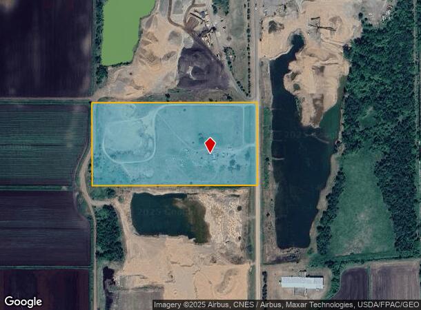
42680 Harder Ave, Harris, MN 55032

NEARBY LISTINGS FOR SALE OR LEASE
Property Detail
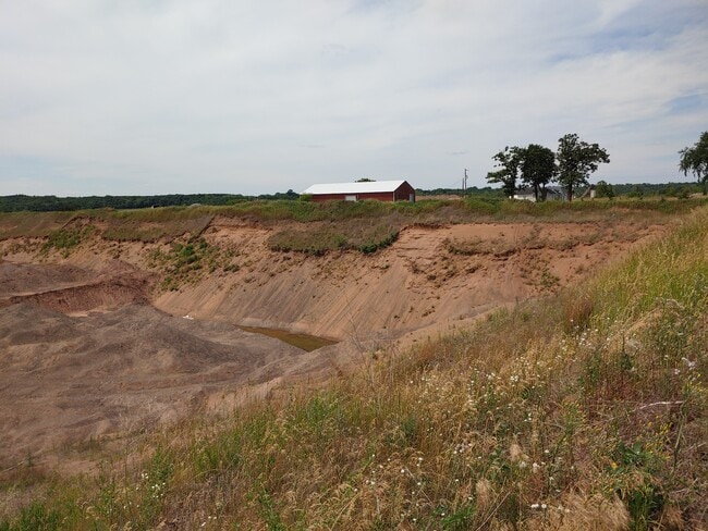
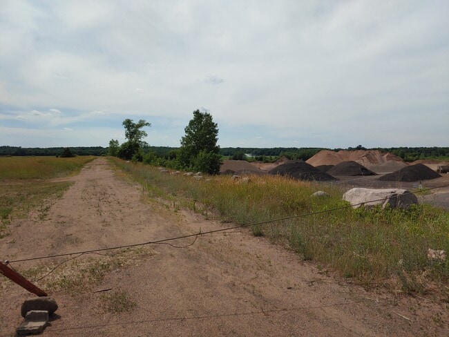
42680 Harder Ave
14-00303-00
N 1/2 OF SE 1/4 OF NW 1/4. (SEVERED MINERAL RIGHTS LOC ON PARCEL #14.60303.00).
Commercialnec
Chisago
X
Minnesota
27025C0155D
20 AC
2025
Chisago County
2024
Minneapolis/St Paul
110202
Minneapolis-St. Paul-Bloomington, MN-WI
1,052 SF
DEMOGRAPHICS near 42680 Harder Ave
1 Mile
3 Mile
5 Mile
2024 Total Population
50
2,405
11,243
2029 Population
52
2,521
11,884
Pop Growth 2024-2029
+ 4.00%
+ 4.82%
+ 5.70%
Average Age
41
40
38
2024 Total Households
19
857
4,139
HH Growth 2024-2029
+ 5.26%
+ 4.90%
+ 5.80%
Median Household Inc
$95,833
$106,144
$93,664
Avg Household Size
2.40
2.70
2.60
2024 Avg HH Vehicles
3.00
3.00
2.00
Median Home Value
$243,750
$268,123
$260,862
Median Year Built
1979
1987
1992
Nearby Places
Map Layers
Map Styles
 Street
 Aerial
- Restaurants
- Banks
- Shops
- Fitness
- Groceries
SALE & LEASE HISTORY
LISTING DATE
SALE/LEASE

May 05, 2022
For Sale
Jul 15, 2020
For Sale
Nearby Properties
Address
Land Use
TOTAL SIZE
Lot Size
Zoning
Address
Land Use
TOTAL SIZE
Lot Size
Zoning
2,700 SF
52.19 AC
I2
Address
Land Use
TOTAL SIZE
Lot Size
Zoning
61,103 SF
6.94 AC
Address
Land Use
TOTAL SIZE
Lot Size
Zoning
103,679 SF
17.47 AC
I
Address
Land Use
TOTAL SIZE
Lot Size
Zoning
57,840 SF
10.18 AC
I2
Address
Land Use
TOTAL SIZE
Lot Size
Zoning
6,000 SF
20 AC
AG1
Address
Land Use
TOTAL SIZE
Lot Size
Zoning
14,030 SF
16.50 AC
I2
Address
Land Use
TOTAL SIZE
Lot Size
Zoning
49,800 SF
1.12 AC
I3
Address
Land Use
TOTAL SIZE
Lot Size
Zoning
28,450 SF
15.27 AC
I2
Address
Land Use
TOTAL SIZE
Lot Size
Zoning
39,300 SF
10.30 AC
Address
Land Use
TOTAL SIZE
Lot Size
Zoning
22,900 SF
13.70 AC
I
Address
Land Use
TOTAL SIZE
Lot Size
Zoning
16,224 SF
3.29 AC
I4
Address
Land Use
TOTAL SIZE
Lot Size
Zoning
34,400 SF
6.30 AC
I
Address
Land Use
TOTAL SIZE
Lot Size
Zoning
15,120 SF
2.45 AC
Address
Land Use
TOTAL SIZE
Lot Size
Zoning
12,300 SF
3.13 AC
I3
Address
Land Use
TOTAL SIZE
Lot Size
Zoning
13,786 SF
4.92 AC
R2
Address
Land Use
TOTAL SIZE
Lot Size
Zoning
11,872 SF
9.40 AC
B2
Address
Land Use
TOTAL SIZE
Lot Size
Zoning
9,792 SF
15.10 AC
B2
Address
Land Use
TOTAL SIZE
Lot Size
Zoning
14,784 SF
7.45 AC
I
Address
Land Use
TOTAL SIZE
Lot Size
Zoning
15,246 SF
1.75 AC
B2
Address
Land Use
TOTAL SIZE
Lot Size
Zoning
10,000 SF
2.84 AC
I3
Address
Land Use
TOTAL SIZE
Lot Size
Zoning
1,330 SF
159.56 AC
AG2
Address
Land Use
TOTAL SIZE
Lot Size
Zoning
1,792 SF
58.70 AC
AG
Address
Land Use
TOTAL SIZE
Lot Size
Zoning
10,778 SF
40 AC
AGOSRR
Address
Land Use
TOTAL SIZE
Lot Size
Zoning
2,528 SF
20.70 AC
AG
Address
Land Use
TOTAL SIZE
Lot Size
Zoning
4,776 SF
5.10 AC
I2
Address
Land Use
TOTAL SIZE
Lot Size
Zoning
22.30 AC
AG2
Address
Land Use
TOTAL SIZE
Lot Size
Zoning
5,529 SF
39 AC
AGOSRR
Address
Land Use
TOTAL SIZE
Lot Size
Zoning
5,236 SF
0.34 AC
R1A
Address
Land Use
TOTAL SIZE
Lot Size
Zoning
9,100 SF
2.10 AC
B2
Address
Land Use
TOTAL SIZE
Lot Size
Zoning
1,440 SF
79.80 AC
R1B
The World's #1 Commercial Real Estate Marketplace
Connect with us
© 2025 CoStar Group
The information above has been obtained from sources believed reliable. While we do not doubt its accuracy we have not verified it and make no guarantee, warranty or representation about it. It is your responsibility to independently confirm its accuracy and completeness. Any projections, opinions, assumptions, or estimates used are for example only and do not represent the current or future performance of the property. The value of this transaction to you depends on tax and other factors which should be evaluated by your tax, financial, and legal advisors. You and your advisors should conduct a careful, independent investigation of the property to determine to your satisfaction the suitability of the property for your needs.