Property Record
427 New Sanford Rd, La Vergne, TN 37086
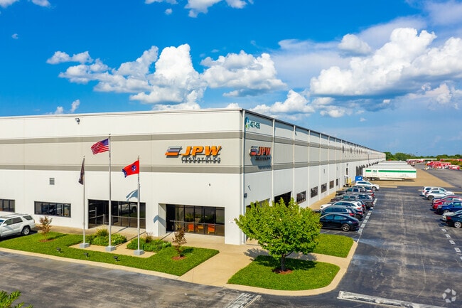


Property Detail
427 New Sanford Rd
029-011.08-000
LOT 6 SANFORD ROAD REV TO LOT 6 PB 35 PG 279 FOR 12
Warehouse
Rutherford
I-2
Tennessee
B and X Area of moderate flood hazard, usually the area between the limits of the 100-year and 500-year floods.
6
2025
29.59 AC
2025
Southeast
040200
Nashville
518,733 SF
Nashville-Davidson--Murfreesboro--Franklin, TN
NEARBY LISTINGS FOR SALE OR LEASE
DEMOGRAPHICS near 427 New Sanford Rd
1 mile
3 mile
5 mile
2025 Total Population
6,340
49,231
120,677
2030 Population
6,873
53,561
130,590
Pop Growth 2025-2030
+ 8.41%
+ 8.80%
+ 8.21%
Average Age
36
37
36
2025 Total Households
2,346
17,487
41,768
HH Growth 2025-2030
+ 8.53%
+ 8.82%
+ 8.38%
Median Household Inc
$84,313
$80,787
$86,140
Avg Household Size
2.70
2.80
2.80
2025 Avg HH Vehicles
2.00
2.00
2.00
Median Home Value
$332,608
$373,519
$370,900
Median Year Built
2005
2001
2002
Nearby Places
Map Layers
Map Styles
 Street
 Aerial
Transit
 Traffic
 Biking
Places
Listings with unknown addresses are not visible on the map
- Restaurants
- Banks
- Shops
- Fitness
- Groceries
PUBLIC TRANSPORTATION
AIRPORT
Nashville International
Drive
Walk
Distance
Nashville International
24 min
14.2 mi
Freight Ports
Port of Mobile
Drive
Walk
Distance
Port of Mobile
497 min
453.1 mi
Nearby Properties
Address
Land Use
TOTAL SIZE
Lot Size
Zoning
Address
Land Use
TOTAL SIZE
Lot Size
Zoning
404,723 SF
1,495 AC
Address
Land Use
TOTAL SIZE
Lot Size
Zoning
302,040 SF
60 AC
Address
Land Use
TOTAL SIZE
Lot Size
Zoning
618,332 SF
45.75 AC
Address
Land Use
TOTAL SIZE
Lot Size
Zoning
564,124 SF
37.66 AC
Address
Land Use
TOTAL SIZE
Lot Size
Zoning
377,869 SF
26.47 AC
Address
Land Use
TOTAL SIZE
Lot Size
Zoning
323,961 SF
27.38 AC
I-2
Address
Land Use
TOTAL SIZE
Lot Size
Zoning
4,709 SF
25.76 AC
RM14
Address
Land Use
TOTAL SIZE
Lot Size
Zoning
17,953 SF
14.92 AC
Address
Land Use
TOTAL SIZE
Lot Size
Zoning
5,352 SF
30 AC
RMF
Address
Land Use
TOTAL SIZE
Lot Size
Zoning
4,974 SF
18.91 AC
C2
Address
Land Use
TOTAL SIZE
Lot Size
Zoning
301,272 SF
26.09 AC
Address
Land Use
TOTAL SIZE
Lot Size
Zoning
526,143 SF
25.75 AC
IR
Address
Land Use
TOTAL SIZE
Lot Size
Zoning
588,845 SF
72.56 AC
Address
Land Use
TOTAL SIZE
Lot Size
Zoning
163,177 SF
39.68 AC
Address
Land Use
TOTAL SIZE
Lot Size
Zoning
512,464 SF
42.43 AC
IR
Address
Land Use
TOTAL SIZE
Lot Size
Zoning
202,737 SF
41 AC
Address
Land Use
TOTAL SIZE
Lot Size
Zoning
600,604 SF
47.70 AC
Address
Land Use
TOTAL SIZE
Lot Size
Zoning
132,470 SF
42.16 AC
Address
Land Use
TOTAL SIZE
Lot Size
Zoning
603,578 SF
47.11 AC
Address
Land Use
TOTAL SIZE
Lot Size
Zoning
484,476 SF
30.01 AC
Address
Land Use
TOTAL SIZE
Lot Size
Zoning
2,196,000 SF
135.70 AC
Address
Land Use
TOTAL SIZE
Lot Size
Zoning
768,304 SF
40.03 AC
I-2
Address
Land Use
TOTAL SIZE
Lot Size
Zoning
195,626 SF
40.50 AC
Address
Land Use
TOTAL SIZE
Lot Size
Zoning
212,268 SF
49 AC
Address
Land Use
TOTAL SIZE
Lot Size
Zoning
128,082 SF
19 AC
Address
Land Use
TOTAL SIZE
Lot Size
Zoning
304,456 SF
40.14 AC
Address
Land Use
TOTAL SIZE
Lot Size
Zoning
10,132 SF
13.41 AC
IR
Address
Land Use
TOTAL SIZE
Lot Size
Zoning
3,142 SF
11.40 AC
C2
Address
Land Use
TOTAL SIZE
Lot Size
Zoning
105,638 SF
17.63 AC
Address
Land Use
TOTAL SIZE
Lot Size
Zoning
121,104 SF
30 AC
The World's #1 Commercial Real Estate Marketplace
Connect with us
© 2026 CoStar Group
The information above has been obtained from sources believed reliable. While we do not doubt its accuracy we have not verified it and make no guarantee, warranty or representation about it. It is your responsibility to independently confirm its accuracy and completeness. Any projections, opinions, assumptions, or estimates used are for example only and do not represent the current or future performance of the property. The value of this transaction to you depends on tax and other factors which should be evaluated by your tax, financial, and legal advisors. You and your advisors should conduct a careful, independent investigation of the property to determine to your satisfaction the suitability of the property for your needs.