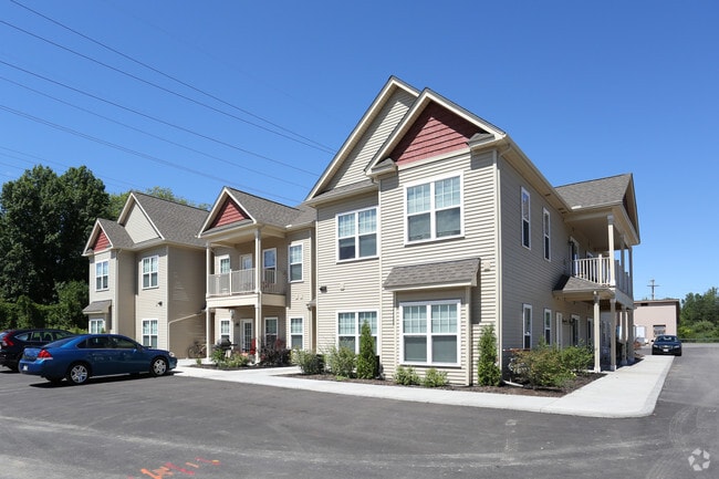
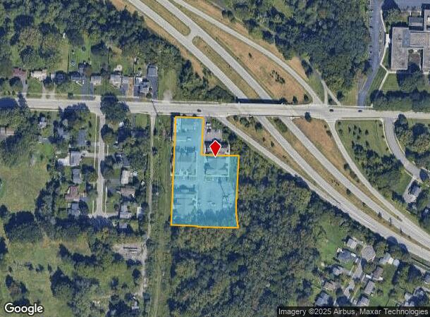
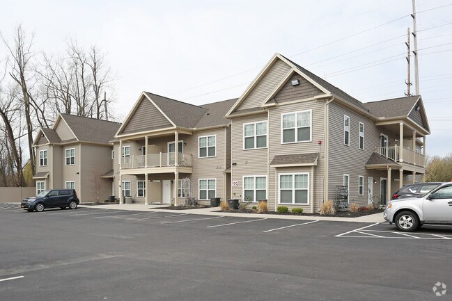
Property Record
427 Latta Rd, Rochester, NY 14612
NEARBY LISTINGS FOR SALE OR LEASE
-
-
View all Rochester listings for sale on LoopNet.com
Property Detail
427 Latta Rd
Rochester, NY
Short Range
261400-047-610-0001-029-000-0000
0085.00 213 23 00659 4325168377881876
Apartment
Monroe
X
New York
36055C0088H
29.000
2025
2.16 AC
2024
Charlotte
008500
Rochester
10,244 SF
DEMOGRAPHICS near 427 Latta Rd
1 Mile
3 Mile
5 Mile
2024 Total Population
10,919
54,709
155,473
2029 Population
10,738
53,942
153,384
Pop Growth 2024-2029
(1.66%)
(1.40%)
(1.34%)
Average Age
44
42
42
2024 Total Households
5,349
23,994
67,130
HH Growth 2024-2029
(1.74%)
(1.49%)
(1.40%)
Median Household Inc
$50,606
$61,361
$58,463
Avg Household Size
2.00
2.20
2.20
2024 Avg HH Vehicles
1.00
2.00
2.00
Median Home Value
$132,929
$143,136
$145,240
Median Year Built
1957
1956
1958
Nearby Places
- Restaurants
- Banks
- Shops
- Fitness
- Groceries
PUBLIC TRANSPORTATION
COMMUTER RAIL
Rochester (Empire Service - VIA Rail, Lake Shore Limited - VIA Rail, Maple Leaf - VIA Rail, Toronto - New York - VIA Rail)
DRIVE
WALK
Distance
Rochester (Empire Service - VIA Rail, Lake Shore Limited - VIA Rail, Maple Leaf - VIA Rail, Toronto - New York - VIA Rail)
13 min
7.6 mi
AIRPORT
Frederick Douglass/Greater Rochester International
DRIVE
WALK
Distance
Frederick Douglass/Greater Rochester International
19 min
13.3 mi
Freight Ports
Albany, NY Port
DRIVE
WALK
Distance
Albany, NY Port
279 min
235.2 mi
Nearby Properties
Address
Land Use
TOTAL SIZE
Lot Size
Zoning
Address
Land Use
TOTAL SIZE
Lot Size
Zoning
270,150 SF
34.40 AC
02 - SINGL
Address
Land Use
TOTAL SIZE
Lot Size
Zoning
Address
Land Use
TOTAL SIZE
Lot Size
Zoning
352,001 SF
76.90 AC
Address
Land Use
TOTAL SIZE
Lot Size
Zoning
3,200 SF
36.50 AC
Address
Land Use
TOTAL SIZE
Lot Size
Zoning
211,954 SF
9.91 AC
15
Address
Land Use
TOTAL SIZE
Lot Size
Zoning
180,406 SF
28.80 AC
Address
Land Use
TOTAL SIZE
Lot Size
Zoning
65,000 SF
5.10 AC
Address
Land Use
TOTAL SIZE
Lot Size
Zoning
37,487 SF
47.63 AC
Address
Land Use
TOTAL SIZE
Lot Size
Zoning
225,793 SF
32.60 AC
Address
Land Use
TOTAL SIZE
Lot Size
Zoning
148,440 SF
4.18 AC
Address
Land Use
TOTAL SIZE
Lot Size
Zoning
Address
Land Use
TOTAL SIZE
Lot Size
Zoning
2,855 SF
243.50 AC
Address
Land Use
TOTAL SIZE
Lot Size
Zoning
187.40 AC
Address
Land Use
TOTAL SIZE
Lot Size
Zoning
145,943 SF
16.15 AC
05 - COMME
Address
Land Use
TOTAL SIZE
Lot Size
Zoning
3,348 SF
31.29 AC
07 - MIXED
Address
Land Use
TOTAL SIZE
Lot Size
Zoning
14,800 SF
14.91 AC
05 - COMME
Address
Land Use
TOTAL SIZE
Lot Size
Zoning
99,308 SF
6.80 AC
05 - COMME
Address
Land Use
TOTAL SIZE
Lot Size
Zoning
Address
Land Use
TOTAL SIZE
Lot Size
Zoning
Address
Land Use
TOTAL SIZE
Lot Size
Zoning
9,052 SF
18.98 AC
05 - COMME
Address
Land Use
TOTAL SIZE
Lot Size
Zoning
14,818 SF
23.87 AC
05 - COMME
Address
Land Use
TOTAL SIZE
Lot Size
Zoning
Address
Land Use
TOTAL SIZE
Lot Size
Zoning
8,272 SF
15.90 AC
05 - COMME
Address
Land Use
TOTAL SIZE
Lot Size
Zoning
52,648 SF
13.59 AC
02 - SINGL
Address
Land Use
TOTAL SIZE
Lot Size
Zoning
Address
Land Use
TOTAL SIZE
Lot Size
Zoning
200 SF
105.92 AC
Address
Land Use
TOTAL SIZE
Lot Size
Zoning
75,592 SF
3.59 AC
Address
Land Use
TOTAL SIZE
Lot Size
Zoning
47.50 AC
Address
Land Use
TOTAL SIZE
Lot Size
Zoning
6,138 SF
5.65 AC
Address
Land Use
TOTAL SIZE
Lot Size
Zoning
14,080 SF
15.20 AC
05 - COMME
The World's #1 Commercial Real Estate Marketplace
Connect with us
© 2025 CoStar Group
The information above has been obtained from sources believed reliable. While we do not doubt its accuracy we have not verified it and make no guarantee, warranty or representation about it. It is your responsibility to independently confirm its accuracy and completeness. Any projections, opinions, assumptions, or estimates used are for example only and do not represent the current or future performance of the property. The value of this transaction to you depends on tax and other factors which should be evaluated by your tax, financial, and legal advisors. You and your advisors should conduct a careful, independent investigation of the property to determine to your satisfaction the suitability of the property for your needs.