Property Record
427 S Vine St, Bastrop, LA 71220

Save to a Folder
{{folder.Name}}
{{folder.ListingIds.length}} Properties
{{folder.ListingIds.length}} Property
Create a New Folder
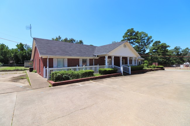
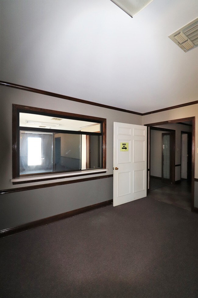
Property Detail
427 S Vine St
Monroe, LA
FROM THE NE COR OF BLK 42 OF ORIGINAL TOWN OF BASTROP PER PLAT IN NOT BK E, TH S 00 DEG 04 MIN W ALONG E LINE OF BLK 42 AND P
200538326
Morehouse
Commercialnec
Louisiana
0
c2
2025
0.26 AC
950800
Louisiana North Area
3,305 SF
Other Market Areas
NEARBY LISTINGS FOR SALE OR LEASE
DEMOGRAPHICS near 427 S Vine St
1 mile
3 mile
5 mile
2025 Total Population
4,336
13,410
16,528
2030 Population
4,190
12,801
15,756
Pop Growth 2025-2030
(3.37%)
(4.54%)
(4.67%)
Average Age
40
41
41
2025 Total Households
1,719
5,310
6,559
HH Growth 2025-2030
(3.49%)
(4.71%)
(4.85%)
Median Household Inc
$26,979
$33,077
$35,035
Avg Household Size
2.30
2.40
2.40
2025 Avg HH Vehicles
1.00
2.00
2.00
Median Home Value
$73,245
$96,590
$107,893
Median Year Built
1971
1973
1974
Nearby Places
Map Layers
Map Styles
 Street
 Aerial
Layers
 Traffic
 Biking
Places
Listings with unknown addresses are not visible on the map
- Restaurants
- Banks
- Shops
- Fitness
- Groceries
PUBLIC TRANSPORTATION
AIRPORT
Monroe Regional
Drive
Walk
Distance
Monroe Regional
35 min
26.5 mi
SALE & LEASE HISTORY
LISTING DATE
SALE/LEASE

Sep 27, 2019
For Lease
Sep 27, 2019
For Sale
Jan 10, 2025
For Sale
Nearby Properties
Address
Land Use
TOTAL SIZE
Lot Size
Zoning
Address
Land Use
TOTAL SIZE
Lot Size
Zoning
61,904 SF
4.51 AC
Address
Land Use
TOTAL SIZE
Lot Size
Zoning
Address
Land Use
TOTAL SIZE
Lot Size
Zoning
197,062 SF
23.12 AC
Address
Land Use
TOTAL SIZE
Lot Size
Zoning
0.61 AC
Address
Land Use
TOTAL SIZE
Lot Size
Zoning
61,738 SF
6 AC
Address
Land Use
TOTAL SIZE
Lot Size
Zoning
Address
Land Use
TOTAL SIZE
Lot Size
Zoning
153,814 SF
6.17 AC
Address
Land Use
TOTAL SIZE
Lot Size
Zoning
100,393 SF
21.56 AC
Address
Land Use
TOTAL SIZE
Lot Size
Zoning
0.11 AC
Address
Land Use
TOTAL SIZE
Lot Size
Zoning
37,319 SF
3.49 AC
Address
Land Use
TOTAL SIZE
Lot Size
Zoning
128,609 SF
20 AC
Address
Land Use
TOTAL SIZE
Lot Size
Zoning
60,638 SF
0.80 AC
Address
Land Use
TOTAL SIZE
Lot Size
Zoning
Address
Land Use
TOTAL SIZE
Lot Size
Zoning
95,592 SF
19.93 AC
Address
Land Use
TOTAL SIZE
Lot Size
Zoning
Address
Land Use
TOTAL SIZE
Lot Size
Zoning
117,226 SF
16.80 AC
Address
Land Use
TOTAL SIZE
Lot Size
Zoning
50,822 SF
3.45 AC
Address
Land Use
TOTAL SIZE
Lot Size
Zoning
40,915 SF
25 AC
Address
Land Use
TOTAL SIZE
Lot Size
Zoning
Address
Land Use
TOTAL SIZE
Lot Size
Zoning
Address
Land Use
TOTAL SIZE
Lot Size
Zoning
29.02 AC
Address
Land Use
TOTAL SIZE
Lot Size
Zoning
10,322 SF
12.69 AC
Address
Land Use
TOTAL SIZE
Lot Size
Zoning
35,900 SF
12 AC
Address
Land Use
TOTAL SIZE
Lot Size
Zoning
Address
Land Use
TOTAL SIZE
Lot Size
Zoning
58,378 SF
0.25 AC
Address
Land Use
TOTAL SIZE
Lot Size
Zoning
46,606 SF
9 AC
Address
Land Use
TOTAL SIZE
Lot Size
Zoning
57,725 SF
6 AC
Address
Land Use
TOTAL SIZE
Lot Size
Zoning
23,552 SF
4 AC
Address
Land Use
TOTAL SIZE
Lot Size
Zoning
49,414 SF
11 AC
Address
Land Use
TOTAL SIZE
Lot Size
Zoning
18,900 SF
3.70 AC
The World's #1 Commercial Real Estate Marketplace
Connect with us
© 2026 CoStar Group
The information above has been obtained from sources believed reliable. While we do not doubt its accuracy we have not verified it and make no guarantee, warranty or representation about it. It is your responsibility to independently confirm its accuracy and completeness. Any projections, opinions, assumptions, or estimates used are for example only and do not represent the current or future performance of the property. The value of this transaction to you depends on tax and other factors which should be evaluated by your tax, financial, and legal advisors. You and your advisors should conduct a careful, independent investigation of the property to determine to your satisfaction the suitability of the property for your needs.