No Photo
Property Record
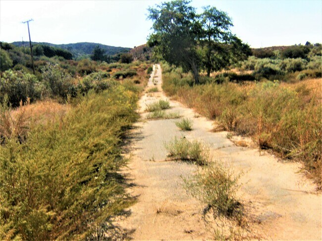
42701 Vac Vic Ranch Club Rd Montello Rd, Palmdale, CA 93551


NEARBY LISTINGS FOR SALE OR LEASE
Property Detail
42701 Vac Vic Ranch Club Rd Montello Rd
Los Angeles-Long Beach-Glendale, CA
20 ACS W 1/2 OF SW 1/4 OF NW 1/4 OF SEC 32 T 7N R 14W
3225-001-007
Los Angeles
Residentialacreage
California
D
32
06037C0370F
19.88 AC
2024
Santa Clarita Valley
2025
Los Angeles
910216
DEMOGRAPHICS near 42701 Vac Vic Ranch Club Rd Montello Rd
1 Mile
3 Mile
5 Mile
2024 Total Population
1,375
2,401
3,194
2029 Population
1,314
2,308
3,072
Pop Growth 2024-2029
(4.44%)
(3.87%)
(3.82%)
Average Age
42
43
43
2024 Total Households
573
993
1,317
HH Growth 2024-2029
(4.89%)
(4.13%)
(4.18%)
Median Household Inc
$89,434
$88,999
$88,343
Avg Household Size
2.40
2.40
2.40
2024 Avg HH Vehicles
3.00
2.00
2.00
Median Home Value
$347,468
$361,538
$379,660
Median Year Built
1982
1979
1979
Nearby Places
Map Layers
Map Styles
 Street
 Aerial
- Restaurants
- Banks
- Shops
- Fitness
- Groceries
SALE & LEASE HISTORY
LISTING DATE
SALE/LEASE

Aug 15, 2022
For Sale
Apr 15, 2024
For Sale
Apr 15, 2021
For Sale
Nearby Properties
Address
Land Use
TOTAL SIZE
Lot Size
Zoning
Address
Land Use
TOTAL SIZE
Lot Size
Zoning
46,246 SF
27.79 AC
LCRR1-A11*
Address
Land Use
TOTAL SIZE
Lot Size
Zoning
20,628 SF
40.10 AC
LCA11*
Address
Land Use
TOTAL SIZE
Lot Size
Zoning
5,986 SF
159.80 AC
LCA22*
Address
Land Use
TOTAL SIZE
Lot Size
Zoning
360 SF
73.69 AC
LCRR1*
Address
Land Use
TOTAL SIZE
Lot Size
Zoning
3,058 SF
0.35 AC
LCR17500*
Address
Land Use
TOTAL SIZE
Lot Size
Zoning
139.80 AC
LCA25*
Address
Land Use
TOTAL SIZE
Lot Size
Zoning
71.77 AC
LCR17500*
Address
Land Use
TOTAL SIZE
Lot Size
Zoning
6,165 SF
3.42 AC
LCRR1*
Address
Land Use
TOTAL SIZE
Lot Size
Zoning
13,676 SF
39.19 AC
LCRR1-A11*
Address
Land Use
TOTAL SIZE
Lot Size
Zoning
1,364 SF
121.26 AC
LCA22*
Address
Land Use
TOTAL SIZE
Lot Size
Zoning
10,020 SF
7.02 AC
LCA21-RR75
Address
Land Use
TOTAL SIZE
Lot Size
Zoning
78.75 AC
LCA121/2*
Address
Land Use
TOTAL SIZE
Lot Size
Zoning
2,556 SF
0.39 AC
LCRR1*
Address
Land Use
TOTAL SIZE
Lot Size
Zoning
904 SF
0.23 AC
LCC2*
Address
Land Use
TOTAL SIZE
Lot Size
Zoning
320 SF
32.76 AC
LCA21-RR75
Address
Land Use
TOTAL SIZE
Lot Size
Zoning
3,696 SF
31.57 AC
LCRR1*
Address
Land Use
TOTAL SIZE
Lot Size
Zoning
32.50 AC
LCA21-RR75
Address
Land Use
TOTAL SIZE
Lot Size
Zoning
3,370 SF
14.22 AC
LCRR1*
Address
Land Use
TOTAL SIZE
Lot Size
Zoning
4,164 SF
0.91 AC
LCC4*
Address
Land Use
TOTAL SIZE
Lot Size
Zoning
26.14 AC
LCA21-R175
Address
Land Use
TOTAL SIZE
Lot Size
Zoning
3,504 SF
1.87 AC
LCA1
Address
Land Use
TOTAL SIZE
Lot Size
Zoning
880 SF
25.24 AC
LCRR1*
Address
Land Use
TOTAL SIZE
Lot Size
Zoning
3,530 SF
74.65 AC
LCN 2
Address
Land Use
TOTAL SIZE
Lot Size
Zoning
59.43 AC
LCA22*
Address
Land Use
TOTAL SIZE
Lot Size
Zoning
54.75 AC
LCA22*
Address
Land Use
TOTAL SIZE
Lot Size
Zoning
98.60 AC
LCA22*
Address
Land Use
TOTAL SIZE
Lot Size
Zoning
20.09 AC
LCA21-RR75
Address
Land Use
TOTAL SIZE
Lot Size
Zoning
46.07 AC
LCA25*
Address
Land Use
TOTAL SIZE
Lot Size
Zoning
20.37 AC
LCA21-RR75
Address
Land Use
TOTAL SIZE
Lot Size
Zoning
46.47 AC
LCRR1*
The World's #1 Commercial Real Estate Marketplace
Connect with us
© 2026 CoStar Group
The information above has been obtained from sources believed reliable. While we do not doubt its accuracy we have not verified it and make no guarantee, warranty or representation about it. It is your responsibility to independently confirm its accuracy and completeness. Any projections, opinions, assumptions, or estimates used are for example only and do not represent the current or future performance of the property. The value of this transaction to you depends on tax and other factors which should be evaluated by your tax, financial, and legal advisors. You and your advisors should conduct a careful, independent investigation of the property to determine to your satisfaction the suitability of the property for your needs.