Property Record
42722 Trade West Dr, Sterling, VA 20166


NEARBY LISTINGS FOR SALE OR LEASE
Property Detail
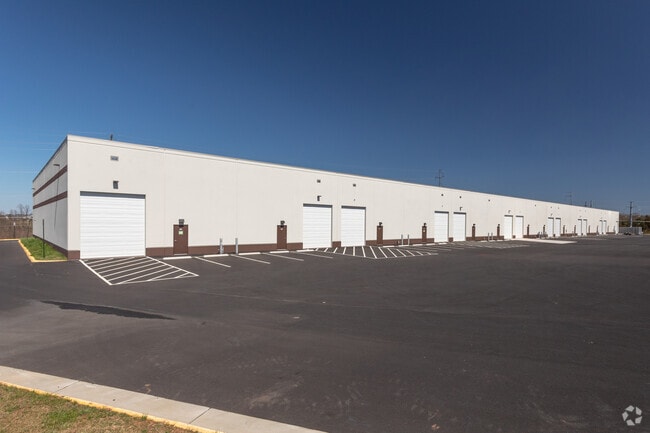
42722 Trade West Dr
Washington-Arlington-Alexandria, DC-VA-MD-WV
Dulles Trade Center West
161-18-2528
DULLES TRADE CENTER WEST LOT 7A 201903060010801/2P
Warehouse
Loudoun
AE
Virginia
51107C0360E
7a
2025
11.40 AC
2025
Rt 28/Dulles North
611812
Washington, DC
124,262 SF
DEMOGRAPHICS near 42722 Trade West Dr
1 Mile
3 Mile
5 Mile
2024 Total Population
6,773
74,992
151,827
2029 Population
7,443
81,335
164,482
Pop Growth 2024-2029
+ 9.89%
+ 8.46%
+ 8.34%
Average Age
34
34
34
2024 Total Households
2,086
23,198
46,560
HH Growth 2024-2029
+ 10.02%
+ 8.57%
+ 8.51%
Median Household Inc
$215,084
$185,867
$182,055
Avg Household Size
3.20
3.20
3.20
2024 Avg HH Vehicles
2.00
2.00
2.00
Median Home Value
$775,924
$723,325
$730,071
Median Year Built
2011
2010
2009
Nearby Places
Map Layers
Map Styles
 Street
 Aerial
- Restaurants
- Banks
- Shops
- Fitness
- Groceries
PUBLIC TRANSPORTATION
AIRPORT
Washington Dulles International
DRIVE
WALK
Distance
Washington Dulles International
22 min
10.1 mi
Ronald Reagan Washington Ntl
DRIVE
WALK
Distance
Ronald Reagan Washington Ntl
52 min
33.7 mi
Freight Ports
Port of Baltimore
DRIVE
WALK
Distance
Port of Baltimore
94 min
67.9 mi
SALE & LEASE HISTORY
LISTING DATE
SALE/LEASE

Dec 14, 2018
For Lease
Apr 06, 2022
For Lease
Apr 02, 2022
For Lease
Nearby Properties
Address
Land Use
TOTAL SIZE
Lot Size
Zoning
Address
Land Use
TOTAL SIZE
Lot Size
Zoning
415,477 SF
97.76 AC
TR1UBF
Address
Land Use
TOTAL SIZE
Lot Size
Zoning
326.06 AC
GI
Address
Land Use
TOTAL SIZE
Lot Size
Zoning
222,313 SF
36.21 AC
PDOP
Address
Land Use
TOTAL SIZE
Lot Size
Zoning
378,278 SF
112.87 AC
PDGI
Address
Land Use
TOTAL SIZE
Lot Size
Zoning
422,597 SF
85.43 AC
TR3UBF
Address
Land Use
TOTAL SIZE
Lot Size
Zoning
48.30 AC
PDIP
Address
Land Use
TOTAL SIZE
Lot Size
Zoning
59.20 AC
IP
Address
Land Use
TOTAL SIZE
Lot Size
Zoning
264,155 SF
10.95 AC
PDTRC
Address
Land Use
TOTAL SIZE
Lot Size
Zoning
230.43 AC
PDGI
Address
Land Use
TOTAL SIZE
Lot Size
Zoning
181,718 SF
10.23 AC
R16
Address
Land Use
TOTAL SIZE
Lot Size
Zoning
303,168 SF
41.95 AC
PDCCRC
Address
Land Use
TOTAL SIZE
Lot Size
Zoning
259,361 SF
65.01 AC
PDH4
Address
Land Use
TOTAL SIZE
Lot Size
Zoning
264,902 SF
60.25 AC
PDH4
Address
Land Use
TOTAL SIZE
Lot Size
Zoning
54 AC
PDTC
Address
Land Use
TOTAL SIZE
Lot Size
Zoning
39.89 AC
PDGI
Address
Land Use
TOTAL SIZE
Lot Size
Zoning
128,948 SF
11.16 AC
PDH4
Address
Land Use
TOTAL SIZE
Lot Size
Zoning
126,263 SF
9.09 AC
PDH4
Address
Land Use
TOTAL SIZE
Lot Size
Zoning
107,378 SF
16.86 AC
PDH4
Address
Land Use
TOTAL SIZE
Lot Size
Zoning
169,872 SF
33.51 AC
PDH4
Address
Land Use
TOTAL SIZE
Lot Size
Zoning
319,600 SF
21.39 AC
PDGI
Address
Land Use
TOTAL SIZE
Lot Size
Zoning
72.66 AC
PDAAAR
Address
Land Use
TOTAL SIZE
Lot Size
Zoning
108,231 SF
26.10 AC
PDH4
Address
Land Use
TOTAL SIZE
Lot Size
Zoning
108,037 SF
18.49 AC
PDCCSC
Address
Land Use
TOTAL SIZE
Lot Size
Zoning
241,429 SF
9.03 AC
PDH4
Address
Land Use
TOTAL SIZE
Lot Size
Zoning
157,520 SF
29.91 AC
PDH4
Address
Land Use
TOTAL SIZE
Lot Size
Zoning
83,185 SF
10.03 AC
PDH4
The World's #1 Commercial Real Estate Marketplace
Connect with us
© 2026 CoStar Group
The information above has been obtained from sources believed reliable. While we do not doubt its accuracy we have not verified it and make no guarantee, warranty or representation about it. It is your responsibility to independently confirm its accuracy and completeness. Any projections, opinions, assumptions, or estimates used are for example only and do not represent the current or future performance of the property. The value of this transaction to you depends on tax and other factors which should be evaluated by your tax, financial, and legal advisors. You and your advisors should conduct a careful, independent investigation of the property to determine to your satisfaction the suitability of the property for your needs.