Property Record
4273 New Holland Rd, Mohnton, PA 19540
NEARBY LISTINGS FOR SALE OR LEASE
-
-
View all Mohnton listings for sale on LoopNet.com
Property Detail
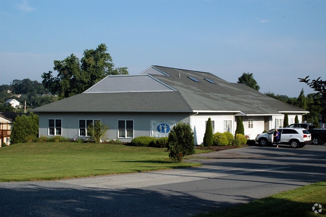
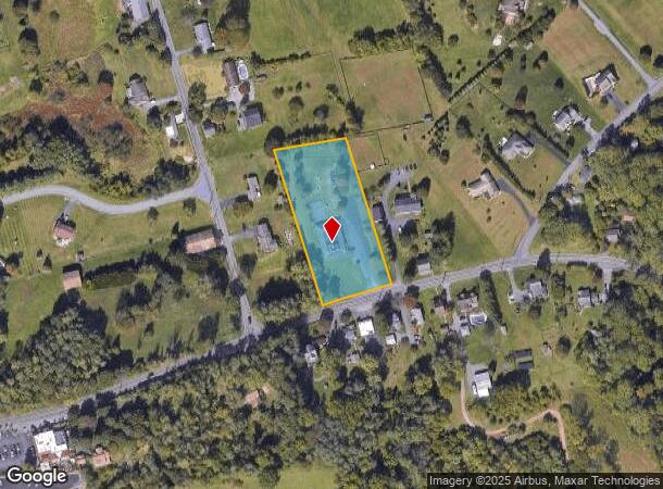
4273 New Holland Rd
34-4393-01-28-0858
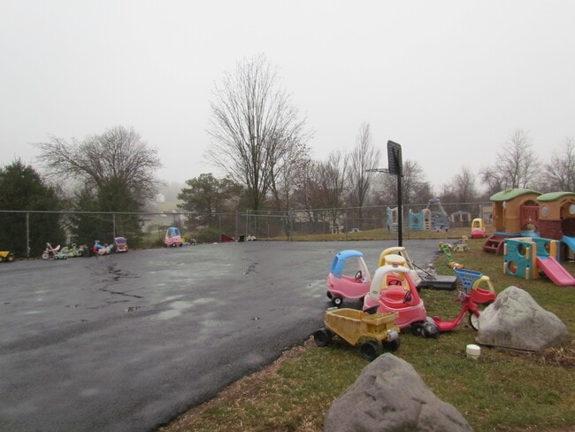
Hammond Heights Comm
Daycare
Berks
X
Pennsylvania
42011C0513G
1
2025
1.99 AC
2025
Berks County
011702
Philadelphia
5,190 SF
Reading, PA
DEMOGRAPHICS near 4273 New Holland Rd
1 Mile
3 Mile
5 Mile
2024 Total Population
1,297
11,728
57,001
2029 Population
1,313
11,782
57,138
Pop Growth 2024-2029
+ 1.23%
+ 0.46%
+ 0.24%
Average Age
45
44
43
2024 Total Households
510
4,643
22,643
HH Growth 2024-2029
+ 1.18%
+ 0.45%
+ 0.24%
Median Household Inc
$119,132
$93,309
$85,092
Avg Household Size
2.50
2.50
2.50
2024 Avg HH Vehicles
3.00
2.00
2.00
Median Home Value
$314,000
$279,056
$237,025
Median Year Built
1983
1978
1975
Nearby Places
Map Layers
Map Styles
 Street
 Aerial
- Restaurants
- Banks
- Shops
- Fitness
- Groceries
SALE & LEASE HISTORY
LISTING DATE
SALE/LEASE

Jan 05, 2022
For Sale
Nearby Properties
Address
Land Use
TOTAL SIZE
Lot Size
Zoning
Address
Land Use
TOTAL SIZE
Lot Size
Zoning
120,390 SF
12.65 AC
Address
Land Use
TOTAL SIZE
Lot Size
Zoning
16,640 SF
9.90 AC
Address
Land Use
TOTAL SIZE
Lot Size
Zoning
6,624 SF
103.60 AC
AG
Address
Land Use
TOTAL SIZE
Lot Size
Zoning
5,430 SF
106.50 AC
AG
Address
Land Use
TOTAL SIZE
Lot Size
Zoning
22,672 SF
4.57 AC
Address
Land Use
TOTAL SIZE
Lot Size
Zoning
28,140 SF
208.09 AC
Address
Land Use
TOTAL SIZE
Lot Size
Zoning
6,154 SF
66.85 AC
AG
Address
Land Use
TOTAL SIZE
Lot Size
Zoning
79,142 SF
10.38 AC
Address
Land Use
TOTAL SIZE
Lot Size
Zoning
3,650 SF
85.90 AC
FR
Address
Land Use
TOTAL SIZE
Lot Size
Zoning
7,144 SF
48.70 AC
AG
Address
Land Use
TOTAL SIZE
Lot Size
Zoning
60,638 SF
7.21 AC
Address
Land Use
TOTAL SIZE
Lot Size
Zoning
14,880 SF
4.49 AC
Address
Land Use
TOTAL SIZE
Lot Size
Zoning
3,872 SF
61.10 AC
AG
Address
Land Use
TOTAL SIZE
Lot Size
Zoning
20,344 SF
9.70 AC
AG
Address
Land Use
TOTAL SIZE
Lot Size
Zoning
2,896 SF
32.70 AC
AG
Address
Land Use
TOTAL SIZE
Lot Size
Zoning
4,044 SF
40.80 AC
AG
Address
Land Use
TOTAL SIZE
Lot Size
Zoning
5,040 SF
20.40 AC
AG
Address
Land Use
TOTAL SIZE
Lot Size
Zoning
29,546 SF
3.51 AC
Address
Land Use
TOTAL SIZE
Lot Size
Zoning
5,522 SF
26.86 AC
AG
Address
Land Use
TOTAL SIZE
Lot Size
Zoning
3,309 SF
52.10 AC
AG
Address
Land Use
TOTAL SIZE
Lot Size
Zoning
6,914 SF
19.50 AC
AG
Address
Land Use
TOTAL SIZE
Lot Size
Zoning
Address
Land Use
TOTAL SIZE
Lot Size
Zoning
6,208 SF
17.50 AC
FR
Address
Land Use
TOTAL SIZE
Lot Size
Zoning
22,308 SF
0.92 AC
Address
Land Use
TOTAL SIZE
Lot Size
Zoning
3,936 SF
26.60 AC
AG
Address
Land Use
TOTAL SIZE
Lot Size
Zoning
6,148 SF
23.37 AC
Address
Land Use
TOTAL SIZE
Lot Size
Zoning
44,901 SF
2.56 AC
Address
Land Use
TOTAL SIZE
Lot Size
Zoning
17,250 SF
4.37 AC
Address
Land Use
TOTAL SIZE
Lot Size
Zoning
3,024 SF
32.90 AC
Address
Land Use
TOTAL SIZE
Lot Size
Zoning
5,616 SF
19.30 AC
AG
The World's #1 Commercial Real Estate Marketplace
Connect with us
© 2025 CoStar Group
The information above has been obtained from sources believed reliable. While we do not doubt its accuracy we have not verified it and make no guarantee, warranty or representation about it. It is your responsibility to independently confirm its accuracy and completeness. Any projections, opinions, assumptions, or estimates used are for example only and do not represent the current or future performance of the property. The value of this transaction to you depends on tax and other factors which should be evaluated by your tax, financial, and legal advisors. You and your advisors should conduct a careful, independent investigation of the property to determine to your satisfaction the suitability of the property for your needs.