Property Record
4275 Us Highway 98 N, Lakeland, FL 33809


NEARBY LISTINGS FOR SALE OR LEASE
Property Detail
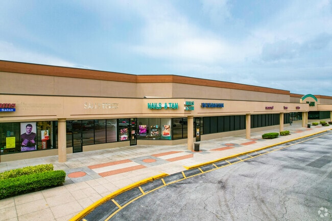
4275 Us Highway 98 N
23-27-36-000000-033020
Baulac Park
Regionalshoppingcenterormallwithanchorstore
COMM NW COR CAMBRIDGE ON THE GREEN RUN S 674.37 FT W 297.67 FT N 290 FT W 317.5 FT N 400.54 FT TO R/W ELY ALONG CURVE ON R/W 186.91 FT E ALONG R/W 429.19 FT TO POB
A
Polk
12105C0301G
Florida
2024
7.43 AC
2025
Polk County
012209
Tampa/St Petersburg
81,060 SF
Lakeland-Winter Haven, FL
DEMOGRAPHICS near 4275 Us Highway 98 N
1 Mile
3 Mile
5 Mile
2024 Total Population
11,105
59,975
139,287
2029 Population
13,238
71,574
166,217
Pop Growth 2024-2029
+ 19.21%
+ 19.34%
+ 19.33%
Average Age
42
41
40
2024 Total Households
4,759
23,756
53,295
HH Growth 2024-2029
+ 19.10%
+ 19.23%
+ 19.60%
Median Household Inc
$55,479
$52,837
$52,150
Avg Household Size
2.20
2.40
2.40
2024 Avg HH Vehicles
2.00
2.00
2.00
Median Home Value
$212,139
$188,757
$193,681
Median Year Built
1989
1989
1986
Nearby Places
Map Layers
Map Styles
 Street
 Aerial
- Restaurants
- Banks
- Shops
- Fitness
- Groceries
PUBLIC TRANSPORTATION
COMMUTER RAIL
Lakeland (Silver Star - Amtrak)
DRIVE
WALK
Distance
Lakeland (Silver Star - Amtrak)
9 min
4.4 mi
Freight Ports
Port of Tampa Bay
DRIVE
WALK
Distance
Port of Tampa Bay
45 min
34.8 mi
Nearby Properties
Address
Land Use
TOTAL SIZE
Lot Size
Zoning
Address
Land Use
TOTAL SIZE
Lot Size
Zoning
2,325,080 SF
27.05 AC
PUD
Address
Land Use
TOTAL SIZE
Lot Size
Zoning
493,501 SF
39.01 AC
MF12
Address
Land Use
TOTAL SIZE
Lot Size
Zoning
470,032 SF
23.21 AC
Address
Land Use
TOTAL SIZE
Lot Size
Zoning
1,091,160 SF
133.41 AC
PUD
Address
Land Use
TOTAL SIZE
Lot Size
Zoning
363,693 SF
22.54 AC
R2
Address
Land Use
TOTAL SIZE
Lot Size
Zoning
361,669 SF
12.73 AC
Address
Land Use
TOTAL SIZE
Lot Size
Zoning
279,726 SF
19.09 AC
C3
Address
Land Use
TOTAL SIZE
Lot Size
Zoning
246,838 SF
24.57 AC
PUD
Address
Land Use
TOTAL SIZE
Lot Size
Zoning
762,259 SF
24.95 AC
PUD
Address
Land Use
TOTAL SIZE
Lot Size
Zoning
208,898 SF
17.62 AC
PUD
Address
Land Use
TOTAL SIZE
Lot Size
Zoning
258,946 SF
11.73 AC
O3
Address
Land Use
TOTAL SIZE
Lot Size
Zoning
79,697 SF
6.37 AC
C2
Address
Land Use
TOTAL SIZE
Lot Size
Zoning
324,191 SF
23.37 AC
PUD
Address
Land Use
TOTAL SIZE
Lot Size
Zoning
169,546 SF
14.40 AC
PUD
Address
Land Use
TOTAL SIZE
Lot Size
Zoning
226,953 SF
34.42 AC
Address
Land Use
TOTAL SIZE
Lot Size
Zoning
425,986 SF
45.72 AC
C5
Address
Land Use
TOTAL SIZE
Lot Size
Zoning
171,525 SF
40.58 AC
RC
Address
Land Use
TOTAL SIZE
Lot Size
Zoning
115,608 SF
11.44 AC
RC
Address
Land Use
TOTAL SIZE
Lot Size
Zoning
142,936 SF
26.38 AC
Address
Land Use
TOTAL SIZE
Lot Size
Zoning
156,987 SF
51.52 AC
Address
Land Use
TOTAL SIZE
Lot Size
Zoning
101,501 SF
16.54 AC
Address
Land Use
TOTAL SIZE
Lot Size
Zoning
180,802 SF
76.35 AC
Address
Land Use
TOTAL SIZE
Lot Size
Zoning
210,000 SF
12.91 AC
Address
Land Use
TOTAL SIZE
Lot Size
Zoning
292,124 SF
29.70 AC
PUD
Address
Land Use
TOTAL SIZE
Lot Size
Zoning
210,000 SF
13.28 AC
Address
Land Use
TOTAL SIZE
Lot Size
Zoning
87,975 SF
5.45 AC
O1
Address
Land Use
TOTAL SIZE
Lot Size
Zoning
226,634 SF
27.21 AC
C3
Address
Land Use
TOTAL SIZE
Lot Size
Zoning
183,800 SF
19.26 AC
Address
Land Use
TOTAL SIZE
Lot Size
Zoning
171,629 SF
14.91 AC
RA4
Address
Land Use
TOTAL SIZE
Lot Size
Zoning
206,724 SF
66.04 AC
RC
The World's #1 Commercial Real Estate Marketplace
Connect with us
© 2026 CoStar Group
The information above has been obtained from sources believed reliable. While we do not doubt its accuracy we have not verified it and make no guarantee, warranty or representation about it. It is your responsibility to independently confirm its accuracy and completeness. Any projections, opinions, assumptions, or estimates used are for example only and do not represent the current or future performance of the property. The value of this transaction to you depends on tax and other factors which should be evaluated by your tax, financial, and legal advisors. You and your advisors should conduct a careful, independent investigation of the property to determine to your satisfaction the suitability of the property for your needs.