Property Record
428 County Road 513, Califon, NJ 07830


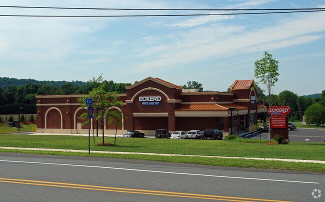
Property Detail
428 County Road 513
04-00002-0000-00003
HUNTERDON
Storebuilding
New Jersey
R-3
3
B and X Area of moderate flood hazard, usually the area between the limits of the 100-year and 500-year floods.
2.45 AC
2025
Route 78 West
2026
Northern New Jersey
010202
Newark, NJ
13,224 SF
NEARBY LISTINGS FOR SALE OR LEASE
DEMOGRAPHICS near 428 County Road 513
1 mile
3 mile
5 mile
2025 Total Population
1,649
7,364
22,003
2030 Population
1,677
7,474
22,338
Pop Growth 2025-2030
+ 1.70%
+ 1.49%
+ 1.52%
Average Age
45
45
44
2025 Total Households
640
2,716
7,907
HH Growth 2025-2030
+ 1.72%
+ 1.58%
+ 1.71%
Median Household Inc
$133,604
$155,544
$155,722
Avg Household Size
2.60
2.60
2.60
2025 Avg HH Vehicles
2.00
2.00
2.00
Median Home Value
$437,626
$601,810
$587,101
Median Year Built
1965
1973
1974
Nearby Places
Map Layers
Map Styles
 Street
 Aerial
Layers
 Traffic
 Biking
Places
Listings with unknown addresses are not visible on the map
- Restaurants
- Banks
- Shops
- Fitness
- Groceries
PUBLIC TRANSPORTATION
COMMUTER RAIL
High Bridge (Raritan Valley Line - NJ Transit Commuter Rail (NJ Transit))
Drive
Walk
Distance
High Bridge (Raritan Valley Line - NJ Transit Commuter Rail (NJ Transit))
8 min
5.4 mi
Annandale (Raritan Valley Line - NJ Transit Commuter Rail (NJ Transit))
Drive
Walk
Distance
Annandale (Raritan Valley Line - NJ Transit Commuter Rail (NJ Transit))
15 min
7.4 mi
AIRPORT
Trenton Mercer
Drive
Walk
Distance
Trenton Mercer
59 min
37.1 mi
Lehigh Valley International
Drive
Walk
Distance
Lehigh Valley International
61 min
40.2 mi
Freight Ports
Maher Terminal
Drive
Walk
Distance
Maher Terminal
66 min
46.8 mi
Nearby Properties
Address
Land Use
TOTAL SIZE
Lot Size
Zoning
Address
Land Use
TOTAL SIZE
Lot Size
Zoning
56.97 AC
R3
Address
Land Use
TOTAL SIZE
Lot Size
Zoning
59,942 SF
20.09 AC
R-5
Address
Land Use
TOTAL SIZE
Lot Size
Zoning
26.52 AC
RC
Address
Land Use
TOTAL SIZE
Lot Size
Zoning
3,823 SF
165 AC
RC
Address
Land Use
TOTAL SIZE
Lot Size
Zoning
2,544 SF
562.37 AC
RC
Address
Land Use
TOTAL SIZE
Lot Size
Zoning
5.70 AC
R-5
Address
Land Use
TOTAL SIZE
Lot Size
Zoning
16,580 SF
25.53 AC
RC
Address
Land Use
TOTAL SIZE
Lot Size
Zoning
64.75 AC
R-5
Address
Land Use
TOTAL SIZE
Lot Size
Zoning
66.80 AC
RC
Address
Land Use
TOTAL SIZE
Lot Size
Zoning
19,905 SF
1.92 AC
R-3
Address
Land Use
TOTAL SIZE
Lot Size
Zoning
2,368 SF
227.39 AC
R3
Address
Land Use
TOTAL SIZE
Lot Size
Zoning
32,049 SF
3.99 AC
B1
Address
Land Use
TOTAL SIZE
Lot Size
Zoning
1,520 SF
302.94 AC
RC
Address
Land Use
TOTAL SIZE
Lot Size
Zoning
44,502 SF
16.86 AC
I
Address
Land Use
TOTAL SIZE
Lot Size
Zoning
6,080 SF
37.09 AC
RC
Address
Land Use
TOTAL SIZE
Lot Size
Zoning
28,530 SF
3.09 AC
HB
Address
Land Use
TOTAL SIZE
Lot Size
Zoning
2,540 SF
250.02 AC
RC
Address
Land Use
TOTAL SIZE
Lot Size
Zoning
12,205 SF
2.25 AC
HL
Address
Land Use
TOTAL SIZE
Lot Size
Zoning
12,300 SF
4.29 AC
HL
Address
Land Use
TOTAL SIZE
Lot Size
Zoning
2,738 SF
2.13 AC
HB
Address
Land Use
TOTAL SIZE
Lot Size
Zoning
9,807 SF
4 AC
HL
Address
Land Use
TOTAL SIZE
Lot Size
Zoning
5,684 SF
5.08 AC
R1.5
Address
Land Use
TOTAL SIZE
Lot Size
Zoning
7,452 SF
3 AC
HL
Address
Land Use
TOTAL SIZE
Lot Size
Zoning
11,111 SF
60.68 AC
HL
Address
Land Use
TOTAL SIZE
Lot Size
Zoning
Address
Land Use
TOTAL SIZE
Lot Size
Zoning
7,865 SF
1.34 AC
RC
Address
Land Use
TOTAL SIZE
Lot Size
Zoning
6,524 SF
5.06 AC
R1.5
Address
Land Use
TOTAL SIZE
Lot Size
Zoning
8,006 SF
1 AC
HL
Address
Land Use
TOTAL SIZE
Lot Size
Zoning
9,232 SF
8 AC
HL
The World's #1 Commercial Real Estate Marketplace
Connect with us
© 2026 CoStar Group
The information above has been obtained from sources believed reliable. While we do not doubt its accuracy we have not verified it and make no guarantee, warranty or representation about it. It is your responsibility to independently confirm its accuracy and completeness. Any projections, opinions, assumptions, or estimates used are for example only and do not represent the current or future performance of the property. The value of this transaction to you depends on tax and other factors which should be evaluated by your tax, financial, and legal advisors. You and your advisors should conduct a careful, independent investigation of the property to determine to your satisfaction the suitability of the property for your needs.