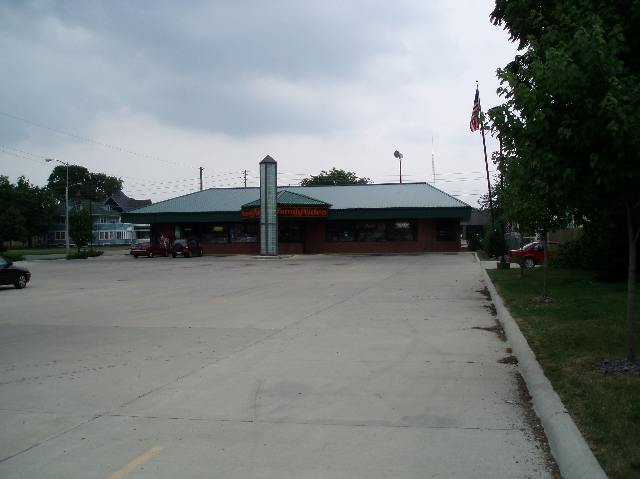
Property Record
220 Franklin St, Waterloo, IA 50703

NEARBY LISTINGS FOR SALE OR LEASE
Property Detail
220 Franklin St
Waterloo-Cedar Falls, IA
Original Plat Waterloo East
8913-24-311-029
ORIGINAL PLAT WATERLOO EAST LOTS 1 THRU 4 AND SE 38 FT NE 34 FT LOT 6 ALL IN BLK 35 EXC THAT PART OF LOT 2 BLK 35 THAT LIES
Storebuilding
Black Hawk
X
Iowa
19013C0189F
1-4,6
2024
0.85 AC
2025
Downtown Waterloo
000100
Other Market Areas
6,996 SF
DEMOGRAPHICS near 220 Franklin St
1 Mile
3 Mile
5 Mile
2024 Total Population
9,234
52,408
77,628
2029 Population
9,359
52,163
77,084
Pop Growth 2024-2029
+ 1.35%
(0.47%)
(0.70%)
Average Age
37
38
39
2024 Total Households
3,919
22,320
33,574
HH Growth 2024-2029
+ 1.66%
(0.44%)
(0.69%)
Median Household Inc
$26,401
$47,526
$54,088
Avg Household Size
2.10
2.20
2.20
2024 Avg HH Vehicles
1.00
2.00
2.00
Median Home Value
$77,817
$126,040
$143,819
Median Year Built
1952
1956
1961
Nearby Places
Map Layers
Map Styles
 Street
 Aerial
- Restaurants
- Banks
- Shops
- Fitness
- Groceries
SALE & LEASE HISTORY
LISTING DATE
SALE/LEASE

Sep 25, 2016
For Lease
Nearby Properties
Address
Land Use
TOTAL SIZE
Lot Size
Zoning
Address
Land Use
TOTAL SIZE
Lot Size
Zoning
596,653 SF
31.45 AC
Address
Land Use
TOTAL SIZE
Lot Size
Zoning
528,634 SF
13.33 AC
Address
Land Use
TOTAL SIZE
Lot Size
Zoning
108,671 SF
3.72 AC
Address
Land Use
TOTAL SIZE
Lot Size
Zoning
186,130 SF
10.89 AC
Address
Land Use
TOTAL SIZE
Lot Size
Zoning
622 SF
106.81 AC
Address
Land Use
TOTAL SIZE
Lot Size
Zoning
341 SF
1.83 AC
Address
Land Use
TOTAL SIZE
Lot Size
Zoning
37,364 SF
10.78 AC
Address
Land Use
TOTAL SIZE
Lot Size
Zoning
101,633 SF
7 AC
Address
Land Use
TOTAL SIZE
Lot Size
Zoning
110,177 SF
1.19 AC
Address
Land Use
TOTAL SIZE
Lot Size
Zoning
202,974 SF
19.11 AC
Address
Land Use
TOTAL SIZE
Lot Size
Zoning
279,063 SF
26.21 AC
Address
Land Use
TOTAL SIZE
Lot Size
Zoning
174,244 SF
34.27 AC
Address
Land Use
TOTAL SIZE
Lot Size
Zoning
9,000 SF
21.25 AC
Address
Land Use
TOTAL SIZE
Lot Size
Zoning
7,140 SF
25.91 AC
Address
Land Use
TOTAL SIZE
Lot Size
Zoning
59,565 SF
0.28 AC
Address
Land Use
TOTAL SIZE
Lot Size
Zoning
115,819 SF
2.07 AC
Address
Land Use
TOTAL SIZE
Lot Size
Zoning
129,863 SF
11.40 AC
Address
Land Use
TOTAL SIZE
Lot Size
Zoning
125,340 SF
0.80 AC
Address
Land Use
TOTAL SIZE
Lot Size
Zoning
97,401 SF
21.83 AC
Address
Land Use
TOTAL SIZE
Lot Size
Zoning
60,496 SF
4.96 AC
Address
Land Use
TOTAL SIZE
Lot Size
Zoning
197,968 SF
6.10 AC
Address
Land Use
TOTAL SIZE
Lot Size
Zoning
82,449 SF
10.62 AC
Address
Land Use
TOTAL SIZE
Lot Size
Zoning
41,999 SF
10.74 AC
Address
Land Use
TOTAL SIZE
Lot Size
Zoning
77,366 SF
38.51 AC
Address
Land Use
TOTAL SIZE
Lot Size
Zoning
70,933 SF
27.58 AC
Address
Land Use
TOTAL SIZE
Lot Size
Zoning
102,131 SF
9.16 AC
Address
Land Use
TOTAL SIZE
Lot Size
Zoning
18,000 SF
141.74 AC
Address
Land Use
TOTAL SIZE
Lot Size
Zoning
1,600 SF
9.51 AC
Address
Land Use
TOTAL SIZE
Lot Size
Zoning
84,388 SF
7.79 AC
Address
Land Use
TOTAL SIZE
Lot Size
Zoning
10,016 SF
The World's #1 Commercial Real Estate Marketplace
Connect with us
© 2025 CoStar Group
The information above has been obtained from sources believed reliable. While we do not doubt its accuracy we have not verified it and make no guarantee, warranty or representation about it. It is your responsibility to independently confirm its accuracy and completeness. Any projections, opinions, assumptions, or estimates used are for example only and do not represent the current or future performance of the property. The value of this transaction to you depends on tax and other factors which should be evaluated by your tax, financial, and legal advisors. You and your advisors should conduct a careful, independent investigation of the property to determine to your satisfaction the suitability of the property for your needs.