Property Record
428 E Maple St, Hartville, OH 44632


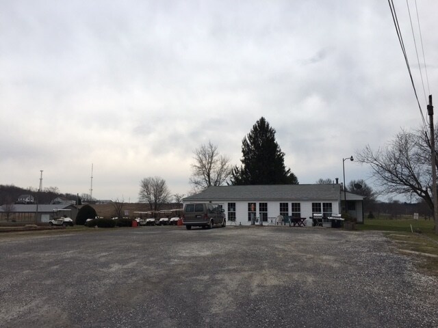
Property Detail
428 E Maple St
10011194
OL 302 - 16.70A
Vehiclerentalsvehiclesales
STARK
B and X Area of moderate flood hazard, usually the area between the limits of the 100-year and 500-year floods.
Ohio
0
16.70 AC
2025
Stark County
711002
Cleveland
9,314 SF
Canton-Massillon, OH
NEARBY LISTINGS FOR SALE OR LEASE
DEMOGRAPHICS near 428 E Maple St
1 mile
3 mile
5 mile
2025 Total Population
2,999
12,511
39,071
2030 Population
2,977
12,421
38,791
Pop Growth 2025-2030
(0.73%)
(0.72%)
(0.72%)
Average Age
42
42
42
2025 Total Households
1,231
4,789
14,864
HH Growth 2025-2030
(0.81%)
(0.77%)
(0.73%)
Median Household Inc
$68,032
$92,902
$92,148
Avg Household Size
2.40
2.60
2.60
2025 Avg HH Vehicles
2.00
2.00
2.00
Median Home Value
$269,615
$268,258
$262,994
Median Year Built
1971
1976
1977
Nearby Places
Map Layers
Map Styles
 Street
 Aerial
Transit
 Traffic
 Biking
Places
Listings with unknown addresses are not visible on the map
- Restaurants
- Banks
- Shops
- Fitness
- Groceries
PUBLIC TRANSPORTATION
AIRPORT
Akron-Canton Regional
Drive
Walk
Distance
Akron-Canton Regional
19 min
10.4 mi
Freight Ports
Port of Toledo
Drive
Walk
Distance
Port of Toledo
186 min
152.3 mi
SALE & LEASE HISTORY
LISTING DATE
SALE/LEASE

Mar 03, 2017
For Sale
Aug 16, 2017
For Sale
Apr 16, 2024
For Sale
Nearby Properties
Address
Land Use
TOTAL SIZE
Lot Size
Zoning
Address
Land Use
TOTAL SIZE
Lot Size
Zoning
220,250 SF
15.78 AC
Address
Land Use
TOTAL SIZE
Lot Size
Zoning
166,070 SF
5.50 AC
Address
Land Use
TOTAL SIZE
Lot Size
Zoning
Address
Land Use
TOTAL SIZE
Lot Size
Zoning
146,057 SF
37.51 AC
Address
Land Use
TOTAL SIZE
Lot Size
Zoning
128,922 SF
17.84 AC
Address
Land Use
TOTAL SIZE
Lot Size
Zoning
286,697 SF
18.04 AC
Address
Land Use
TOTAL SIZE
Lot Size
Zoning
162,939 SF
14.22 AC
Address
Land Use
TOTAL SIZE
Lot Size
Zoning
127,106 SF
20.28 AC
Address
Land Use
TOTAL SIZE
Lot Size
Zoning
Address
Land Use
TOTAL SIZE
Lot Size
Zoning
137,493 SF
11.61 AC
Address
Land Use
TOTAL SIZE
Lot Size
Zoning
52,728 SF
10.14 AC
Address
Land Use
TOTAL SIZE
Lot Size
Zoning
103,645 SF
29.83 AC
Address
Land Use
TOTAL SIZE
Lot Size
Zoning
46,002 SF
10.21 AC
Address
Land Use
TOTAL SIZE
Lot Size
Zoning
154,148 SF
15.85 AC
Address
Land Use
TOTAL SIZE
Lot Size
Zoning
23,797 SF
2.86 AC
Address
Land Use
TOTAL SIZE
Lot Size
Zoning
74,418 SF
396.24 AC
Address
Land Use
TOTAL SIZE
Lot Size
Zoning
5.85 AC
Address
Land Use
TOTAL SIZE
Lot Size
Zoning
133,300 SF
30.63 AC
Address
Land Use
TOTAL SIZE
Lot Size
Zoning
30,820 SF
5.59 AC
Address
Land Use
TOTAL SIZE
Lot Size
Zoning
30,389 SF
5.58 AC
Address
Land Use
TOTAL SIZE
Lot Size
Zoning
1,604 SF
101.15 AC
Address
Land Use
TOTAL SIZE
Lot Size
Zoning
Address
Land Use
TOTAL SIZE
Lot Size
Zoning
4,128 SF
257.85 AC
Address
Land Use
TOTAL SIZE
Lot Size
Zoning
14,921 SF
308.17 AC
Address
Land Use
TOTAL SIZE
Lot Size
Zoning
42,805 SF
26.69 AC
Address
Land Use
TOTAL SIZE
Lot Size
Zoning
27,106 SF
5.77 AC
Address
Land Use
TOTAL SIZE
Lot Size
Zoning
22,836 SF
4.15 AC
Address
Land Use
TOTAL SIZE
Lot Size
Zoning
24,749 SF
6.21 AC
Address
Land Use
TOTAL SIZE
Lot Size
Zoning
2,446 SF
170.40 AC
Address
Land Use
TOTAL SIZE
Lot Size
Zoning
57,620 SF
2.62 AC
The World's #1 Commercial Real Estate Marketplace
Connect with us
© 2026 CoStar Group
The information above has been obtained from sources believed reliable. While we do not doubt its accuracy we have not verified it and make no guarantee, warranty or representation about it. It is your responsibility to independently confirm its accuracy and completeness. Any projections, opinions, assumptions, or estimates used are for example only and do not represent the current or future performance of the property. The value of this transaction to you depends on tax and other factors which should be evaluated by your tax, financial, and legal advisors. You and your advisors should conduct a careful, independent investigation of the property to determine to your satisfaction the suitability of the property for your needs.