Property Record
428 Harold L Dow Hwy, Eliot, ME 03903


NEARBY LISTINGS FOR SALE OR LEASE
Property Detail
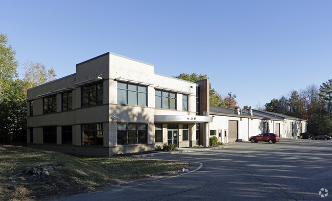
428 Harold L Dow Hwy
Manufacturinglight
York
A
Maine
23031C0645G
5.10 AC
2024
York County
2024
Portland/South Portland
037000
Portland-South Portland, ME
21,600 SF
ELIO-000045-000011
DEMOGRAPHICS near 428 Harold L Dow Hwy
1 Mile
3 Mile
5 Mile
2024 Total Population
333
8,826
34,573
2029 Population
347
9,221
36,265
Pop Growth 2024-2029
+ 4.20%
+ 4.48%
+ 4.89%
Average Age
44
45
44
2024 Total Households
132
3,610
15,321
HH Growth 2024-2029
+ 3.79%
+ 4.43%
+ 4.91%
Median Household Inc
$88,281
$101,015
$99,863
Avg Household Size
2.50
2.40
2.20
2024 Avg HH Vehicles
2.00
2.00
2.00
Median Home Value
$431,818
$421,086
$430,213
Median Year Built
1980
1979
1978
Nearby Places
Map Layers
Map Styles
 Street
 Aerial
- Restaurants
- Banks
- Shops
- Fitness
- Groceries
PUBLIC TRANSPORTATION
COMMUTER RAIL
Dover (Downeaster - Amtrak)
DRIVE
WALK
Distance
Dover (Downeaster - Amtrak)
14 min
7.1 mi
AIRPORT
Portsmouth International at Pease
DRIVE
WALK
Distance
Portsmouth International at Pease
16 min
8.2 mi
Freight Ports
Portland, ME
DRIVE
WALK
Distance
Portland, ME
64 min
52.3 mi
SALE & LEASE HISTORY
LISTING DATE
SALE/LEASE

Sep 25, 2016
For Lease
Sep 25, 2016
For Lease
Nov 16, 2022
For Lease
Nearby Properties
Address
Land Use
TOTAL SIZE
Lot Size
Zoning
Address
Land Use
TOTAL SIZE
Lot Size
Zoning
98.73 AC
C/I
Address
Land Use
TOTAL SIZE
Lot Size
Zoning
0.67 AC
VD
Address
Land Use
TOTAL SIZE
Lot Size
Zoning
3.78 AC
COMM
Address
Land Use
TOTAL SIZE
Lot Size
Zoning
64.76 AC
WIND
Address
Land Use
TOTAL SIZE
Lot Size
Zoning
3.97 AC
SD
Address
Land Use
TOTAL SIZE
Lot Size
Zoning
9,060 SF
7.02 AC
IND
Address
Land Use
TOTAL SIZE
Lot Size
Zoning
275,051 SF
19.38 AC
COMM
Address
Land Use
TOTAL SIZE
Lot Size
Zoning
35.86 AC
R-40
Address
Land Use
TOTAL SIZE
Lot Size
Zoning
11 AC
R-20
Address
Land Use
TOTAL SIZE
Lot Size
Zoning
88,630 SF
5.50 AC
R-S
Address
Land Use
TOTAL SIZE
Lot Size
Zoning
23.05 AC
VD
Address
Land Use
TOTAL SIZE
Lot Size
Zoning
21.22 AC
OFF
Address
Land Use
TOTAL SIZE
Lot Size
Zoning
7.49 AC
IND
Address
Land Use
TOTAL SIZE
Lot Size
Zoning
66,492 SF
4.26 AC
COMM
Address
Land Use
TOTAL SIZE
Lot Size
Zoning
30 AC
SD
Address
Land Use
TOTAL SIZE
Lot Size
Zoning
10.67 AC
WIND
Address
Land Use
TOTAL SIZE
Lot Size
Zoning
14.15 AC
R-20
Address
Land Use
TOTAL SIZE
Lot Size
Zoning
1,800 SF
5.76 AC
C/I
Address
Land Use
TOTAL SIZE
Lot Size
Zoning
6.82 AC
WIND
Address
Land Use
TOTAL SIZE
Lot Size
Zoning
38,994 SF
2.49 AC
WIND
Address
Land Use
TOTAL SIZE
Lot Size
Zoning
1,480 SF
7 AC
OFF
Address
Land Use
TOTAL SIZE
Lot Size
Zoning
22 AC
VD
Address
Land Use
TOTAL SIZE
Lot Size
Zoning
3.06 AC
SD
Address
Land Use
TOTAL SIZE
Lot Size
Zoning
301 AC
RD
Address
Land Use
TOTAL SIZE
Lot Size
Zoning
72,765 SF
2.80 AC
C-2
Address
Land Use
TOTAL SIZE
Lot Size
Zoning
42,240 SF
9.76 AC
C/I
Address
Land Use
TOTAL SIZE
Lot Size
Zoning
4.67 AC
OFF
Address
Land Use
TOTAL SIZE
Lot Size
Zoning
3.04 AC
WIND
Address
Land Use
TOTAL SIZE
Lot Size
Zoning
45.51 AC
COMM
Address
Land Use
TOTAL SIZE
Lot Size
Zoning
10,017 SF
2.75 AC
OFF
The World's #1 Commercial Real Estate Marketplace
Connect with us
© 2026 CoStar Group
The information above has been obtained from sources believed reliable. While we do not doubt its accuracy we have not verified it and make no guarantee, warranty or representation about it. It is your responsibility to independently confirm its accuracy and completeness. Any projections, opinions, assumptions, or estimates used are for example only and do not represent the current or future performance of the property. The value of this transaction to you depends on tax and other factors which should be evaluated by your tax, financial, and legal advisors. You and your advisors should conduct a careful, independent investigation of the property to determine to your satisfaction the suitability of the property for your needs.