Property Record
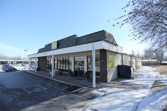
428 Howdershell Rd, Florissant, MO 63031


Property Detail
428 Howdershell Rd
07L-34-0784
CREST AIRE PLAT SIX LOT PT A RESUB LOT 1A
Stripcommercialcenter
Saint Louis
C2
Missouri
B and X Area of moderate flood hazard, usually the area between the limits of the 100-year and 500-year floods.
1a
2024
3.72 AC
2025
North County
211331
St. Louis
35,877 SF
St. Louis, MO-IL
NEARBY LISTINGS FOR SALE OR LEASE
DEMOGRAPHICS near 428 Howdershell Rd
1 mile
3 mile
5 mile
2025 Total Population
14,438
67,026
129,395
2030 Population
14,182
66,138
128,351
Pop Growth 2025-2030
(1.77%)
(1.32%)
(0.81%)
Average Age
40
39
40
2025 Total Households
5,799
27,217
51,951
HH Growth 2025-2030
(1.90%)
(1.34%)
(0.84%)
Median Household Inc
$74,569
$66,385
$67,470
Avg Household Size
2.40
2.40
2.40
2025 Avg HH Vehicles
2.00
2.00
2.00
Median Home Value
$178,419
$155,842
$161,237
Median Year Built
1967
1966
1966
Nearby Places
Map Layers
Map Styles
 Street
 Aerial
Layers
 Traffic
 Biking
Places
Listings with unknown addresses are not visible on the map
- Restaurants
- Banks
- Shops
- Fitness
- Groceries
PUBLIC TRANSPORTATION
COMMUTER RAIL
Lambert Airport East Terminal (Lambert Airport Shiloh-Scott - St. Louis MetroLink (MetroLink))
Drive
Walk
Distance
Lambert Airport East Terminal (Lambert Airport Shiloh-Scott - St. Louis MetroLink (MetroLink))
13 min
7.8 mi
Lambert Airport Main Terminal (Lambert Airport Shiloh-Scott - St. Louis MetroLink (MetroLink))
Drive
Walk
Distance
Lambert Airport Main Terminal (Lambert Airport Shiloh-Scott - St. Louis MetroLink (MetroLink))
15 min
8.3 mi
AIRPORT
St Louis Lambert International
Drive
Walk
Distance
St Louis Lambert International
11 min
6.1 mi
Freight Ports
Port Milwaukee
Drive
Walk
Distance
Port Milwaukee
429 min
376.9 mi
Nearby Properties
Address
Land Use
TOTAL SIZE
Lot Size
Zoning
Address
Land Use
TOTAL SIZE
Lot Size
Zoning
47,184 SF
71.66 AC
R4
Address
Land Use
TOTAL SIZE
Lot Size
Zoning
4,416 SF
54.81 AC
80B
Address
Land Use
TOTAL SIZE
Lot Size
Zoning
893,188 SF
71.88 AC
G
Address
Land Use
TOTAL SIZE
Lot Size
Zoning
528,000 SF
21.10 AC
80I
Address
Land Use
TOTAL SIZE
Lot Size
Zoning
491,800 SF
18.69 AC
80AG
Address
Land Use
TOTAL SIZE
Lot Size
Zoning
445,715 SF
28.16 AC
80I
Address
Land Use
TOTAL SIZE
Lot Size
Zoning
343,900 SF
19.62 AC
80AG
Address
Land Use
TOTAL SIZE
Lot Size
Zoning
335,294 SF
33.83 AC
24MFD
Address
Land Use
TOTAL SIZE
Lot Size
Zoning
6.88 AC
H
Address
Land Use
TOTAL SIZE
Lot Size
Zoning
293,622 SF
28.06 AC
H
Address
Land Use
TOTAL SIZE
Lot Size
Zoning
262,938 SF
11.32 AC
80H
Address
Land Use
TOTAL SIZE
Lot Size
Zoning
269,258 SF
89.80 AC
80F
Address
Land Use
TOTAL SIZE
Lot Size
Zoning
216,000 SF
16.42 AC
80AG
Address
Land Use
TOTAL SIZE
Lot Size
Zoning
320,176 SF
9.83 AC
24MFD
Address
Land Use
TOTAL SIZE
Lot Size
Zoning
135,721 SF
5.40 AC
80F
Address
Land Use
TOTAL SIZE
Lot Size
Zoning
387,158 SF
34.19 AC
R6
Address
Land Use
TOTAL SIZE
Lot Size
Zoning
196,819 SF
9.83 AC
7M-1
Address
Land Use
TOTAL SIZE
Lot Size
Zoning
36.40 AC
80I
Address
Land Use
TOTAL SIZE
Lot Size
Zoning
203,240 SF
8.50 AC
80H
Address
Land Use
TOTAL SIZE
Lot Size
Zoning
213,100 SF
11.28 AC
80AG
Address
Land Use
TOTAL SIZE
Lot Size
Zoning
382,000 SF
28.06 AC
80I
Address
Land Use
TOTAL SIZE
Lot Size
Zoning
76.67 AC
80I
Address
Land Use
TOTAL SIZE
Lot Size
Zoning
999 SF
21.20 AC
R
Address
Land Use
TOTAL SIZE
Lot Size
Zoning
305,740 SF
15.77 AC
7M-1
Address
Land Use
TOTAL SIZE
Lot Size
Zoning
78,460 SF
4.13 AC
G
Address
Land Use
TOTAL SIZE
Lot Size
Zoning
11.27 AC
24R4
Address
Land Use
TOTAL SIZE
Lot Size
Zoning
17.26 AC
24R4
Address
Land Use
TOTAL SIZE
Lot Size
Zoning
6.20 AC
24R4
Address
Land Use
TOTAL SIZE
Lot Size
Zoning
87,049 SF
7.57 AC
80AG
Address
Land Use
TOTAL SIZE
Lot Size
Zoning
236,362 SF
23.95 AC
R6
The World's #1 Commercial Real Estate Marketplace
Connect with us
© 2026 CoStar Group
The information above has been obtained from sources believed reliable. While we do not doubt its accuracy we have not verified it and make no guarantee, warranty or representation about it. It is your responsibility to independently confirm its accuracy and completeness. Any projections, opinions, assumptions, or estimates used are for example only and do not represent the current or future performance of the property. The value of this transaction to you depends on tax and other factors which should be evaluated by your tax, financial, and legal advisors. You and your advisors should conduct a careful, independent investigation of the property to determine to your satisfaction the suitability of the property for your needs.