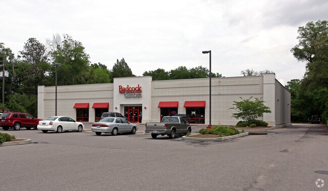
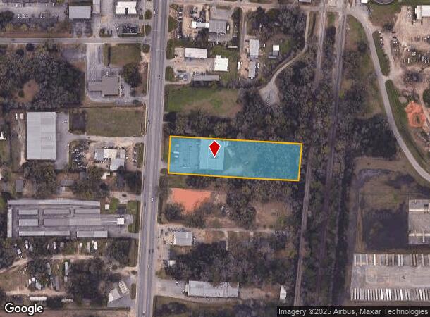
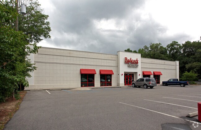
Property Record
428 Saraland Blvd N, Saraland, AL 36571
NEARBY LISTINGS FOR SALE OR LEASE
Property Detail
428 Saraland Blvd N
22-02-03-3-000-016
Commercial Site
Storebuilding
FROM SW COR SEC 03 T3S R1W RUN ELY DIR ALG SLY BDRY OF SD SEC 673 FT TO E ROWL OF JOHN CRAFT HWY AS SD ROWL EXISTED PRIOR TO
X
Mobile
01097C0437L
Alabama
2025
2.50 AC
2025
Northeast Mobile
006106
Mobile
15,620 SF
Mobile, AL
DEMOGRAPHICS near 428 Saraland Blvd N
1 Mile
3 Mile
5 Mile
2024 Total Population
4,250
14,884
35,631
2029 Population
4,193
14,641
35,436
Pop Growth 2024-2029
(1.34%)
(1.63%)
(0.55%)
Average Age
38
39
40
2024 Total Households
1,736
5,924
13,906
HH Growth 2024-2029
(1.44%)
(1.70%)
(0.59%)
Median Household Inc
$44,332
$55,383
$44,407
Avg Household Size
2.40
2.50
2.50
2024 Avg HH Vehicles
2.00
2.00
2.00
Median Home Value
$137,401
$149,714
$142,090
Median Year Built
1973
1973
1973
Nearby Places
Map Layers
Map Styles
 Street
 Aerial
- Restaurants
- Banks
- Shops
- Fitness
- Groceries
PUBLIC TRANSPORTATION
AIRPORT
Mobile International
DRIVE
WALK
Distance
Mobile International
24 min
14.4 mi
Mobile Regional
DRIVE
WALK
Distance
Mobile Regional
35 min
19.7 mi
Nearby Properties
Address
Land Use
TOTAL SIZE
Lot Size
Zoning
Address
Land Use
TOTAL SIZE
Lot Size
Zoning
66,138 SF
35.24 AC
Address
Land Use
TOTAL SIZE
Lot Size
Zoning
9,100 SF
34.07 AC
Address
Land Use
TOTAL SIZE
Lot Size
Zoning
35,775 SF
22.48 AC
Address
Land Use
TOTAL SIZE
Lot Size
Zoning
35,828 SF
26.30 AC
Address
Land Use
TOTAL SIZE
Lot Size
Zoning
187,257 SF
33.10 AC
Address
Land Use
TOTAL SIZE
Lot Size
Zoning
21,700 SF
6.98 AC
Address
Land Use
TOTAL SIZE
Lot Size
Zoning
197,471 SF
15.90 AC
Address
Land Use
TOTAL SIZE
Lot Size
Zoning
66,678 SF
2.29 AC
Address
Land Use
TOTAL SIZE
Lot Size
Zoning
57,084 SF
1.97 AC
Address
Land Use
TOTAL SIZE
Lot Size
Zoning
116,512 SF
9.60 AC
Address
Land Use
TOTAL SIZE
Lot Size
Zoning
1,104 SF
6.01 AC
Address
Land Use
TOTAL SIZE
Lot Size
Zoning
45,980 SF
10.72 AC
Address
Land Use
TOTAL SIZE
Lot Size
Zoning
125,239 SF
11.20 AC
Address
Land Use
TOTAL SIZE
Lot Size
Zoning
35,952 SF
5.37 AC
Address
Land Use
TOTAL SIZE
Lot Size
Zoning
54,965 SF
1.97 AC
Address
Land Use
TOTAL SIZE
Lot Size
Zoning
294,193 SF
7.06 AC
Address
Land Use
TOTAL SIZE
Lot Size
Zoning
86,174 SF
9.30 AC
Address
Land Use
TOTAL SIZE
Lot Size
Zoning
18,818 SF
6.21 AC
Address
Land Use
TOTAL SIZE
Lot Size
Zoning
142,692 SF
11.60 AC
Address
Land Use
TOTAL SIZE
Lot Size
Zoning
114,942 SF
29 AC
Address
Land Use
TOTAL SIZE
Lot Size
Zoning
128,250 SF
13.83 AC
Address
Land Use
TOTAL SIZE
Lot Size
Zoning
73,680 SF
27 AC
Address
Land Use
TOTAL SIZE
Lot Size
Zoning
40,245 SF
1.99 AC
Address
Land Use
TOTAL SIZE
Lot Size
Zoning
48,304 SF
3.28 AC
Address
Land Use
TOTAL SIZE
Lot Size
Zoning
76,682 SF
9.62 AC
Address
Land Use
TOTAL SIZE
Lot Size
Zoning
21,800 SF
6 AC
Address
Land Use
TOTAL SIZE
Lot Size
Zoning
122,776 SF
14.32 AC
Address
Land Use
TOTAL SIZE
Lot Size
Zoning
50,740 SF
1.57 AC
Address
Land Use
TOTAL SIZE
Lot Size
Zoning
31,420 SF
3.54 AC
Address
Land Use
TOTAL SIZE
Lot Size
Zoning
200,000 SF
The World's #1 Commercial Real Estate Marketplace
Connect with us
© 2026 CoStar Group
The information above has been obtained from sources believed reliable. While we do not doubt its accuracy we have not verified it and make no guarantee, warranty or representation about it. It is your responsibility to independently confirm its accuracy and completeness. Any projections, opinions, assumptions, or estimates used are for example only and do not represent the current or future performance of the property. The value of this transaction to you depends on tax and other factors which should be evaluated by your tax, financial, and legal advisors. You and your advisors should conduct a careful, independent investigation of the property to determine to your satisfaction the suitability of the property for your needs.