Property Record
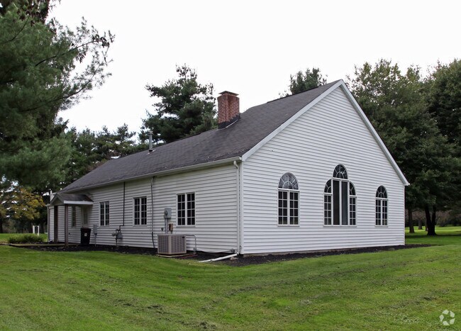
470 South St, Chardon, OH 44024


NEARBY LISTINGS FOR SALE OR LEASE
Property Detail
470 South St
Cleveland-Elyria, OH
Original Chardon Village
10-009700
LOT 138 139 146 SEC 1 PARCEL #1
Golfcourse
Geauga
A
Ohio
39055C0129D
138
2024
128.53 AC
2024
Geauga County
312201
Cleveland
3,168 SF
DEMOGRAPHICS near 470 South St
1 Mile
3 Mile
5 Mile
2024 Total Population
4,111
12,980
22,727
2029 Population
4,137
13,063
22,831
Pop Growth 2024-2029
+ 0.63%
+ 0.64%
+ 0.46%
Average Age
43
44
44
2024 Total Households
1,797
5,319
8,900
HH Growth 2024-2029
+ 0.61%
+ 0.58%
+ 0.39%
Median Household Inc
$83,657
$84,117
$93,175
Avg Household Size
2.20
2.30
2.50
2024 Avg HH Vehicles
2.00
2.00
2.00
Median Home Value
$235,314
$254,745
$270,532
Median Year Built
1978
1978
1979
Nearby Places
Map Layers
Map Styles
 Street
 Aerial
- Restaurants
- Banks
- Shops
- Fitness
- Groceries
SALE & LEASE HISTORY
LISTING DATE
SALE/LEASE

Dec 14, 2017
For Lease
Nearby Properties
Address
Land Use
TOTAL SIZE
Lot Size
Zoning
Address
Land Use
TOTAL SIZE
Lot Size
Zoning
188,150 SF
20.01 AC
C3
Address
Land Use
TOTAL SIZE
Lot Size
Zoning
70,289 SF
12.03 AC
PUD
Address
Land Use
TOTAL SIZE
Lot Size
Zoning
48,998 SF
8.10 AC
Address
Land Use
TOTAL SIZE
Lot Size
Zoning
98,228 SF
20 AC
S
Address
Land Use
TOTAL SIZE
Lot Size
Zoning
123,170 SF
7.50 AC
S
Address
Land Use
TOTAL SIZE
Lot Size
Zoning
140,974 SF
15.62 AC
IWTTO
Address
Land Use
TOTAL SIZE
Lot Size
Zoning
50,048 SF
14.78 AC
C3
Address
Land Use
TOTAL SIZE
Lot Size
Zoning
960 SF
552.62 AC
Address
Land Use
TOTAL SIZE
Lot Size
Zoning
5,847 SF
14.15 AC
R2
Address
Land Use
TOTAL SIZE
Lot Size
Zoning
105,182 SF
10.64 AC
IWTTO
Address
Land Use
TOTAL SIZE
Lot Size
Zoning
1,870 SF
102.70 AC
R1
Address
Land Use
TOTAL SIZE
Lot Size
Zoning
106,658 SF
14.40 AC
C3
Address
Land Use
TOTAL SIZE
Lot Size
Zoning
8,618 SF
19.46 AC
Address
Land Use
TOTAL SIZE
Lot Size
Zoning
36,696 SF
10.30 AC
R3
Address
Land Use
TOTAL SIZE
Lot Size
Zoning
80,188 SF
5.83 AC
C3
Address
Land Use
TOTAL SIZE
Lot Size
Zoning
2,370 SF
43.96 AC
MHP
Address
Land Use
TOTAL SIZE
Lot Size
Zoning
3,024 SF
66.06 AC
Address
Land Use
TOTAL SIZE
Lot Size
Zoning
15,293 SF
19.32 AC
Address
Land Use
TOTAL SIZE
Lot Size
Zoning
35,159 SF
0.42 AC
R2
Address
Land Use
TOTAL SIZE
Lot Size
Zoning
55,768 SF
9.84 AC
C3
Address
Land Use
TOTAL SIZE
Lot Size
Zoning
6,840 SF
12.42 AC
R1
Address
Land Use
TOTAL SIZE
Lot Size
Zoning
29,878 SF
5.77 AC
C3
Address
Land Use
TOTAL SIZE
Lot Size
Zoning
38,367 SF
5.29 AC
C3
Address
Land Use
TOTAL SIZE
Lot Size
Zoning
66,551 SF
13.25 AC
PUD
Address
Land Use
TOTAL SIZE
Lot Size
Zoning
67,501 SF
6.59 AC
C3
Address
Land Use
TOTAL SIZE
Lot Size
Zoning
25,898 SF
2.26 AC
R2
Address
Land Use
TOTAL SIZE
Lot Size
Zoning
12,800 SF
7.50 AC
R4
Address
Land Use
TOTAL SIZE
Lot Size
Zoning
3,480 SF
9.30 AC
PUD
Address
Land Use
TOTAL SIZE
Lot Size
Zoning
68,539 SF
7.06 AC
IWTTO
Address
Land Use
TOTAL SIZE
Lot Size
Zoning
240 SF
188.67 AC
The World's #1 Commercial Real Estate Marketplace
Connect with us
© 2025 CoStar Group
The information above has been obtained from sources believed reliable. While we do not doubt its accuracy we have not verified it and make no guarantee, warranty or representation about it. It is your responsibility to independently confirm its accuracy and completeness. Any projections, opinions, assumptions, or estimates used are for example only and do not represent the current or future performance of the property. The value of this transaction to you depends on tax and other factors which should be evaluated by your tax, financial, and legal advisors. You and your advisors should conduct a careful, independent investigation of the property to determine to your satisfaction the suitability of the property for your needs.